


The Manaslu Circuit is Nepal’s quiet epic, a journey that begins in the humid lowlands and climbs into the thin air of the Tibetan plateau. From Kathmandu, a long way along the Budhi Gandaki River. The first few days are hot, humid, and deceptively challenging; the trail weaves through half-built roads, suspension bridges, and villages that feel more like the plains than the mountains.
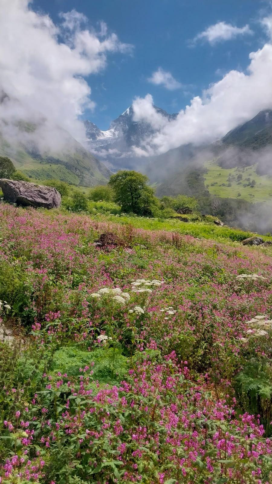
A single hanging bridge marks the shift, as if taking you back in time. On the other side, everything changes. The valley narrows, pine forests rise, and prayer flags begin to replace concrete. The people, the language, and the rhythm of life start to feel different. Villages like Shyala, Samagaon, and Sumdo carry the calm of a world shaped by wind, stone, and silence.
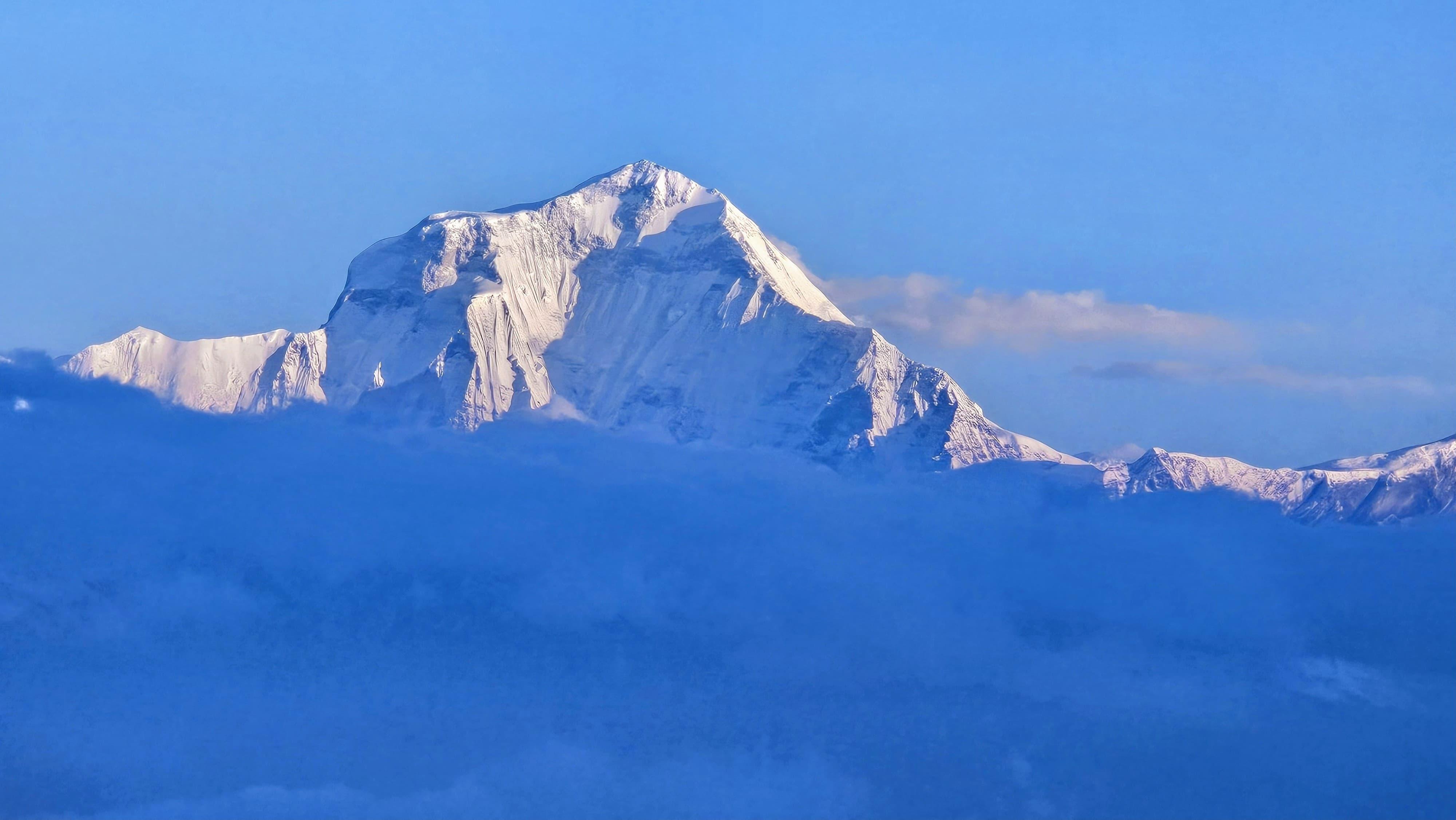
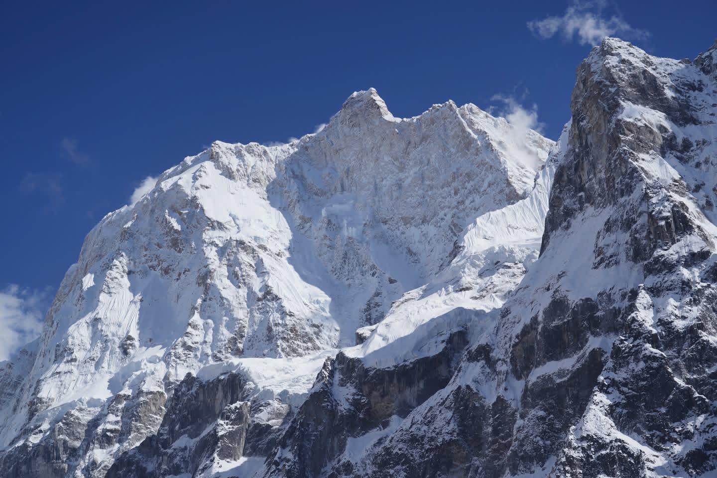
The crossing of Larkya La Pass (5,106 m) is the heart of the trek, a long, pre-dawn push through snow and wind that tests your patience more than your fitness. On the other side, Bhimthang opens up like a secret meadow, mountains on all sides, stillness in the air, and a quiet sense of having arrived.
The Manaslu Circuit isn’t just a trail around the eighth-highest mountain; it’s a gradual return to simplicity, a reminder of how vast, and how human, the mountains can feel.
Day 1
Drive from Kathmandu to Machhakhola
Drive Distance: ~160 km (Kathmandu to Machhakhola)
Time Taken: 8–9 hours
Elevation Profile: 4,600 ft / 1400m(Kathmandu) → 3,300 ft / 900m (Machhakhola)
The day begins early with a long drive out of Kathmandu, winding through green middle hills and small Nepali towns. The road stays smooth until Arughat, then turns rough and narrow. From Soti Khola onward, the real adventure begins, a 15 km stretch that takes more than an hour through dusty cliffs and rutted tracks. Most city vehicles stop here, so expect to switch to a local 4x4 for the final leg to Machakhola.
By the time you arrive, you’ll be ready to stretch. Machakhola is a small riverside hamlet tucked in a gorge, humid, quiet, and the starting point of the Manaslu trail. In the evening, you can sit by the Budhi Gandaki, dip your tired feet in the water, and watch the last light fade behind the ridges.
Day 2
Machhakhola to Jagat
Trek Distance: ~20 km (Machhakhola to Jagat)
Time Taken: 7-8 hours
Elevation Profile: 3,300 ft / 900m → 4,265 ft / 1300 m
The trail follows the Budhi Gandaki all day, humid, steep, and full of sound. Waterfalls crash beside you, small bridges sway over the river, and bikes occasionally rattle past on dusty tracks. This section is long and exposed; the sun reflects off the rock walls, and the humidity builds as you walk through narrow gorges.
By late morning, you reach Tatopani, known for its natural hot springs, though few trekkers feel tempted when the air itself feels like a steam bath. After lunch at a teahouse beyond Tatopani, the route grows steeper and greener, winding past two tall waterfalls, one so close you have to wade through its spray to cross.
It’s a long day; trekkers reach Jagat by early evening. Jagat is a charming stone village with paved alleys and a checkpoint marking the entry into the Manaslu Conservation Area.
A short walk away, there’s a plunge pool below a waterfall, the perfect place to cool off after the day’s heat. Few things feel better than dipping into that icy water after nine hours on the trail.
Day 3
Jagat to Deng
Trek Distance: ~19 km (Jagat to Deng)
Time Taken: 8-9 hours
Elevation Profile: 4,265 ft / 1300m → 6,200 ft / 1890m
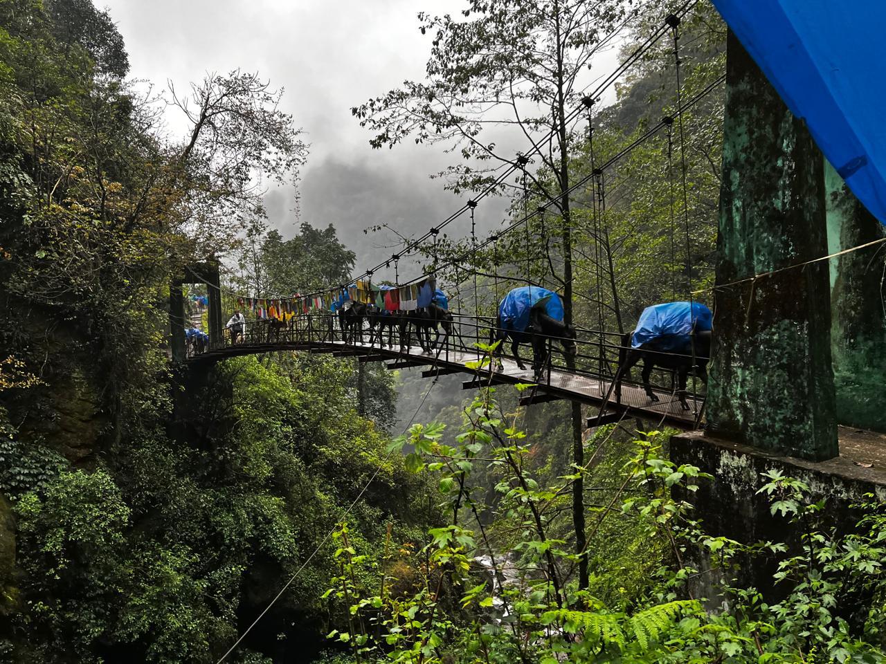
This is the day the trail finally feels like a trek. You leave behind the last traces of road and the occasional motorbike, and the route starts to narrow into a true mountain path. There are more hanging bridges today, each one swinging over the Budhi Gandaki, each one marking a step deeper into the valley.
A long bridge leads to Philim, a small but lively village that feels like the Nepal we’ve all imagined, with stone houses, cafés serving fresh coffee and cakes, and a few general stores where you can restock or linger. From Philim onward, the scenery changes dramatically. The trail winds through dense forest, past waterfalls, and across a few more bridges until you reach the Tsum Valley junction, where a side trail branches east.
A couple more hours of steady walking and you reach Deng, a quiet riverside hamlet surrounded by cliffs and prayer flags. It’s been a long, undulating day, but this is where you begin to feel the rhythm of the Manaslu Circuit.
Day 4
Deng to Namrung
Trek Distance: ~20 km (Deng to Namrung)
Time Taken: 8-9 hours
Elevation Profile: 6,200 ft / 1890m → 8,625 ft / 2630m
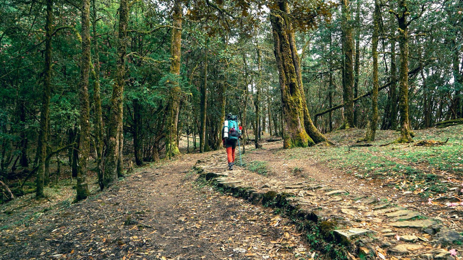
The trail from Deng to Namrung is one of transitions: in scenery, altitude, and spirit. The Budhi Gandaki runs below you for most of the day as the path climbs through pine forests and narrow ravines. Waterfalls thread down the cliffs beside you, and mani stones start to appear along the trail, the first quiet signs that you’re entering the Tibetan belt of the Manaslu region.
It’s a long day with continuous ascents and descents, some steep, some rolling. Small villages appear every few hours, serving coffee, and other refreshments, and unexpected comforts that break the fatigue. The walk through the forest is calm and meditative, the sound of rushing water never too far away.
The final ascent before Namrung is demanding but worth every step. As you reach the top, the landscape opens into what locals call Apple Valley, the first place where the mountains suddenly feel towering and near. The air turns cooler, the architecture changes, and prayer flags line the rooftops. Namrung feels like the threshold of a new world, the beginning of the Tibetan side of the Manaslu Circuit.
Day 5
Namrung to Shyala
Trek Distance: ~16 km (Namrung to Shyala)
Time Taken: 8 hours
Elevation Profile: 8,625 ft / 2630m → 11,500 ft / 3500m
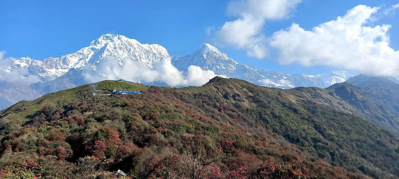
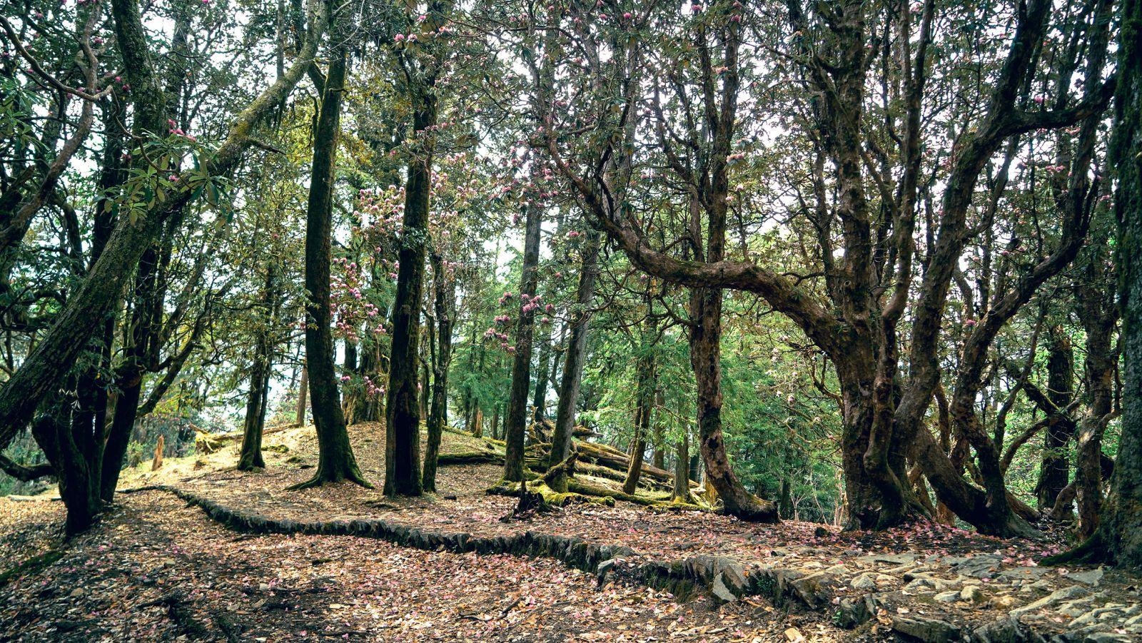
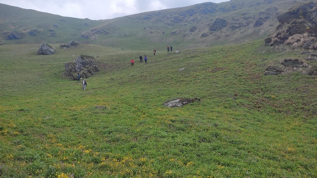
The walk from Namrung to Shyala feels gentler than the previous days, yet it’s one of the most scenic sections of the entire circuit. The trail winds through classic Tibetan-style villages, Lihi, Sho, and Lho ,each framed by fields of barley and fluttering prayer flags.
We stop for lunch at Lho, beneath the watchful walls of Ribung Gompa, with Manaslu’s massive face rising beyond it. From here, the trail climbs gradually through a forest of pines and rhododendrons, crossing small wooden bridges with a stream flowing alongside. Mist hangs low in the valley, giving the walk a quiet, meditative rhythm.
The final climb into Shyala is short but steep, and the view that greets you makes every step worth it, Manaslu and Manaslu North standing impossibly close, glowing in the late-afternoon light. Shyala itself is a small, peaceful village ringed by peaks. Nearby, the Pungyen Monastery sits on a bluff above the valley, a perfect place to visit the next morning before continuing towards Samagaon.
Day 6
Shyala to Samagaon via Pungyen Monastery
Trek Distance: ~5 km
Time Taken: 3-4 hours
Elevation Profile: 11,500 ft / 3500m → 11,581 / 3530m ft via 13,310 ft / 4055m
Today is one of the shortest and most peaceful days of the trek. Starting leisurely, the trail climbs gently through meadows and rhododendron forests toward Pungyen Monastery, a serene gompa perched above the valley at 4,055 m, offering breathtaking views of Manaslu, Himal Chuli, and Ngadi Chuli. The place is calm, windswept, and deeply spiritual, a perfect pause before you continue your journey.
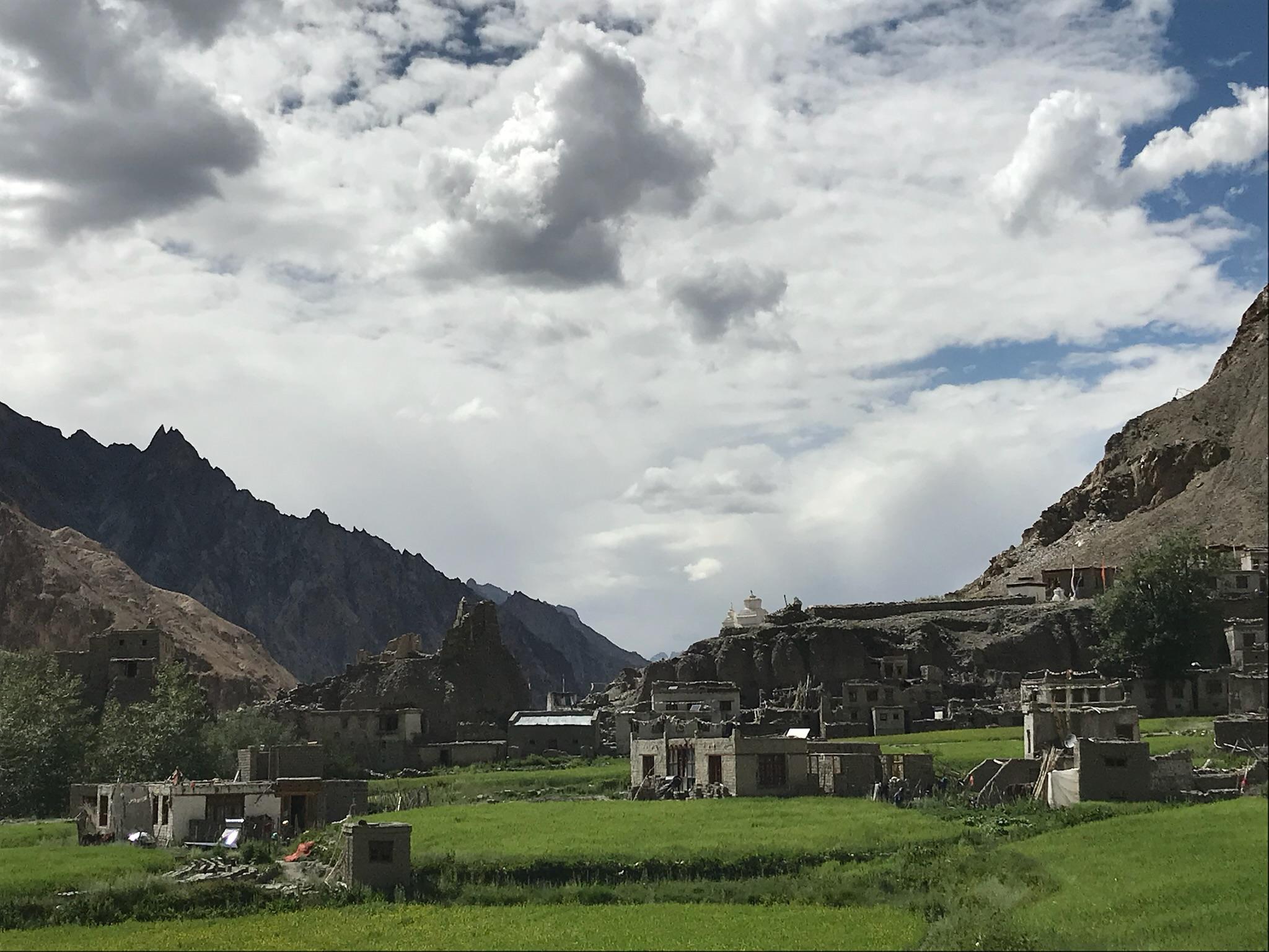
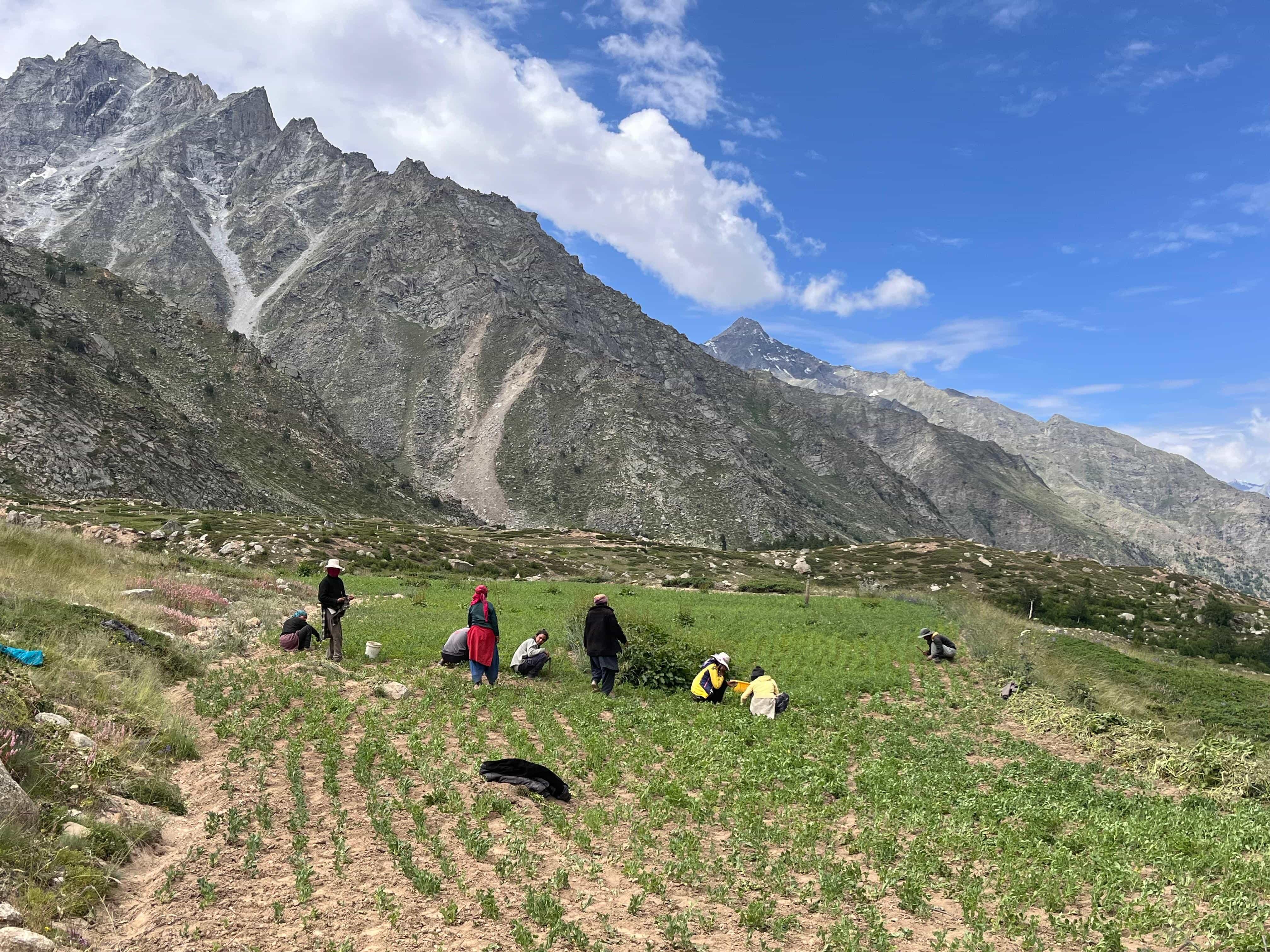
After visiting the monastery, descend back to the main trail and continue to Samagaon. The trail flattens out, and the valley opens wide. Samagaon feels alive, one of the largest villages on the circuit, with cafés, shops, schools, and even a small government check post. Once a central trading hub between Tibet and Nepal, it still carries that quiet rhythm of exchange and coexistence. Spend the afternoon exploring or simply resting as you acclimatise to the days ahead.
Day 7
Acclimatization day at Samagaon
Trek Distance: ~8 km (Acclimatisation day at Samagaon / optional hike to Manaslu Base Camp)
Time Taken: Base Camp trek and back 8-9 hours
Elevation Profile: 11,581 ft / 3530m → 15,750 ft / 4800m
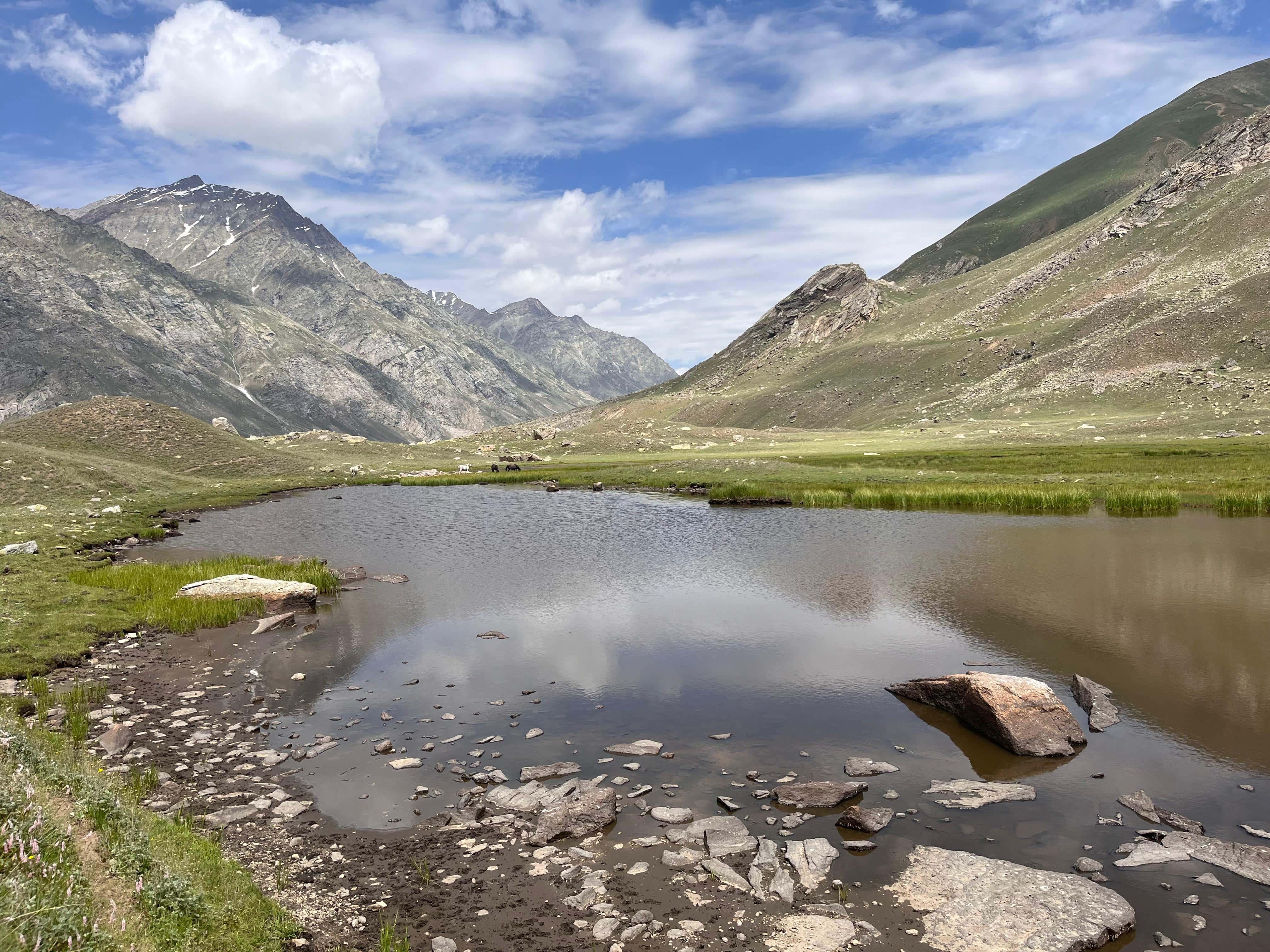
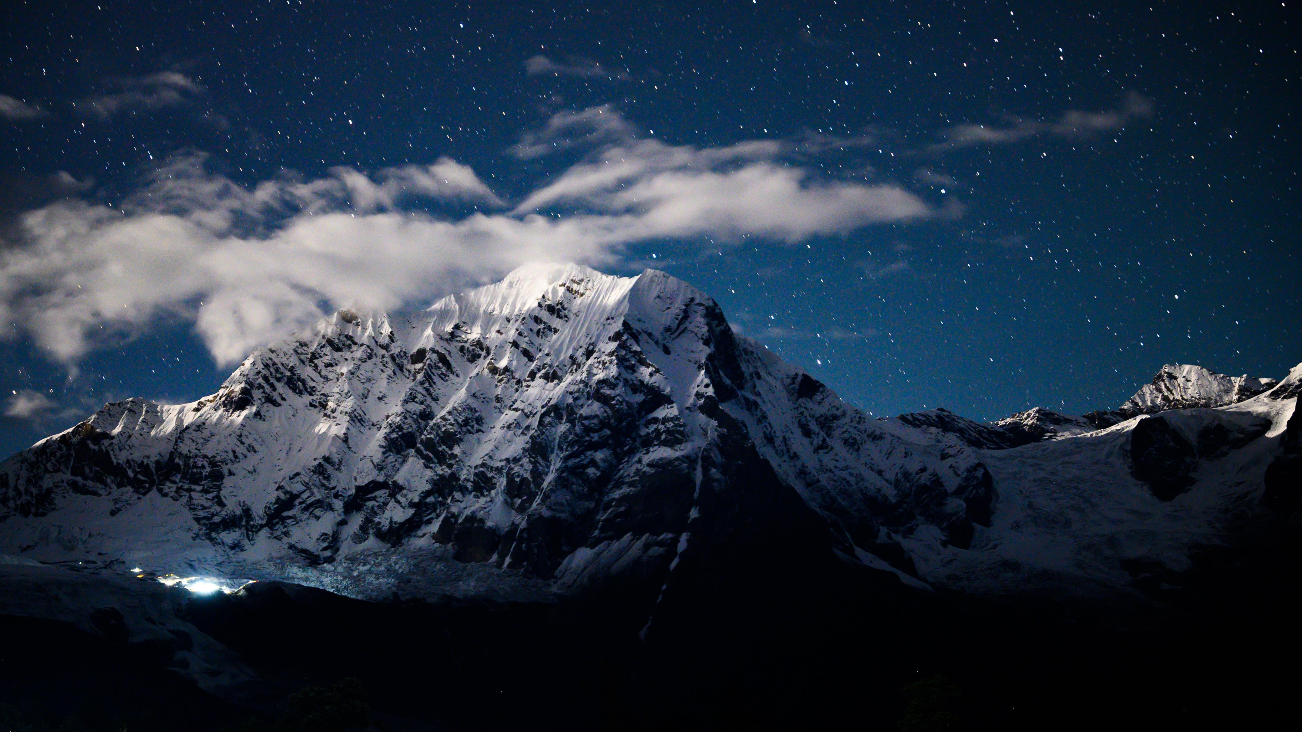
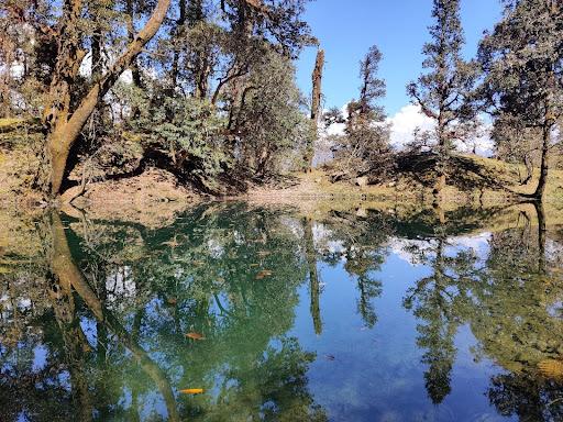
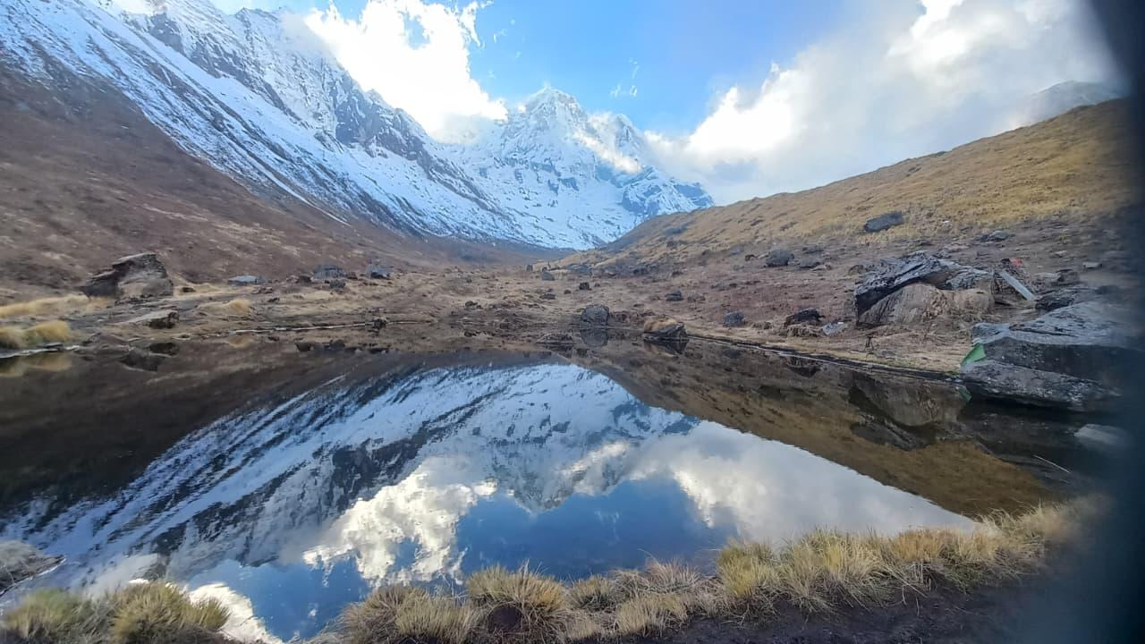
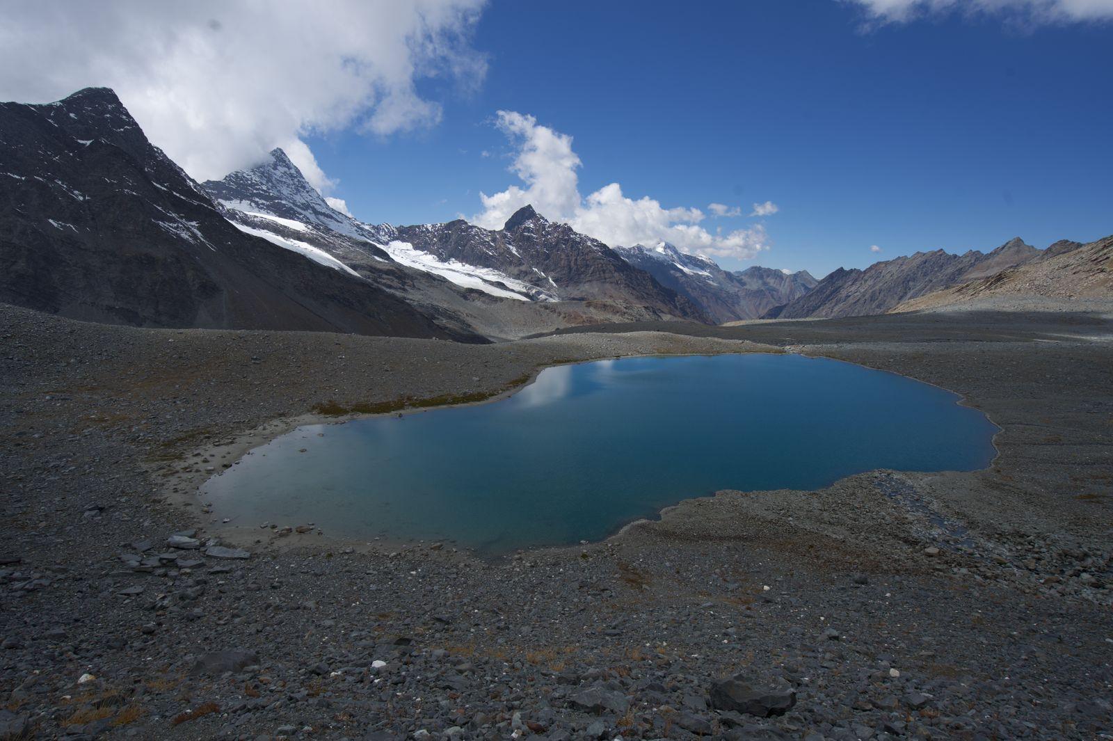
This isn’t a rest day, it’s a day of patience and slow climbing. The hike from Samagaon to Manaslu Base Camp gains more than 1,200 meters in just 4 km, and the trail wastes no time in getting steep. You start early, around 6:30 AM, winding above Birendra Tal, a turquoise glacial lake at the foot of Manaslu. From there, the path climbs sharply through moraine and alpine scrub, the mountain growing taller with every step.
It takes the better part of the day to reach the base camp at 4,800 m, a desolate amphitheatre of rock and ice beneath the towering north face of Manaslu. The views are raw and humbling, icefalls, seracs, and clouds swirling around the peak. After some time here, you descend carefully back to Samagaon, reaching by evening.
If you’d prefer an easier day, you can skip the base camp hike and walk to Birendra Tal, about 1.5 km from the village. It’s a gentle walk and a beautiful spot to acclimatise, with clear reflections of Manaslu shimmering in the lake on calm mornings.
This is one of the most significant days of the trek, an actual test of altitude acclimatisation and a glimpse into the vastness of the Manaslu range.
Day 8
Samagaon to Samdo
Trek Distance: ~6 km (Samagaon to Samdo)
Time Taken: 4–5 hours
Elevation Profile: 11,580 ft / 3530m → 12,700 ft / 3870m
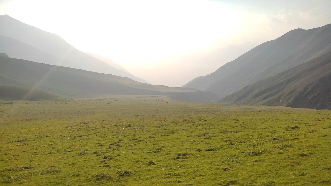
After several demanding days, today feels light and spacious. The trail leaves the last patches of forest behind and opens into a broad alpine valley, with the Budhi Gandaki glinting beside you. The gradient is gentle, more of a walk than a climb, with long, flattish sections that make it easy to enjoy the silence and views.
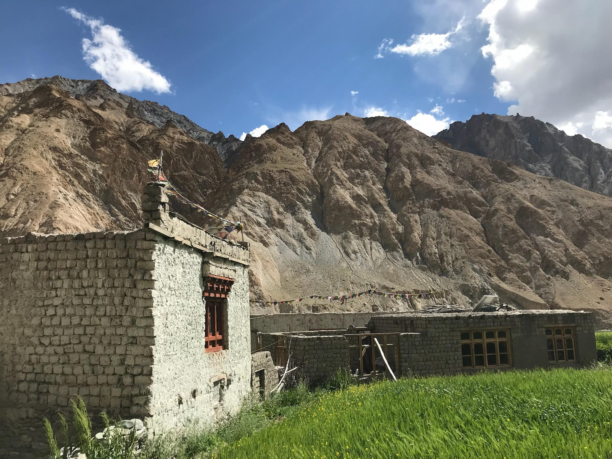
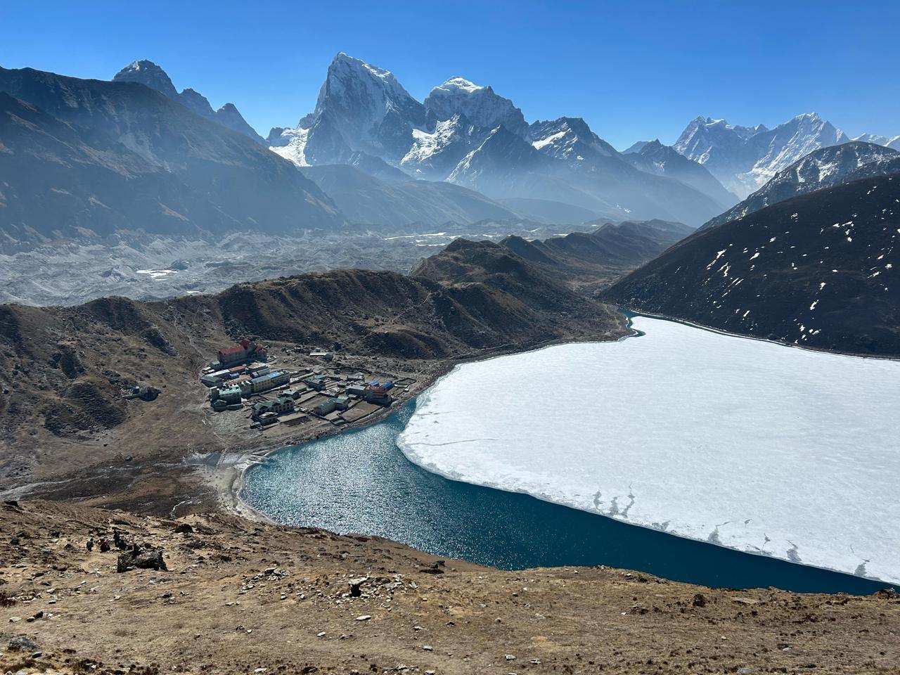
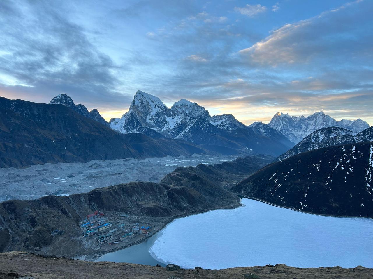
You’ll pass grazing yaks, stone-walled shelters, and the occasional herd of horses moving through the mist. The mountains stand closer now, their slopes bare and wind-sculpted. By late morning, the trail bends gently into Samdo, a small, windswept village that once served as a Tibetan trading outpost.
“The name Samdo means ‘meeting point’, caravans from Tibet would rest here, salt on one side, rice on the other. Today, it feels empty, but if you listen closely, you can almost hear the bells of yak caravans that once crossed these high pastures.”
Samdo is an ideal place to rest, explore the ridgelines, and prepare for the crossing of Larkya La in the days ahead.
Day 9
Samdo to Dharamsala/Larkya Phedi
Trek Distance: ~6 km (Sumdo to Dharamsala)
Time Taken: 4-5 hours
Elevation Profile: 12,700 ft / 3870m → 14,600 ft / 4450m
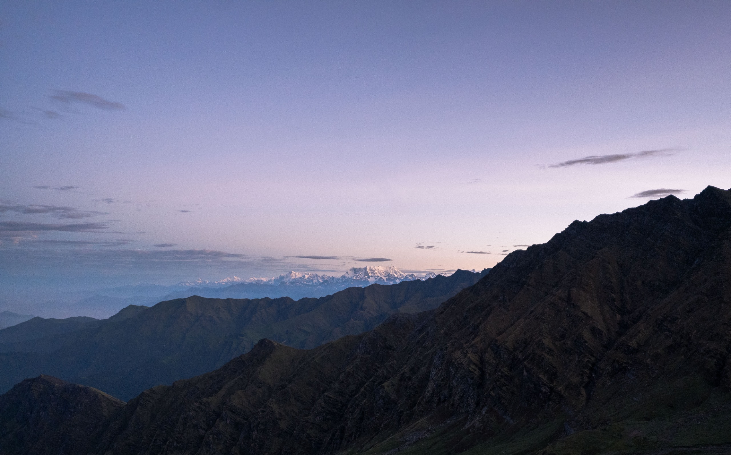
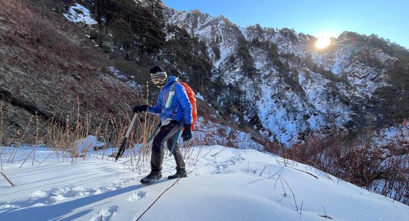
This is a short but significant day, a slow climb into the world above the tree line. The trail rises gradually through a barren, high-altitude landscape of scattered boulders. The air grows thin, and every sound, wind, boots, yak bells, feels sharper in the cold. Behind you, Samdo fades into the distance, framed by the snow peaks of the Manaslu range.
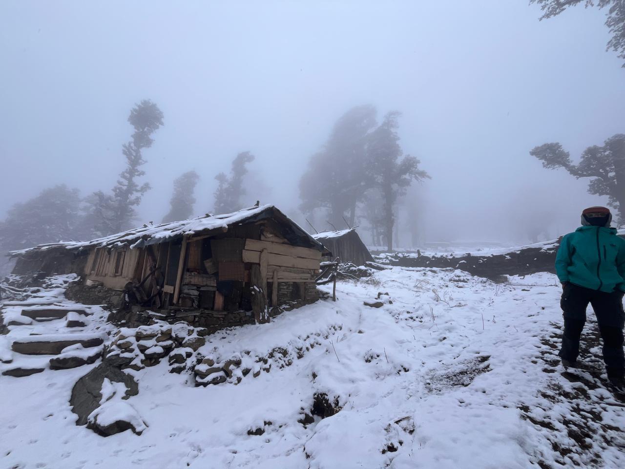
You’ll pass a few yak shelters and frozen streams before reaching Dharamsala, a collection of cabins explicitly built for trekkers. Facilities here are basic, unlike the villages below, but the warmth of a shared dining room and the quiet hum of anticipation make it memorable in its own way.
The afternoon is for rest, hydration, and preparing for the big climb ahead. As the sun dips behind the ridge, temperatures drop sharply. Everyone eats early and turns in soon after. Tomorrow is the day of the Larkya La Pass, the longest and most demanding stretch of the trek.
Day 10
Dharamsala to Bimthang via Larkya La Pass
Trek Distance: ~21 km (Dharamsala to Bimthang via Larkya La Pass)
Time Taken: 12-13 hours
Elevation Profile: 14,600 ft / 4450m → 16,752 ft / 5106m (Larkya La) → 11,775 ft / 3590m (Bimthang)
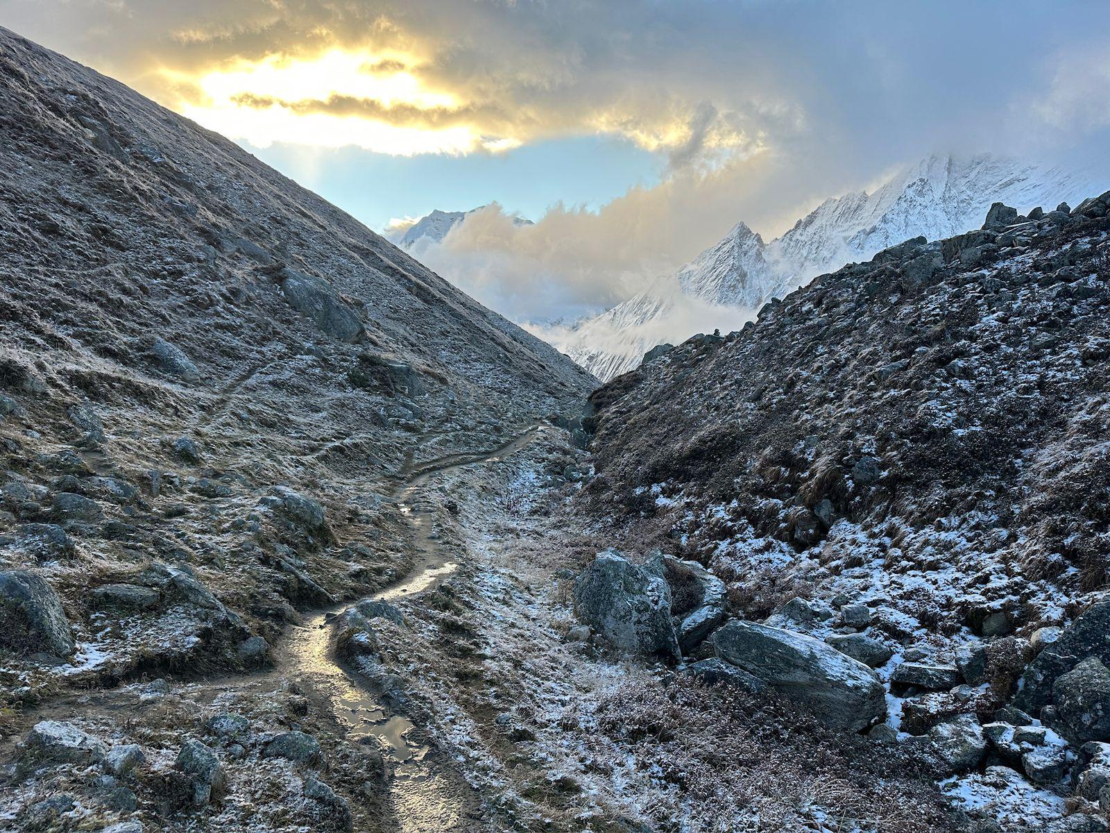
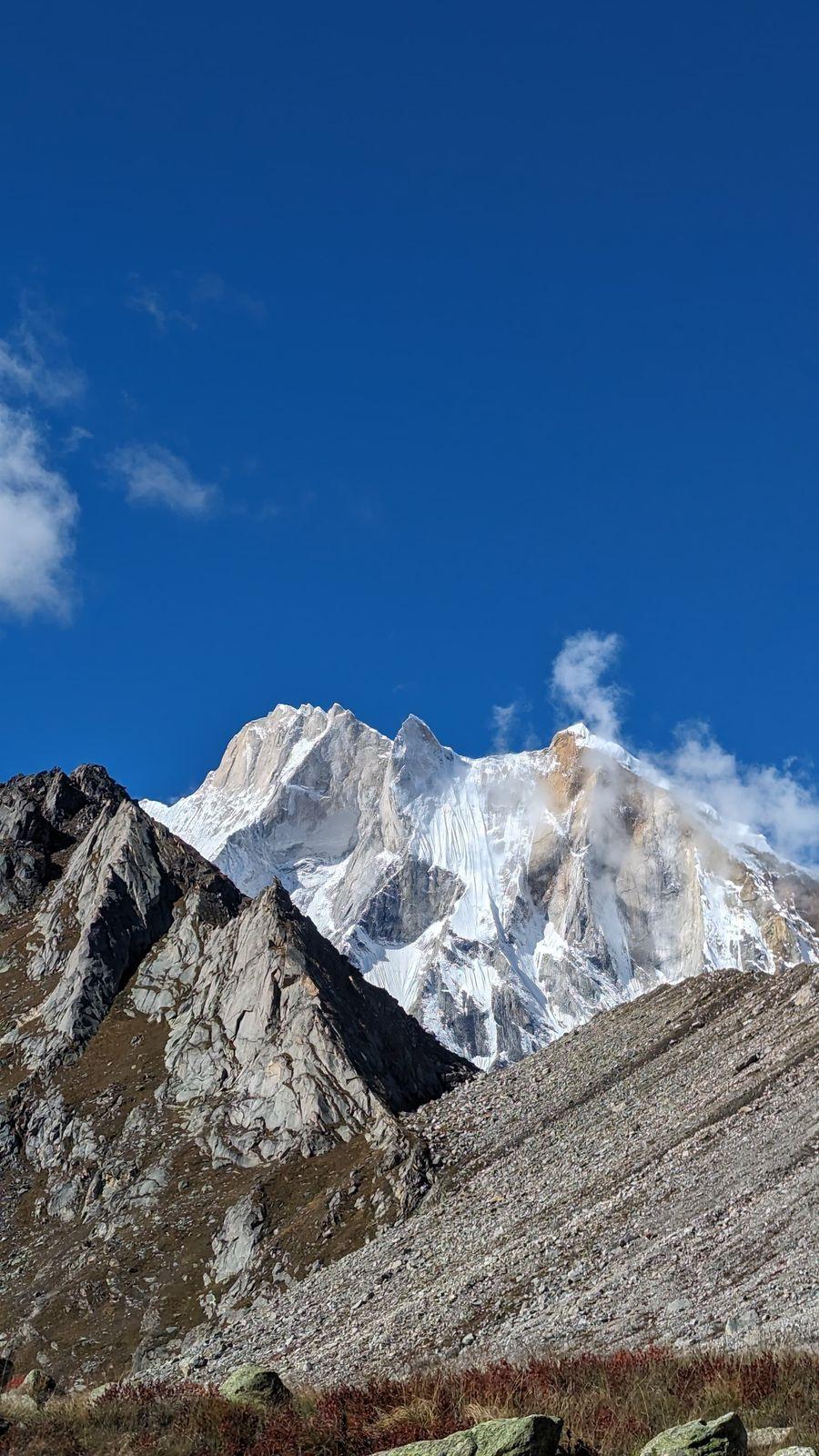
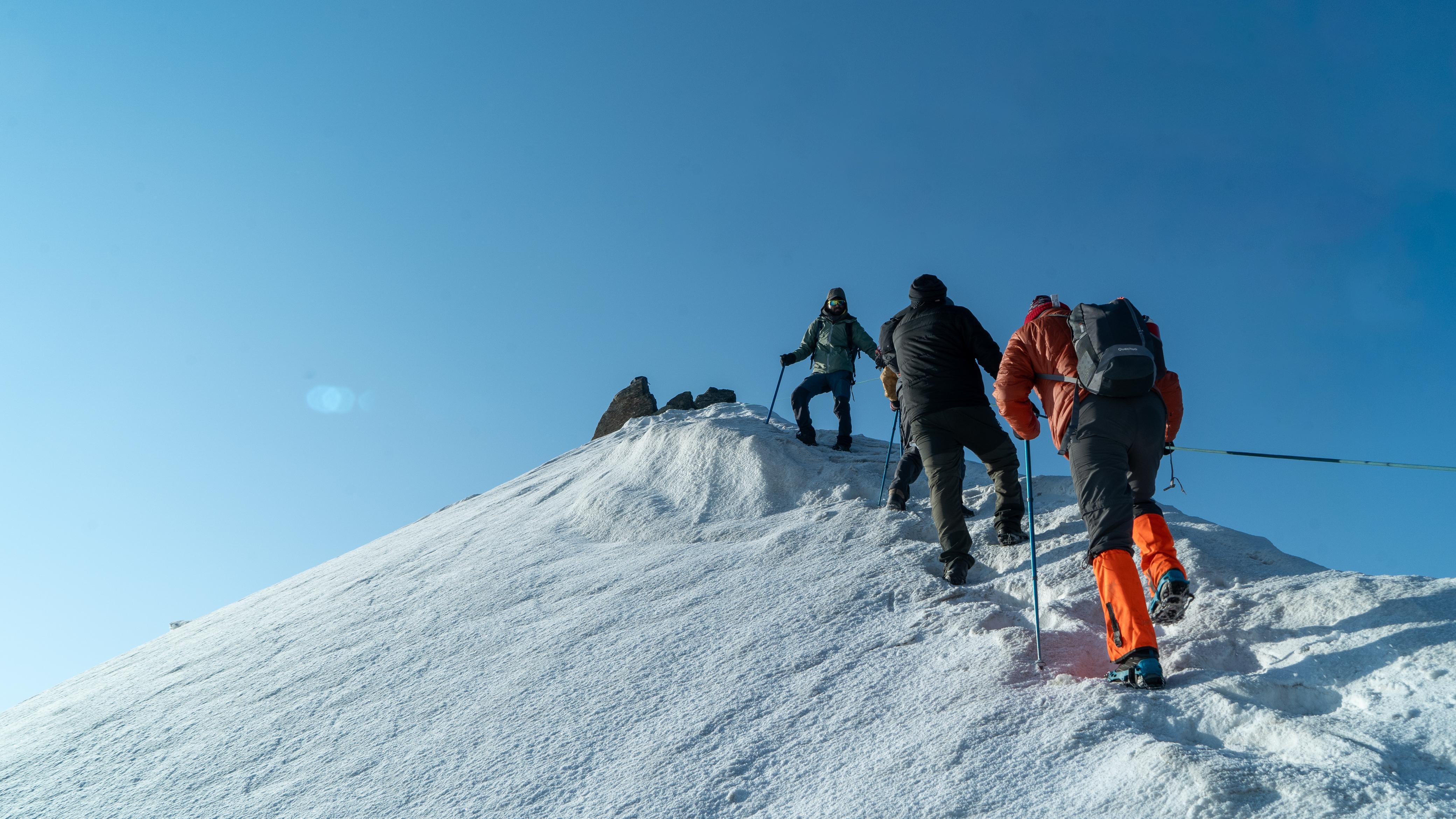
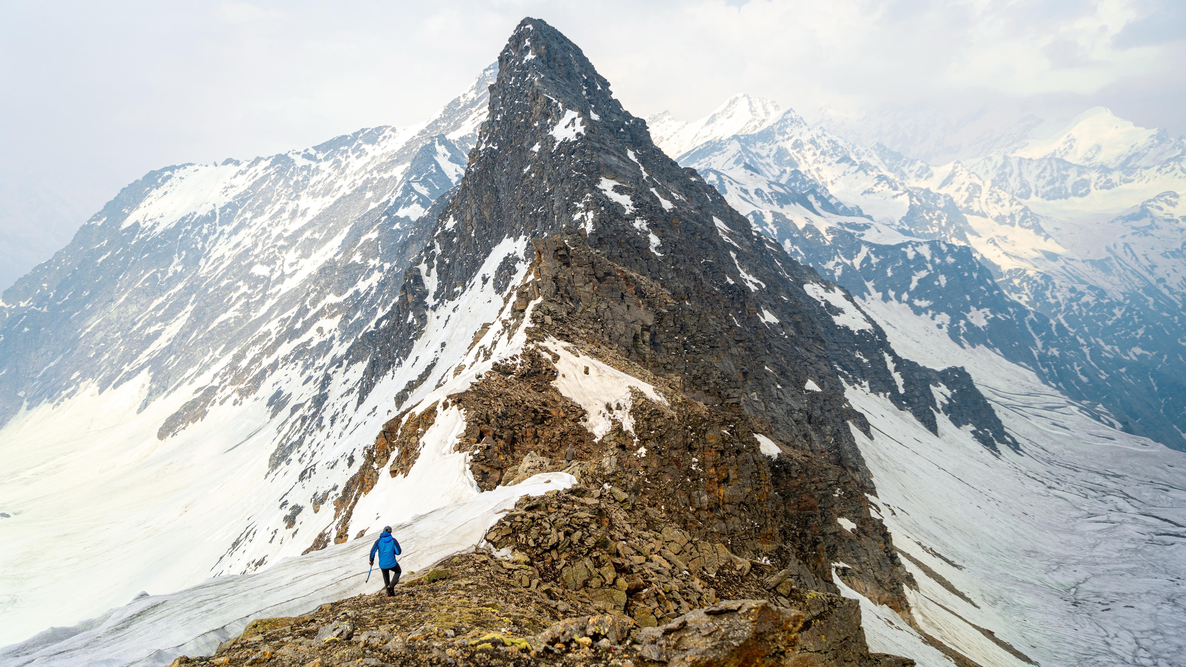
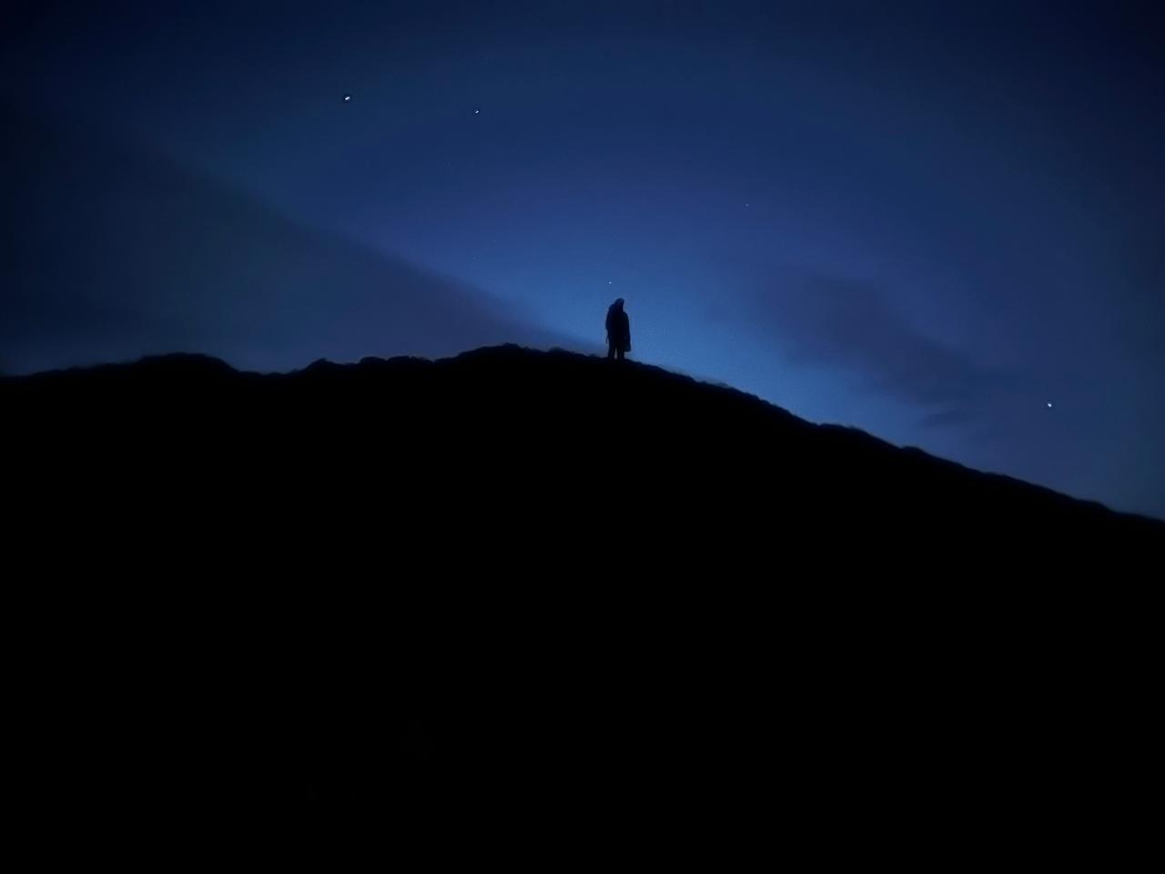
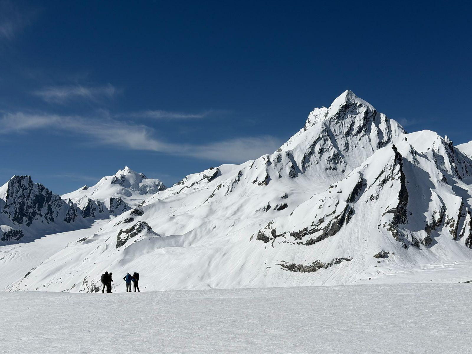
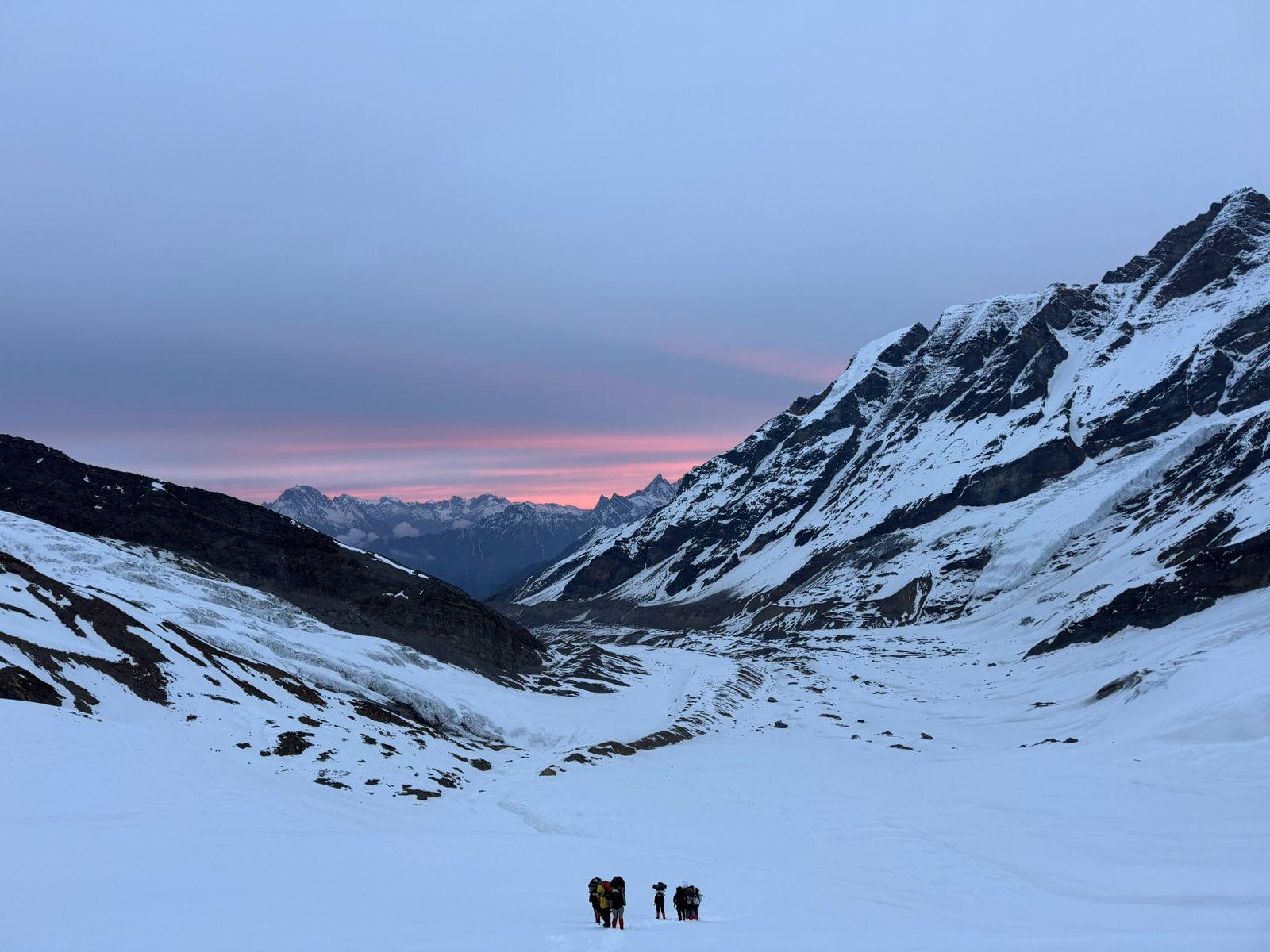
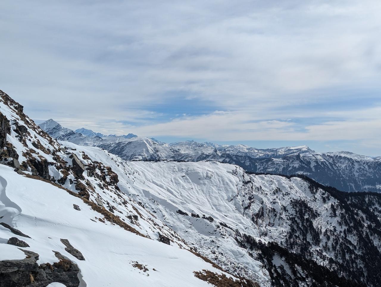
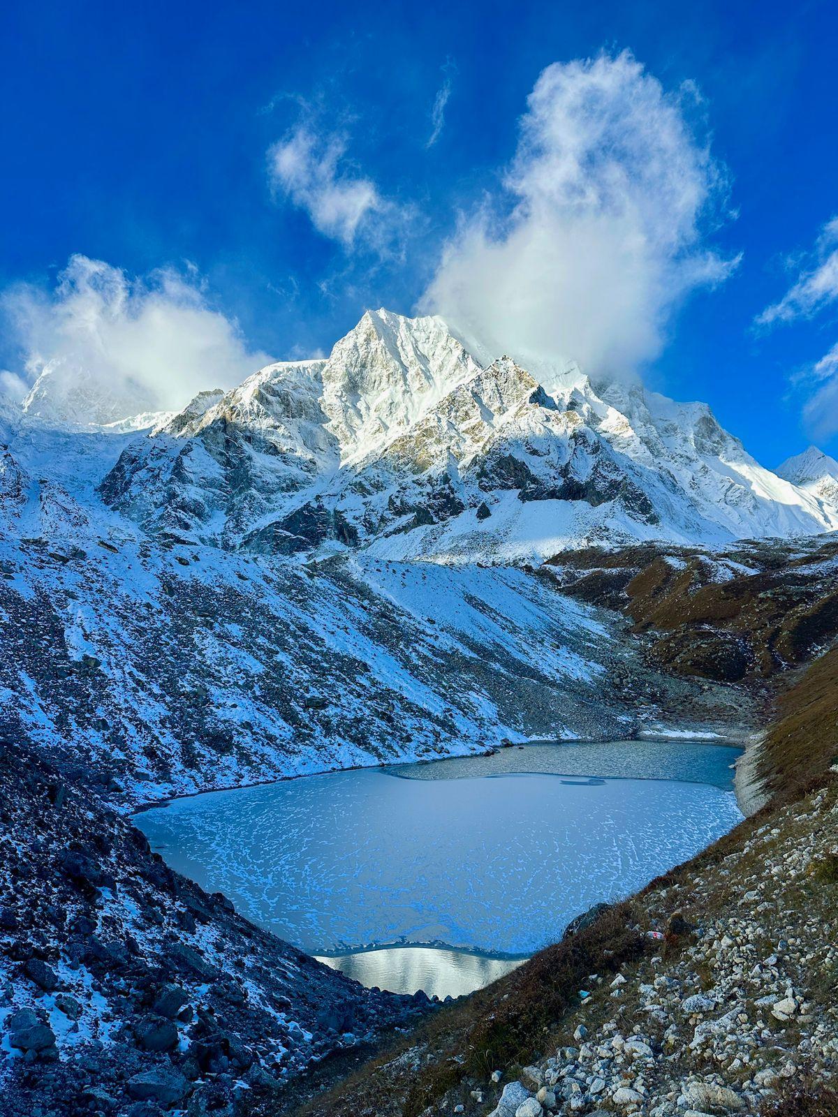
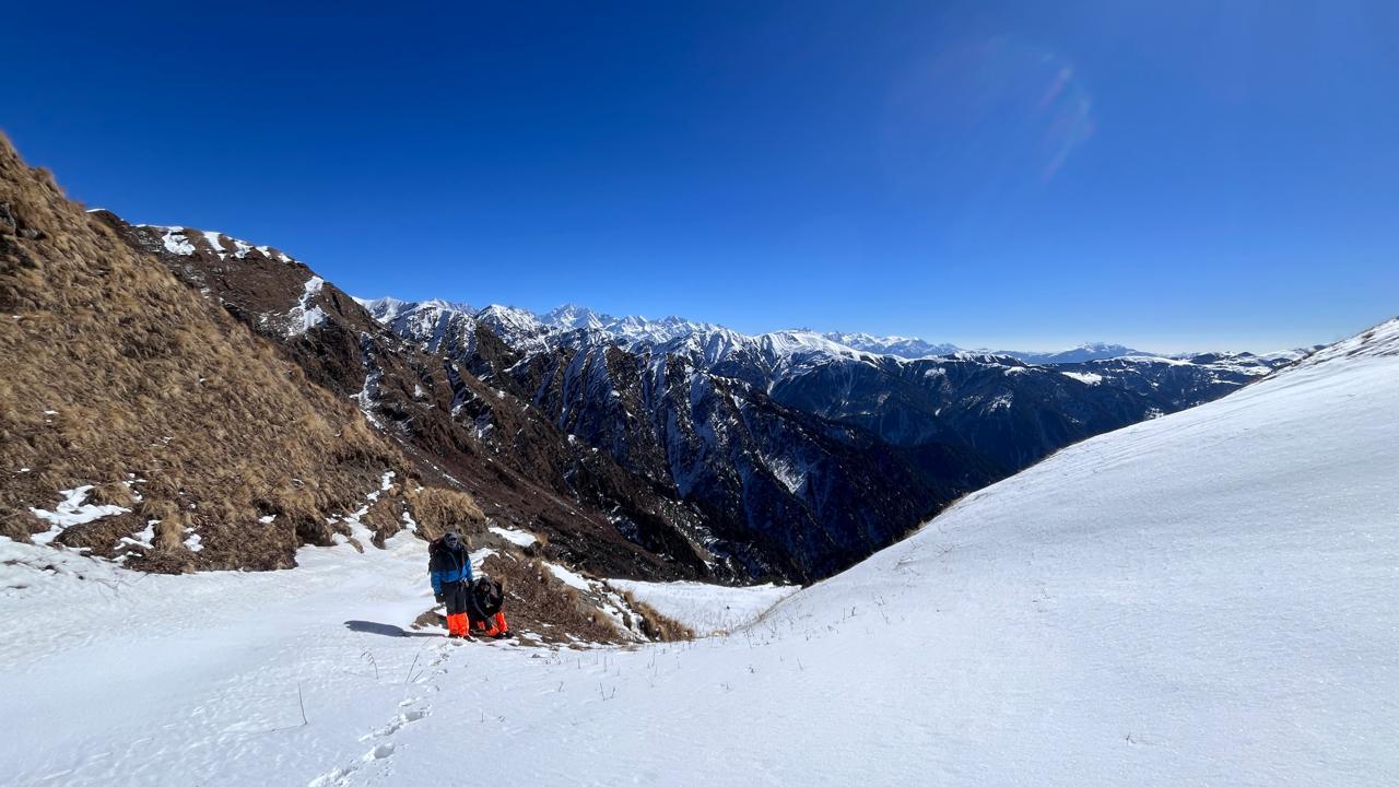
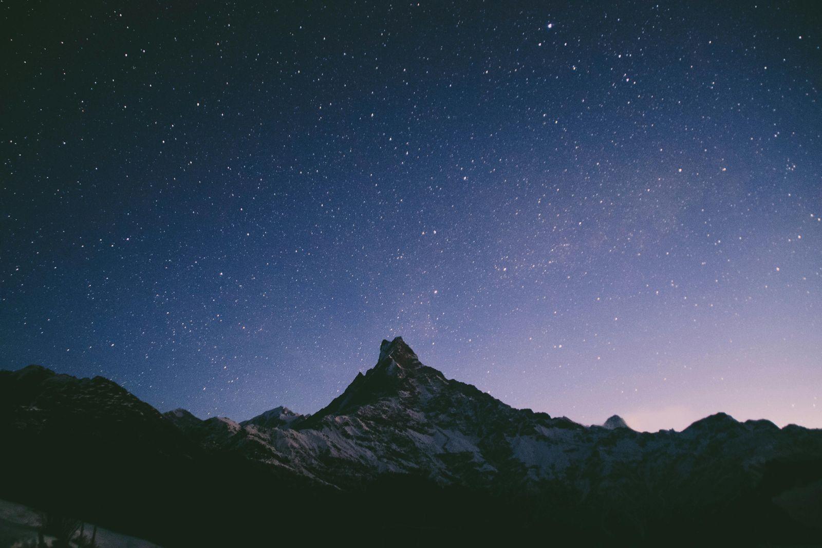
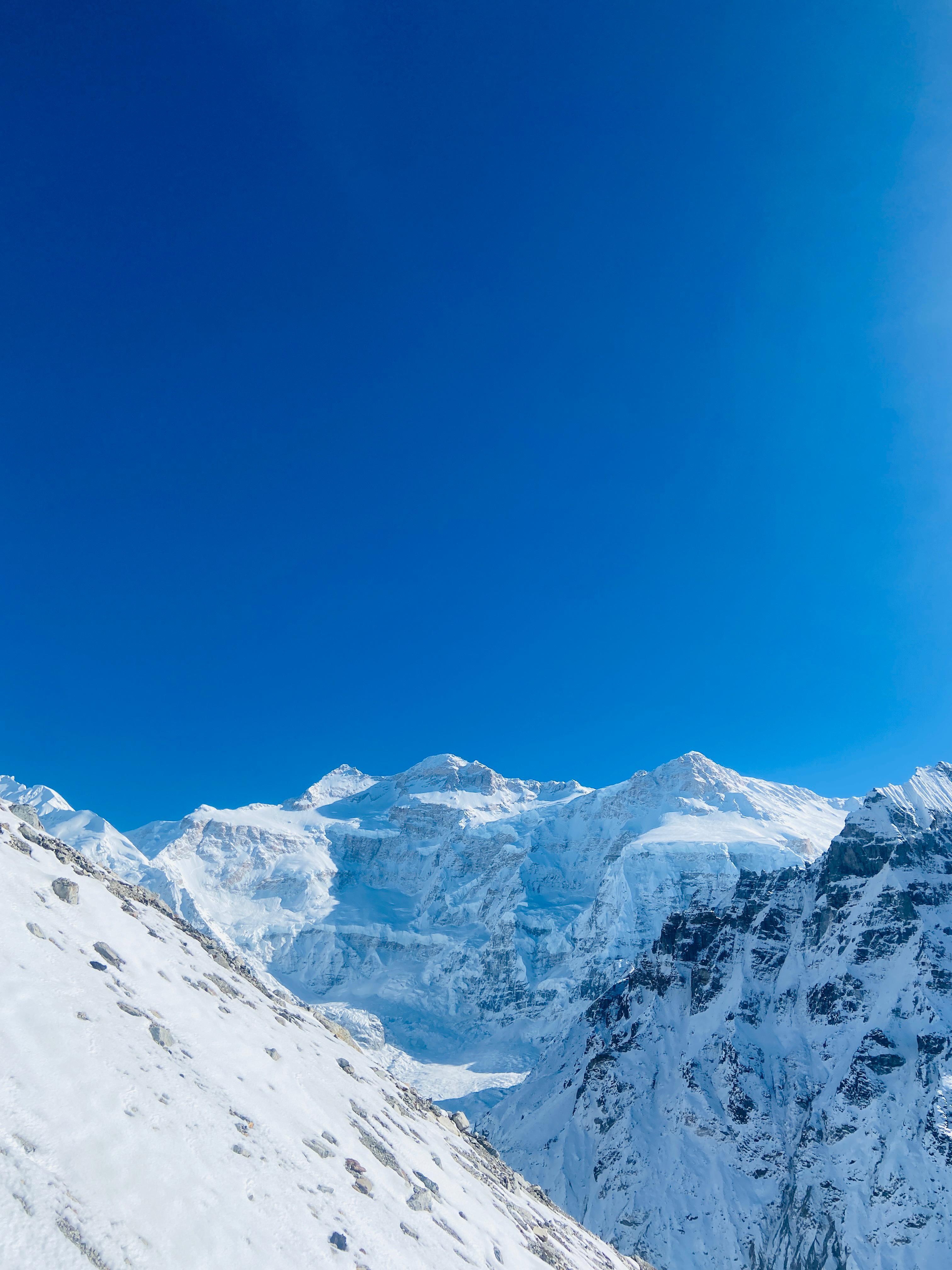
This is the most demanding and most rewarding day of the Manaslu Circuit, the one everything has been leading up to. The climb begins around 4 AM from Dharamsala, under cold, starlit skies. The trail winds slowly across a moraine ridge, climbing steadily through snow and ice toward Larkya La Pass.
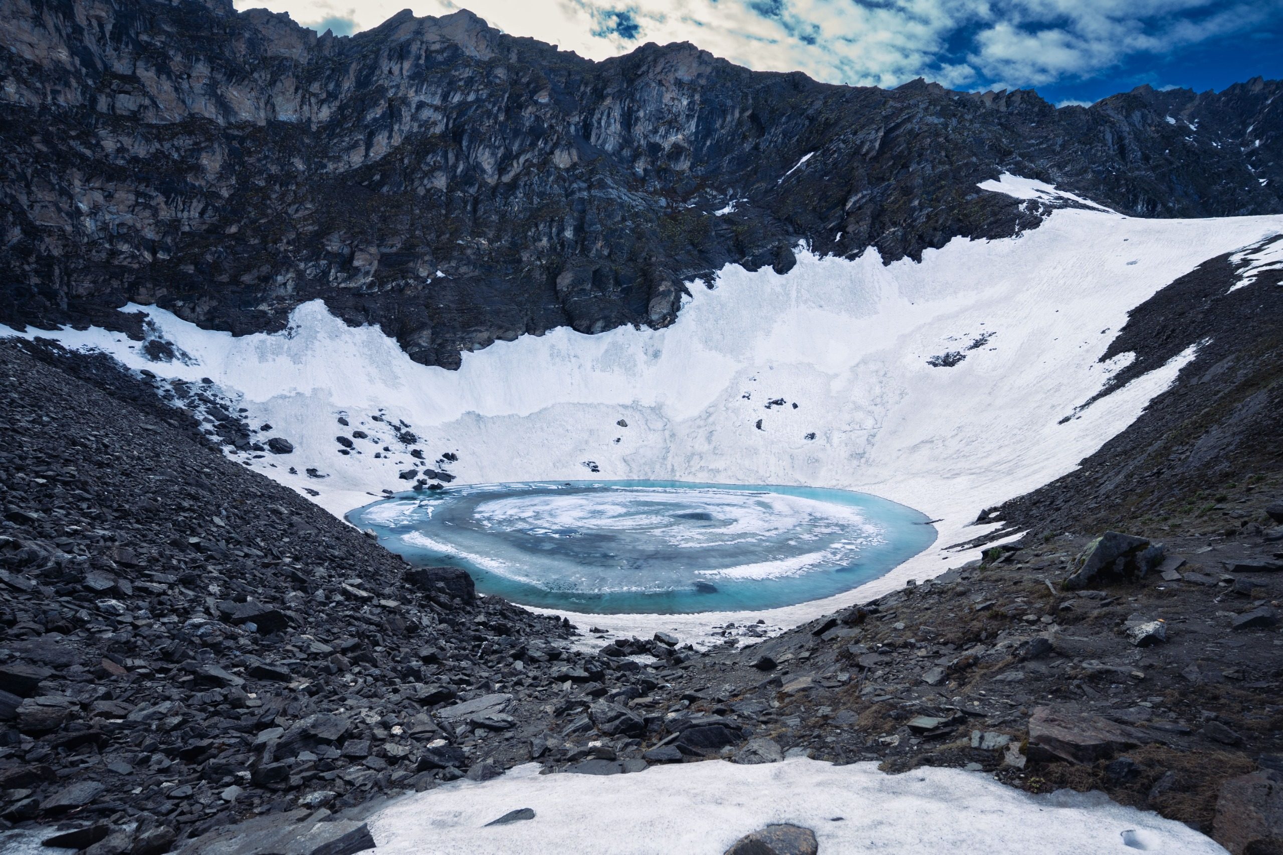
As dawn breaks, the first light spills over Larkya Peak and the silhouettes of Cheo Himal, Himlung, and Manaslu North. Far below, a small alpine lake glows turquoise in the half-light, one of those rare sights that freezes everyone in silence.
The final approach to the pass can be windy and bitterly cold, with loose scree and hard ice underfoot. Conditions vary each season, check the snow before your climb and carry microspikes for safety. By the time you reach Larkya La (5,106 m), the wind usually picks up, and standing still becomes difficult. After a quick photo beside the fluttering prayer flags, you begin the long descent.
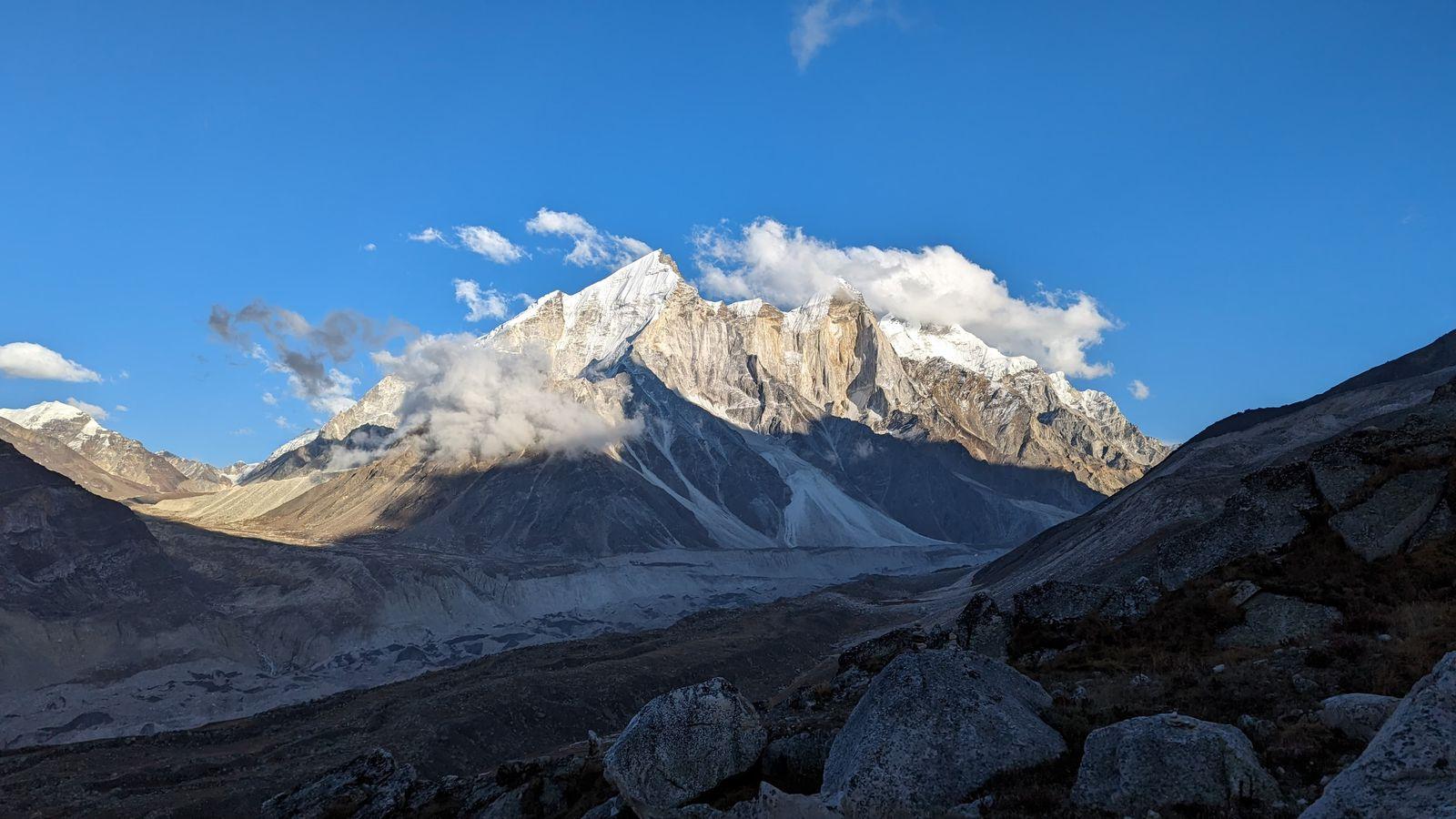
The way down is steep and relentless, crossing glacial moraine and frozen patches all the way to Surki Khola, where most teams stop for a late lunch. Beyond it, the valley opens up beautifully, leading to Bhimthang, an expansive meadow surrounded by peaks.
Reaching Bhimthang feels like a quiet triumph. After ten days of climbing, you’re finally back among grass and trees, watching the last light touch the snow ridges you crossed that morning.
Day 11
Bimthang to Tilche
Trek Distance: ~18 km (Bimthang to Tilche)
Time Taken: 7-8 hours
Elevation Profile: 11,775 ft / 3590 m → 7,400 ft/ 2255 m
After the intensity of the pass, today feels like exhaling. The trail drops steadily from Bhimthang through pine and rhododendron forests alive with birdsong and streams. For the first time in days, the air feels warm again. You catch glimpses of Manaslu’s pinnacle and the Lamjung Himal as you descend, the snow peaks slowly giving way to green hillsides.
The path crosses clear rivers over wooden bridges and passes small teahouses tucked beneath waterfalls. The contrast from the frozen silence of Larkya La to the lush valley below is striking; it feels like returning to life.
By evening, you reach Tilche, a lively Gurung village that marks the end of the remote upper Manaslu region. The lower altitude brings familiar comforts, thicker air, fresh vegetables, and warm laughter from the locals. It’s the perfect place to rest, share stories, and let the last ten days sink in.
Day 12
Tilche to Pokhara or Kathmandu
Drive Distance: ~125 km (Tilche to Pokhara) / ~200 km (Tilche to Kathmandu)
Time Taken: 5–6 hours (Pokhara) | 9–10 hours (Kathmandu)
Elevation Profile: 7,400 ft → 2,950 ft
The trekking part of the journey comes to an end today.
After a short, easy walk from Tilche to Dharapani, the landscape begins to shift. The rugged trails and high valleys slowly give way to wider paths, villages, and motor roads. At Dharapani, you board a jeep and begin your long descent through the Marsyangdi valley.
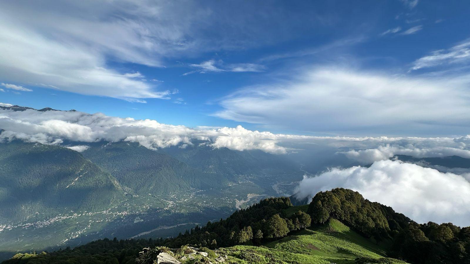
The drive winds through forests, riverside towns, terraced farms, and increasingly greener terrain. You’ll notice the air getting warmer, the mountains pulling back, and life becoming louder and busier with every passing hour. Besisahar, a key junction on the Annapurna Circuit, marks the transition from remote mountain travel to Nepal’s central highways.
From here, the journey continues toward either Pokhara or Kathmandu, depending on the group’s onward plans.
- Pokhara offers a softer landing after the mountains, lakeside cafés, hot showers, good food, and a chance to truly slow down. It’s an ideal place to rest, reflect, and celebrate the completion of the Manaslu Circuit.
- Kathmandu brings you back to the pulse of Nepal, chaotic, cultural, and full of contrasts, after weeks in the high Himalayas.
Travel logistics (necessary to note):
- Odyssey arranges vehicle transport up to Kathmandu by default.
- If the entire group wishes to go to Pokhara, the vehicle can be arranged accordingly.
- If the group is split, the vehicle will be arranged only up to Kathmandu.
For participants heading to Kathmandu who prefer a shorter journey, an alternative option is to drive to Pokhara first and take a 20-minute domestic flight to Kathmandu (flight not included).
Our Expectations from the participants
This is a demanding high-altitude journey, and we expect participants to arrive prepared, both physically and mentally, as well as logistically.
Preparation: Be willing to commit to consistent physical training for at least two months before the trek. Odyssey will provide a structured program to help you build endurance, strength, and mobility for the mountains.
Experience: Prior experience of multi-day treks above 12,000 ft is recommended. You should be comfortable walking 12–20 km a day for 7–9 hours, carrying your own daypack.
Fitness & Health: Good overall fitness, no significant history of altitude sickness, and a basic understanding of acclimatisation principles are essential. The Manaslu Circuit rewards patience and steady effort more than speed.
Documentation: All trekkers must carry a valid passport, TIMS card, and Manaslu Conservation Area Permit. Odyssey will help arrange the permits, but you’ll need to arrive one day before the trek (before 10 AM) to complete the process in person.
Attitude: Above all, we expect an openness to new cultures, new people, and the unpredictability of the mountains. Flexibility and team spirit make as much of a difference as endurance up here.
Minimum Fitness Requirement
The Manaslu Circuit demands steady endurance and strong legs. You don’t need to be an athlete, but you do need to train consistently.
Stamina: Be able to walk uphill and downhill for several hours while carrying a 6–8 kg backpack.
Endurance: Prepare for long days on the trail (up to 12 hours) during the pass crossing.
Training Period: Follow a structured fitness routine for at least 6–8 weeks before the trek.
Cardio: Include running, brisk walking, cycling, or swimming, 3-5 sessions per week.
Strength: Incorporate 2–3 sessions of strength training focused on the legs, core, and glutes to enhance stability on uneven terrain.
You don’t train for speed, you train for steadiness. The mountain rewards those who move slowly, breathe deeply, and stay consistent.
Expedition Behaviour
- Punctuality, cooperation with the team, and respect for locals, customs, and the environment.
- Active participation in all briefings and decisions that concern the safety of the group.
- Readiness to deal with basic discomforts: altitude symptoms, limited shower access, and shared accommodations.
Inclusion
Exclusion
How difficult is the Manaslu Circuit Trek?
What's the highest altitude we'll reach?
How many days does the trek take?
How is it different from EBC or ABC?
Is a special permit required?
- Manaslu Restricted Area Permit (RAP)
- Manaslu Conservation Area Permit (MCAP)
- Annapurna Conservation Area Permit (ACAP)
Odyssey arranges all permits for you. You will need to arrive a day prior (before 10:00 AM) for in-person verification at the permit office in Kathmandu.
What kind of accommodation is provided?
Tip: Carry your own hygiene liners for extra comfort and cleanliness.
How cold does it get?
Is there a phone network or Wi-Fi?
What about food and water?
Breakfast: Toast, porridge, muesli, eggs, pancakes, tea, coffee, ginger-lemon-honey.
Lunch & Dinner: Noodles, fried rice, pasta, macaroni, momos, and the classic Dal Bhat, which is freshly made, filling, and often unlimited.
Food costs rise with altitude since mules or porters carry everything up.
Water is available in boiled or filtered form at every stop. Please carry your own bottle and purification tablets. Avoid buying plastic bottles.
Do I need to worry about altitude sickness?
Our leaders monitor oxygen levels daily and are trained to recognise and manage any symptoms of AMS that may appear.
Is travel insurance necessary?
What's the best time to do this trek?
Spring (Mar–May): Warmer days, rhododendron bloom, and vibrant valleys.
Winter and monsoon months are not ideal due to snow and landslides.
How much cash should I carry for food and extras?
Breakfast: 600–800 NPR (porridge, muesli, eggs, toast, and a hot drink).
Lunch/Dinner: Around 1,000 NPR each.
Add a bit more for tea, coffee, snacks, or baked treats at cafés along the route.
Carry all cash from Kathmandu; there are no reliable ATMs beyond Soti Khola.
How many people are there in a team?
Are there restrooms and hot showers on the trek?
Can I charge my phone or camera?
How do we handle waste on the trek?
What currency should I carry?
ATMs beyond Soti Khola are unreliable, and the teahouses accept only cash.
SELECT DATE TO REGISTER


Thank You!
Your form has been submitted successfully. We'll get back to you soon.
₹ 66,499 + 5% GST