


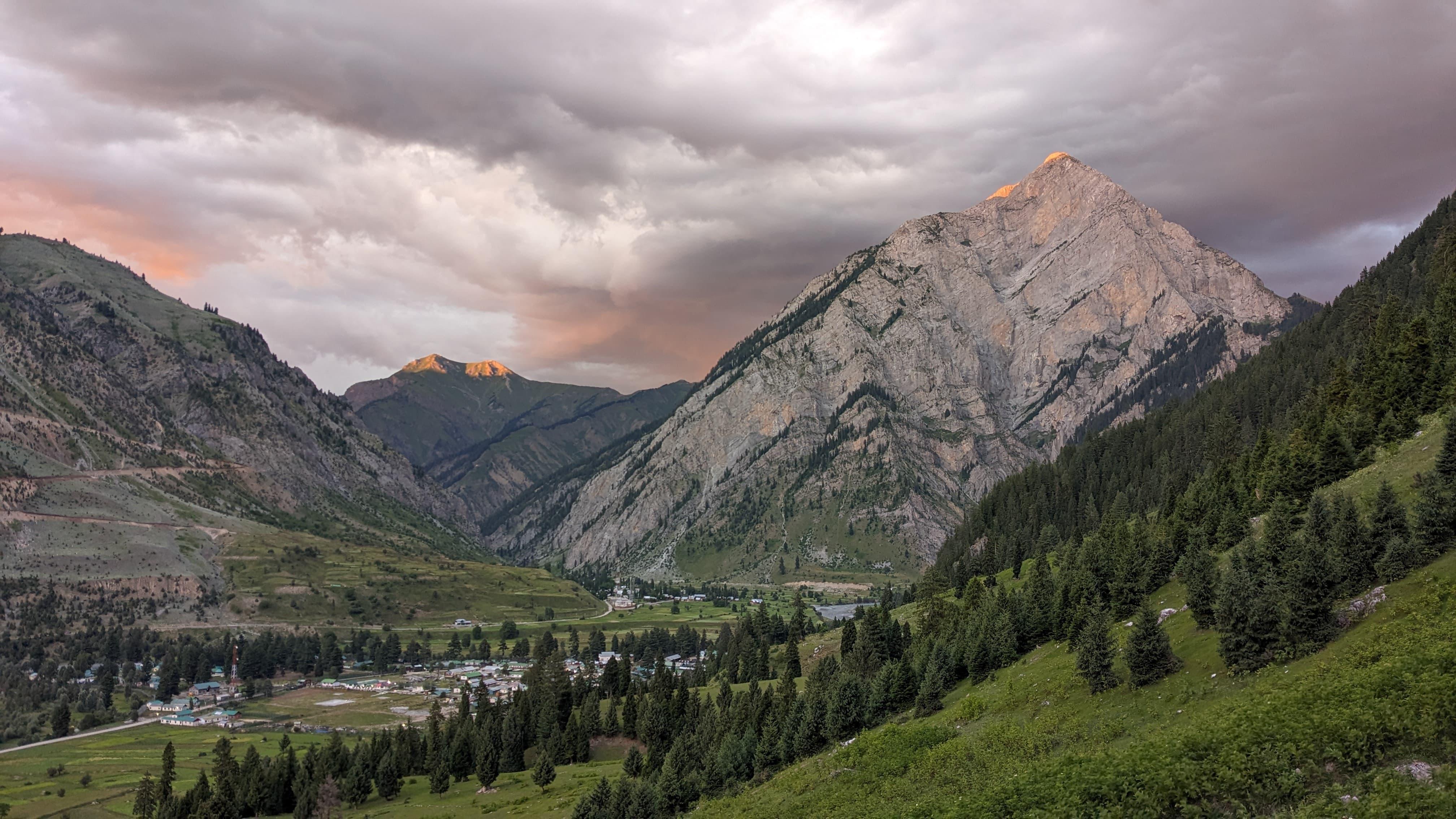
You begin in Panikhar, which is already at 10,000 ft (3,050 m), a quiet settlement tucked between broad valleys and stark mountains. Even at the trailhead, the air feels a little lighter, and the landscape tells you you’re entering a remote part of the Himalaya. The villages are sparse, the mountains stand close, and everything around you feels open and exposed.
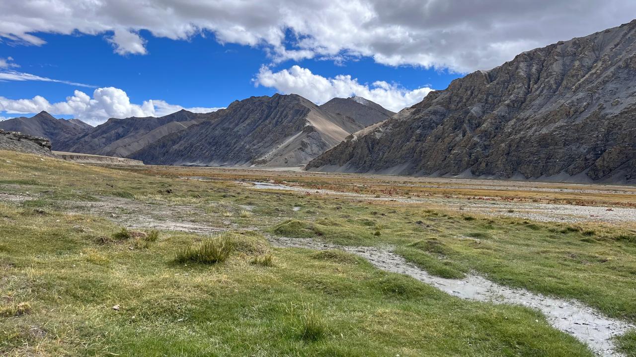
As you walk deeper, the valley continues to change, with long stretches along the river, sandy basins, and sections where the trail disappears into moraine. Campsites like Denora and Kalapari sit in huge open spaces where the sound of the river is the only thing you hear once the sun goes down.
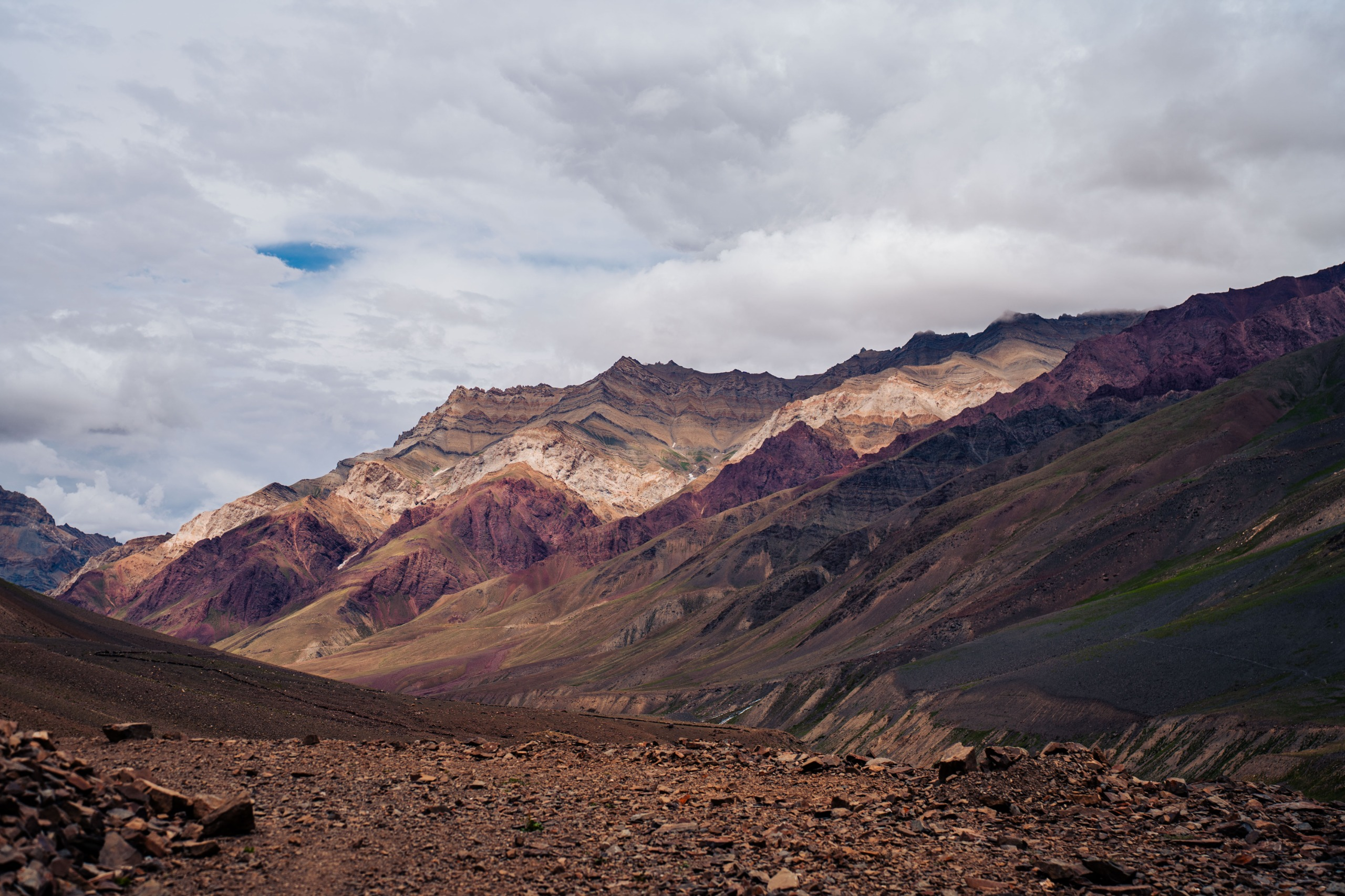
The climb to Lomvilad Pass at 14,495 ft (4,420 m) is steady and slow. On top, the view opens in a way that makes you pause for a moment. The side you climbed from looks stark and rugged. The side you descend into looks gentler, with greener slopes, distant tree lines, and streams cutting through the valley below. It’s a very real shift in landscape, something you feel as soon as you begin descending towards Kaintal
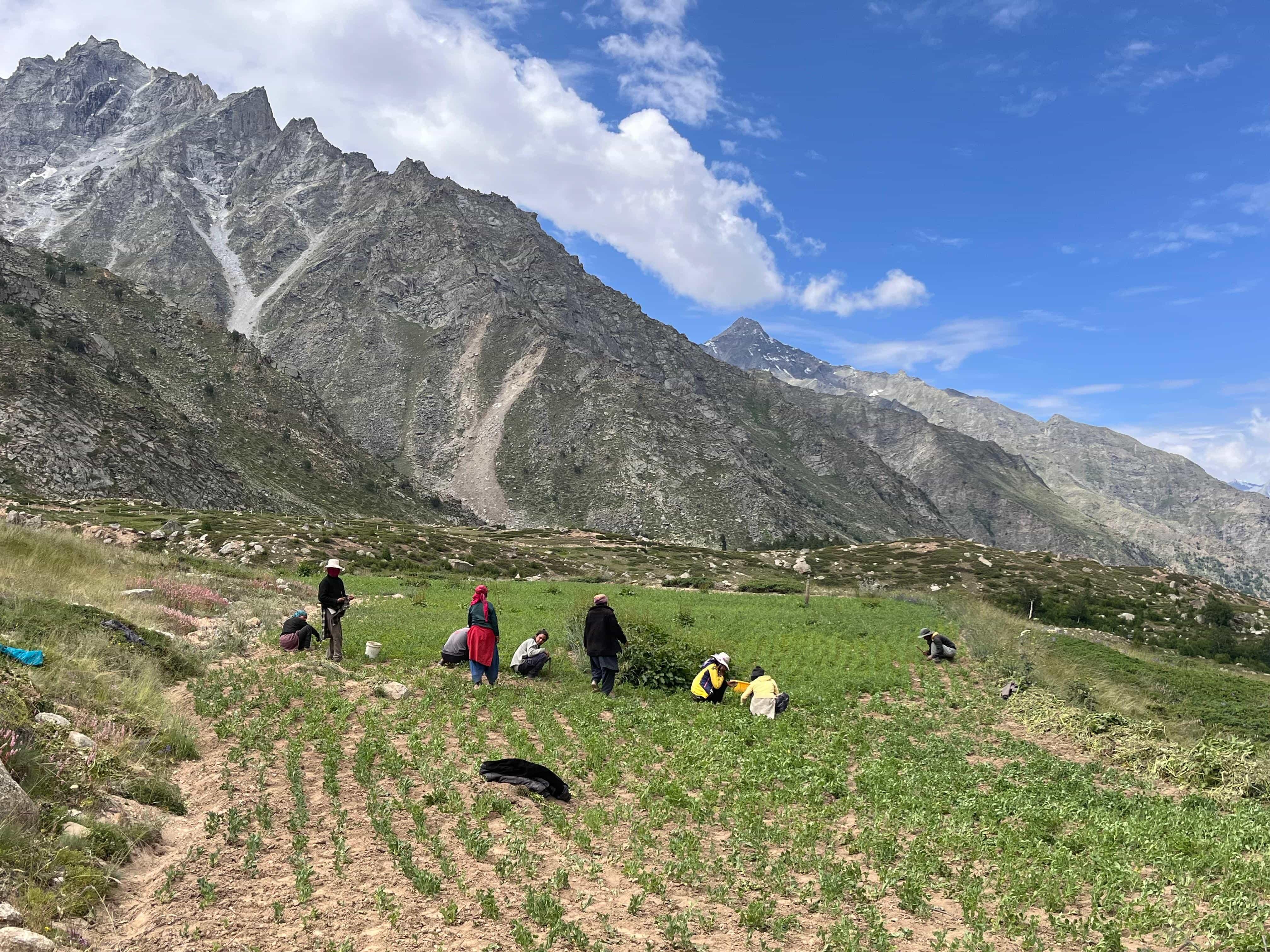
Lower down, the trail passes through long meadows, willow trees, and wooden homes where people still reside, working their fields by hand alongside livestock. Villages like Humpet and Sukhnai are small but full of life, children running along streams, smoke rising from kitchens, and families going about their day with no rush.
Throughout the trail, the backpacking element stays constant.
You carry your pack, cook together, pitch tents, and move as a small, self-sufficient team. The terrain is raw and remote, but it’s also gratifying because of the work you put into it. Every day teaches you something about pace, judgment, and how to live simply in the mountains.
Warwan Valley stays with you because of its contrasts in terrain, cultures, quiet stretches, and long walking days, where your team finds its own rhythm.
Day 1
Srinagar to Panikhar
Drive: ~185 km
Starting Elevation: 5,200 ft / 1,585 m (Srinagar)
Ending Elevation: 10,000 ft / 3,050 m (Panikhar)
The day starts early, long before the markets of Srinagar open. As you drive out of the city, Dal Lake is still quiet, houseboats barely awake, and the first light is falling on the water. The road climbs steadily towards Sonamarg, and the familiar hum of traffic slowly fades as the mountains rise higher around you.
Past Sonamarg, the landscape begins to stretch. The road bends along the Sindh River, the air cools, and the terrain starts to change.
The climb to Zojila Pass (11,575 ft / 3,528 m) is initially gradual and then suddenly becomes dramatic.
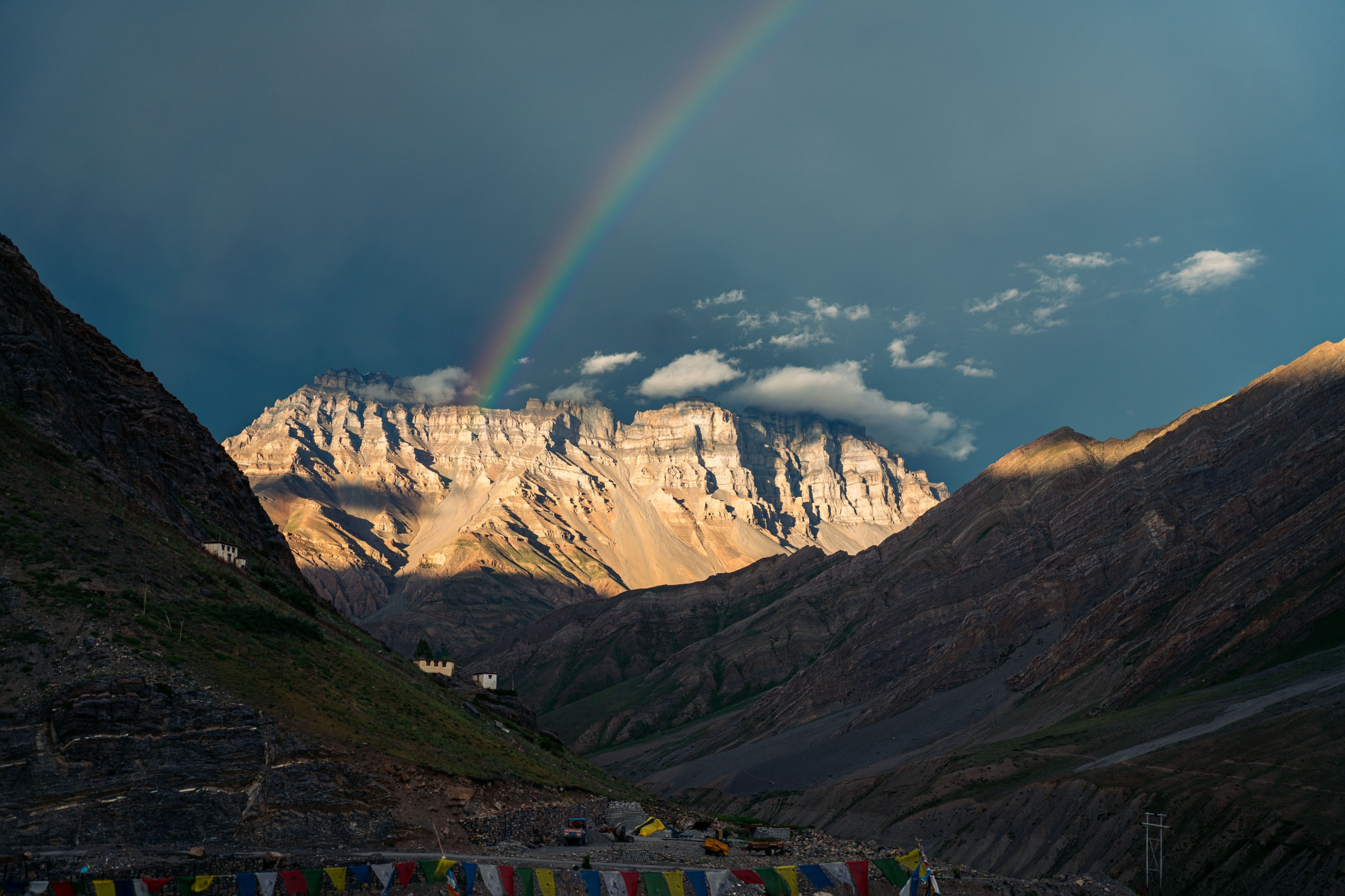
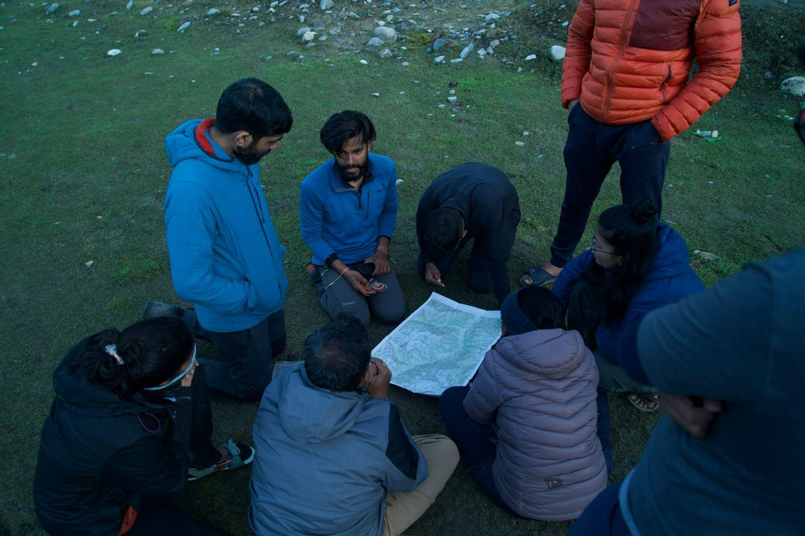
By the time you reach Panikhar, it feels like a place suspended between worlds, the openness of Ladakh behind you and the deep, folded valleys of Warwan ahead. This is where your basecamp is. We will plan our ration, arrange our gears and plan the next 7 days.
Day 2
Panikhar to Denora
Trek Distance: ~14 km
Elevation: 10,000 ft / 3,050 m → 12,375 ft / 3,770 m
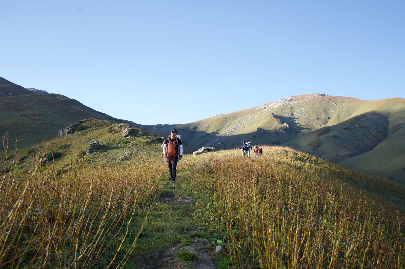
You leave Panikhar with the first light touching the barley fields. The trail starts easily. A wide path follows the river, flat in some places, gently rising in others. You walk past scattered hamlets, wooden homes, willow trees, and stacks of firewood, each feeling more remote than the last.
The valley opens wider as you move ahead. On one side, long ridges of brown rock. On the other hand, slopes shaped by old glaciers are smooth and silent. This is one of Warwan’s signatures, that sudden sense of space, where the valley becomes so wide you feel tiny walking through it.
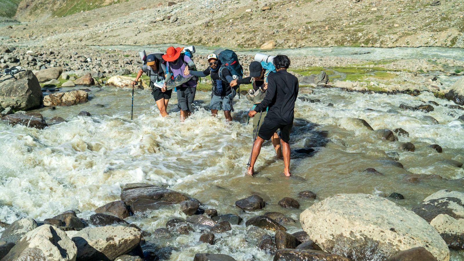
You take your first break near a shallow stream crossing, your shoes off, as the cold water numbs your feet.
As you approach Denora, the valley changes once again. The cliffs close in a little, and the sound of the river deepens.
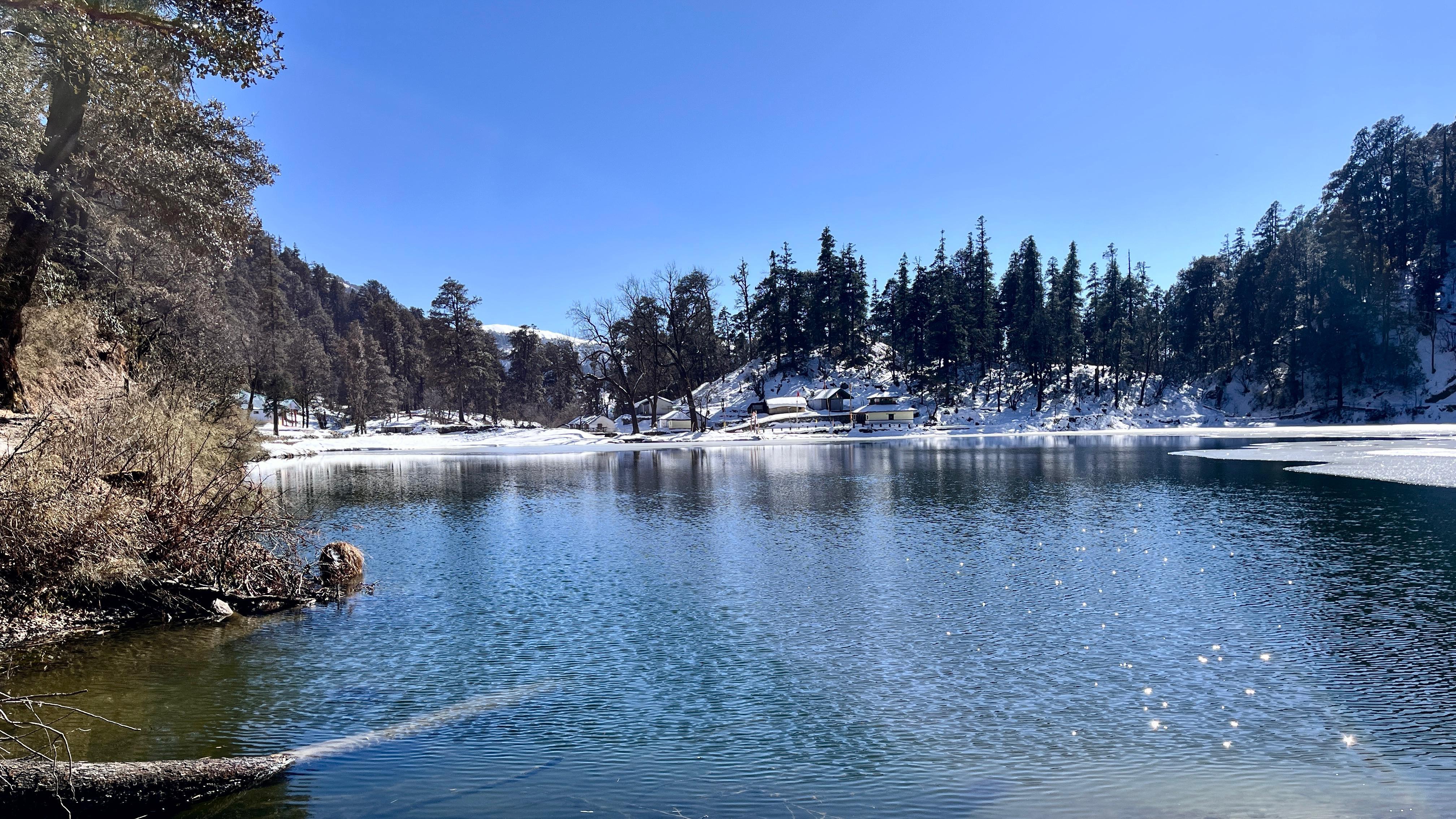
Denora itself sits on a flat meadow, open, green, and surrounded by mountains that catch the evening light beautifully.
Your camp is usually set up on a grassy shelf overlooking the braided river plain.
There’s enough space to spread out, cook, refill water, and sit quietly watching the colours change on the mountains.
Day 3
Denora to Kalapari
Trek Distance: ~3–4 km
Elevation: 12,375 ft / 3,770 m → 12,880 ft / 3,925 m
This is the quietest and shortest day of the entire trek, intentionally so. There is no campsite beyond Kalapari until after the pass, so today is about positioning yourself well for the big climb tomorrow.
You leave Denora by late morning, after the sun has warmed the valley a little. The trail begins with a series of cold stream crossings, not deep, but icy enough to wake every sense in your body. The water runs straight down from hidden glaciers above, and you can feel it instantly.
Once you cross the braided streams, the trail curves gently towards the right valley. The scenery tightens, brown cliffs on one side, a tumbling river on the other, and a faint path leading you deeper. It’s not a strenuous walk; it’s simply steady and beautiful.
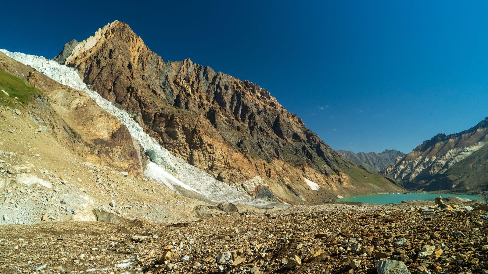
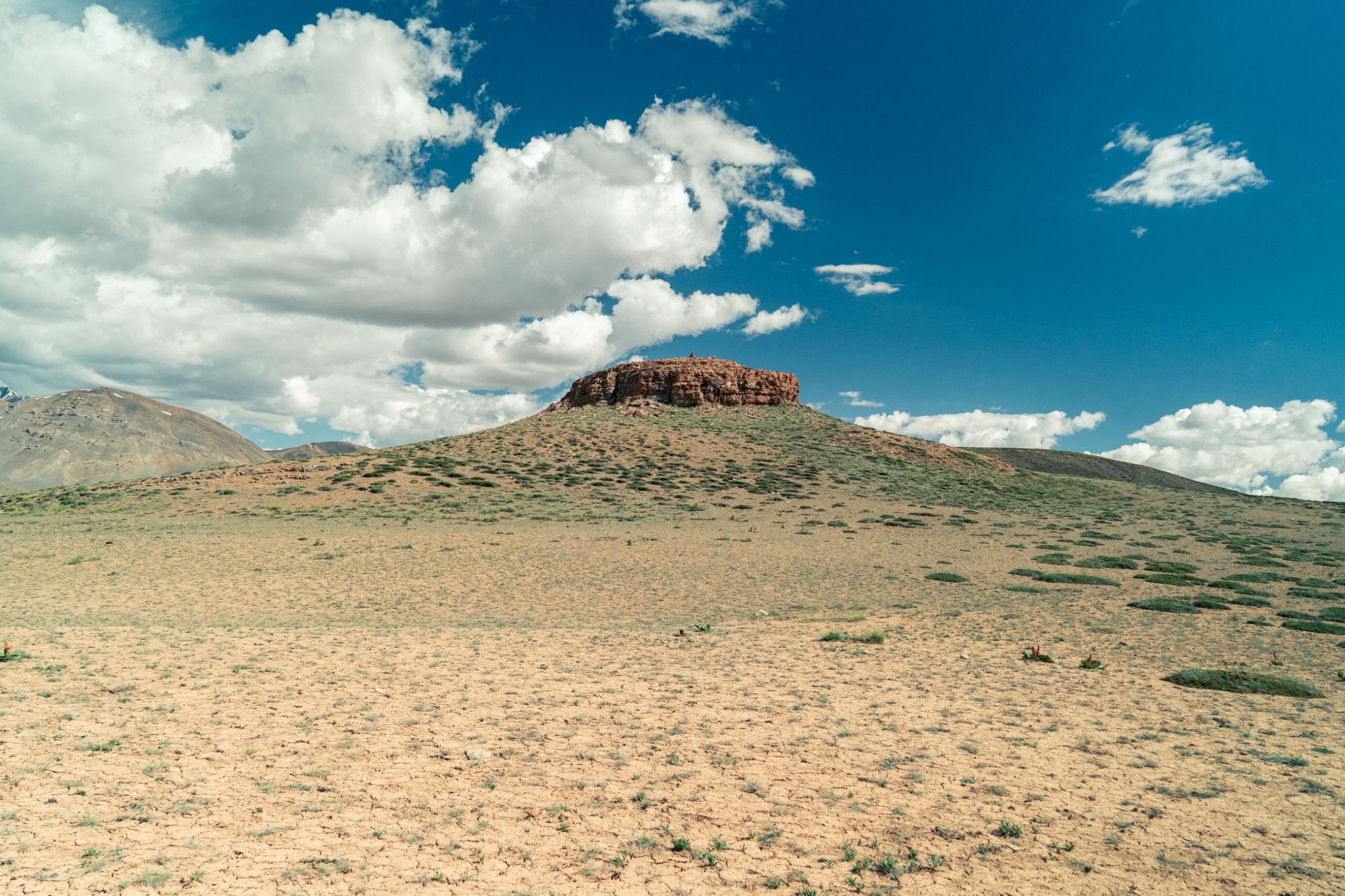
Within a couple of hours, Kalapari appears, a quiet meadow tucked against the rising walls of the mountains. It’s a small, sheltered bowl of land, open enough for tents but enclosed enough to make you feel held by the valley.
The rest of the afternoon unfolds slowly:
- You spread out your gear, dry your socks, and refill your water.
- Someone starts chopping vegetables, and someone else lights the stove.
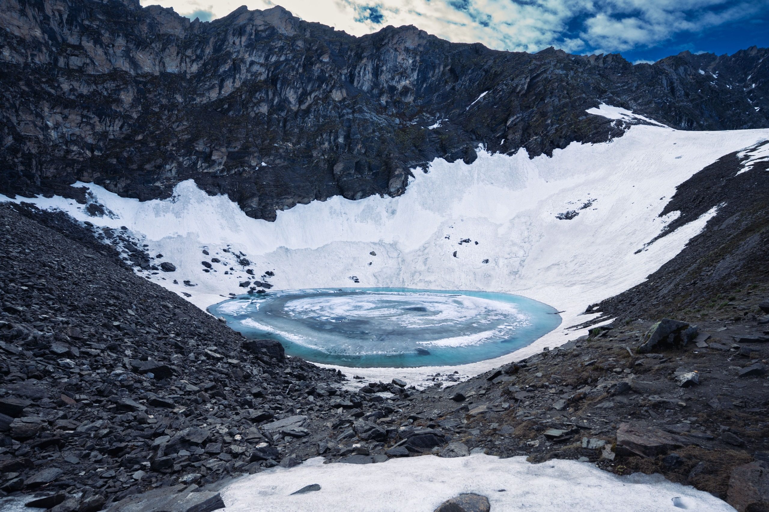
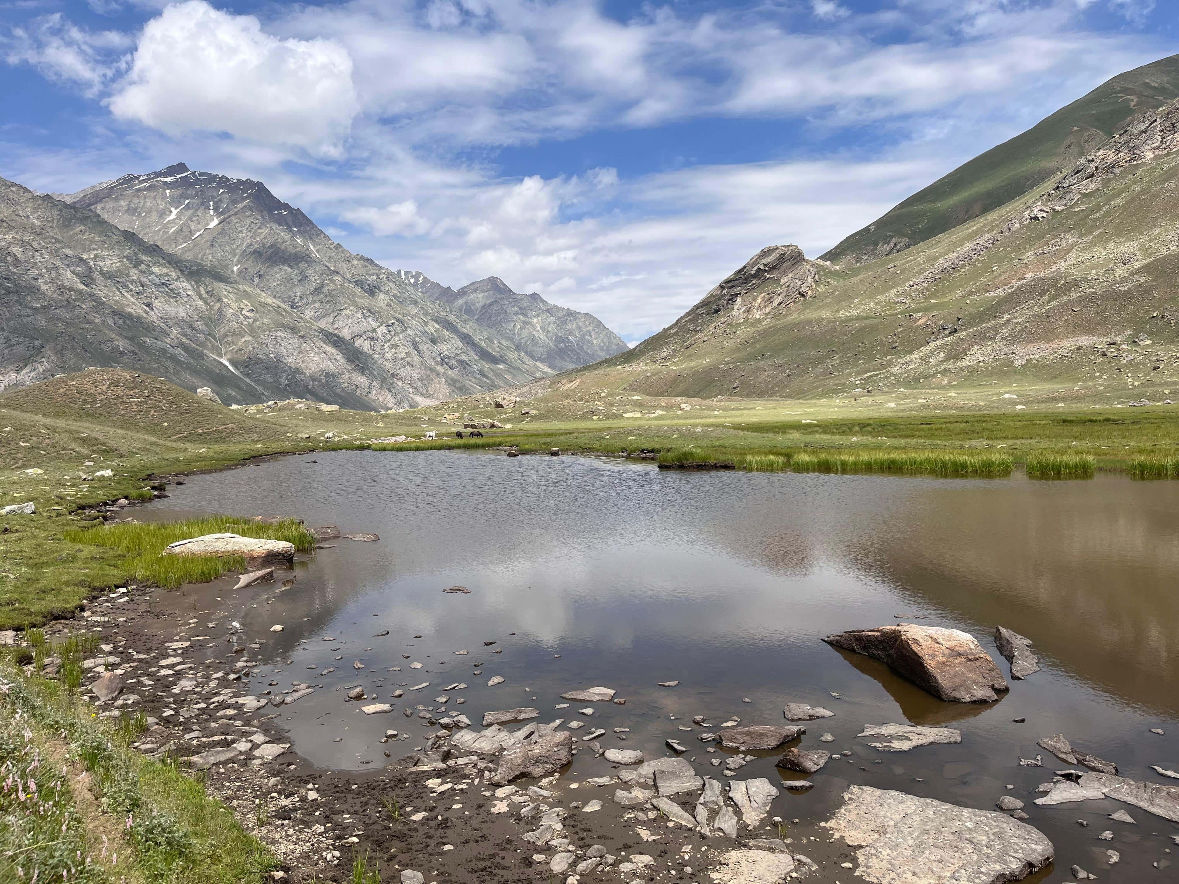
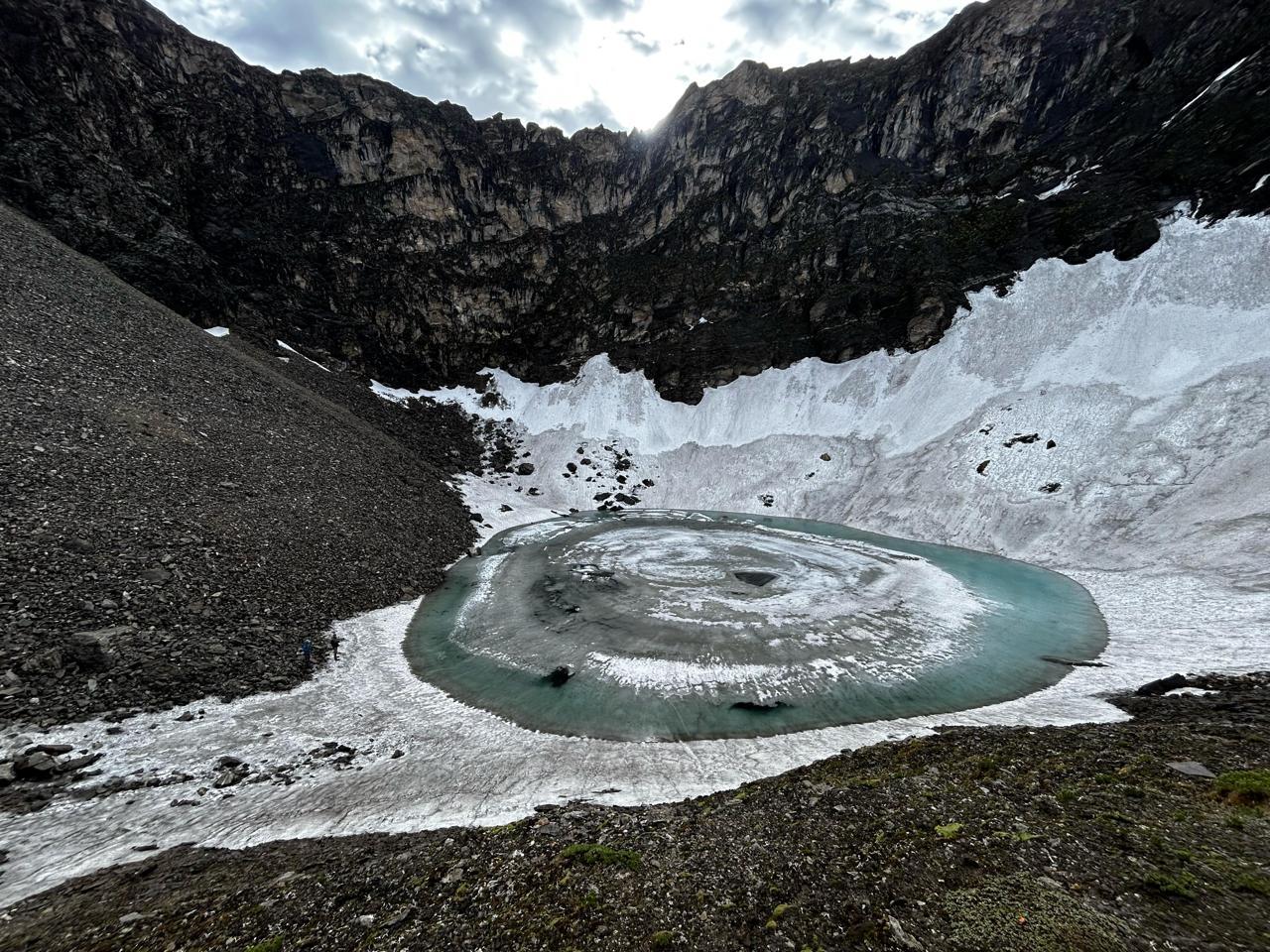
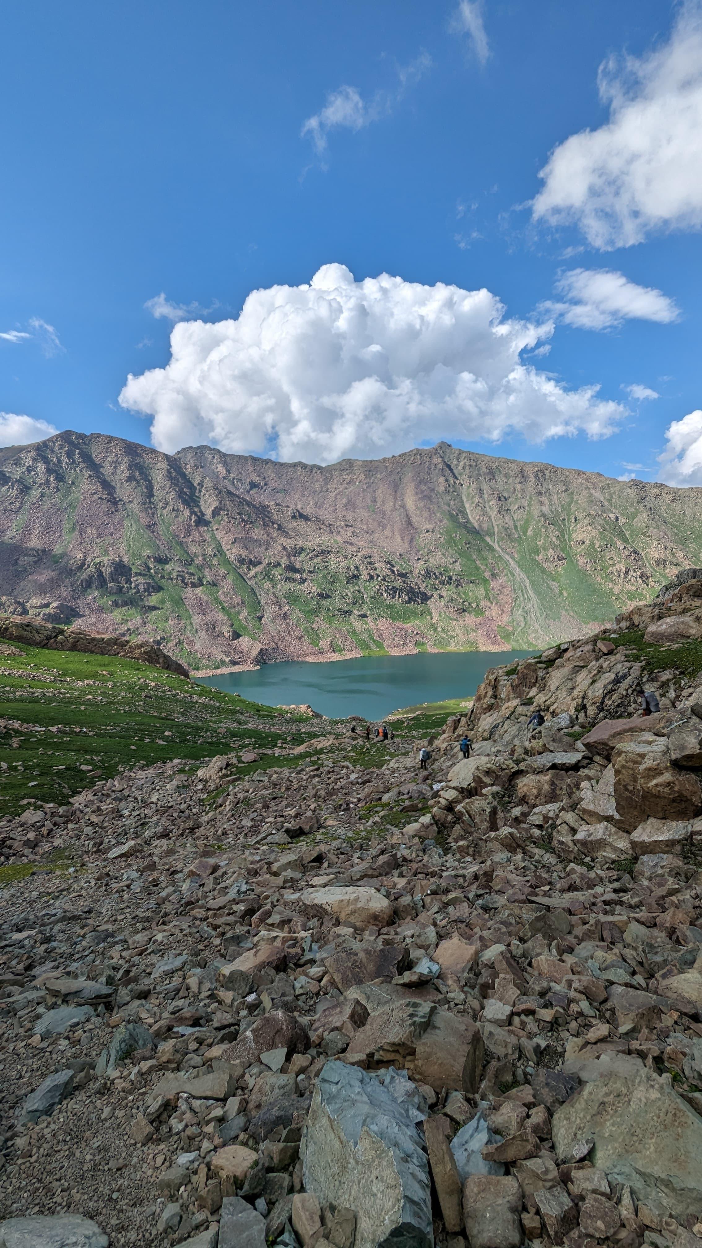
- A few of you take a walk to the nearby high-altitude lake, a short acclimatisation hike that gives a stunning view of the upper valley and tomorrow’s route.
- The colours change sharply as the sun dips; the valley becomes colder and quieter.
Tomorrow is the most extended and demanding day of the trek, the day of the pass crossing.
Tonight, you eat well, pack tight, sleep early, and let your body rest.
Day 4
Kalapari to Kaintal via Lomvilad Pass
Trek Distance: ~21–27 km (varies depending on campsite location)
Elevation: 12,880 ft / 3,925 m → 14,495 ft / 4,420 m (Lomvilad Pass) → ~11,800 ft / ~3,600 m (Kaintal)
This is the day everything builds toward, the longest, slowest, and most absorbing day of the Warwan Valley trek.
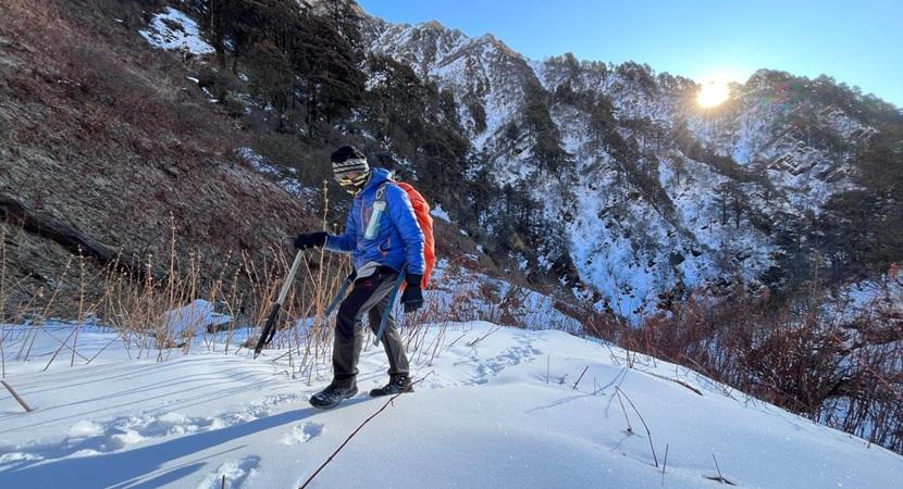
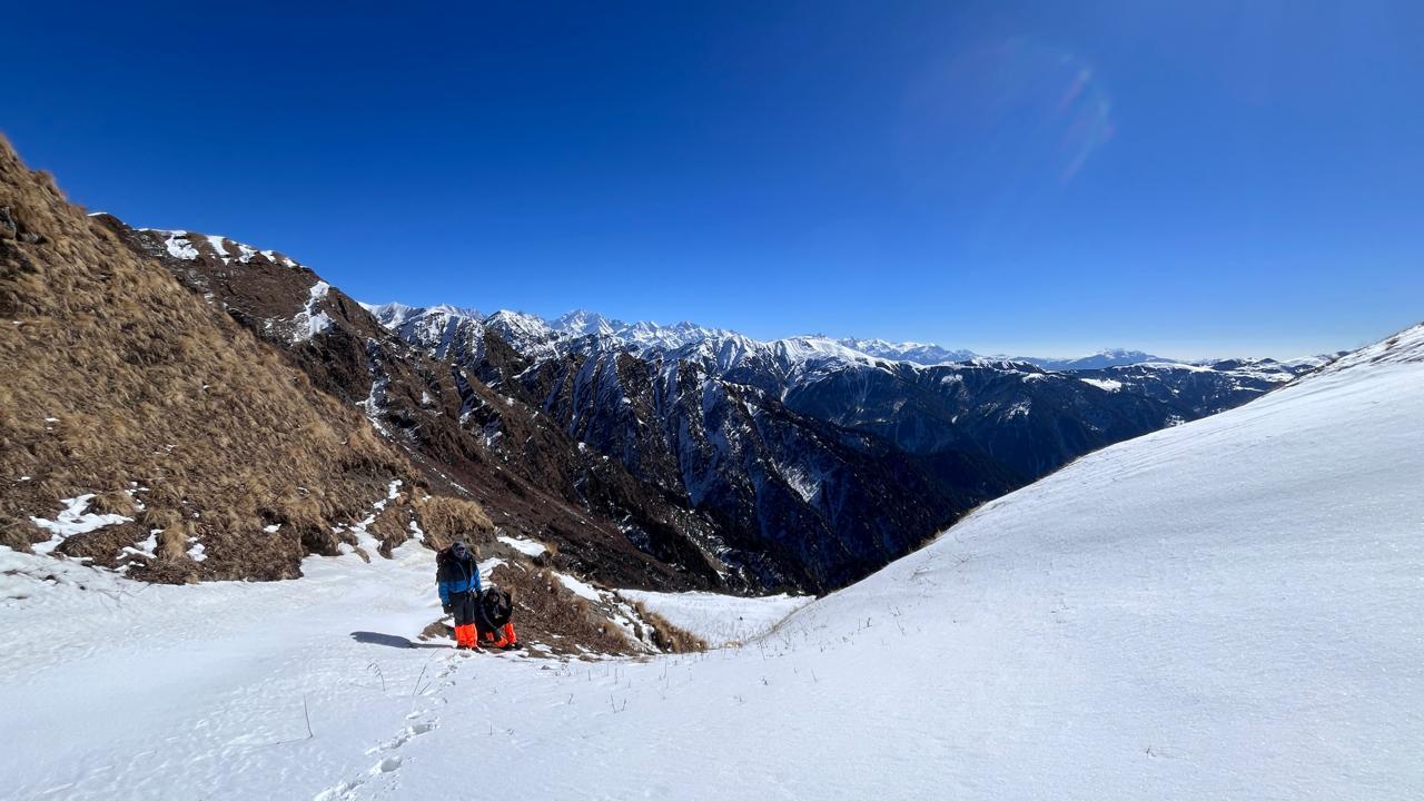
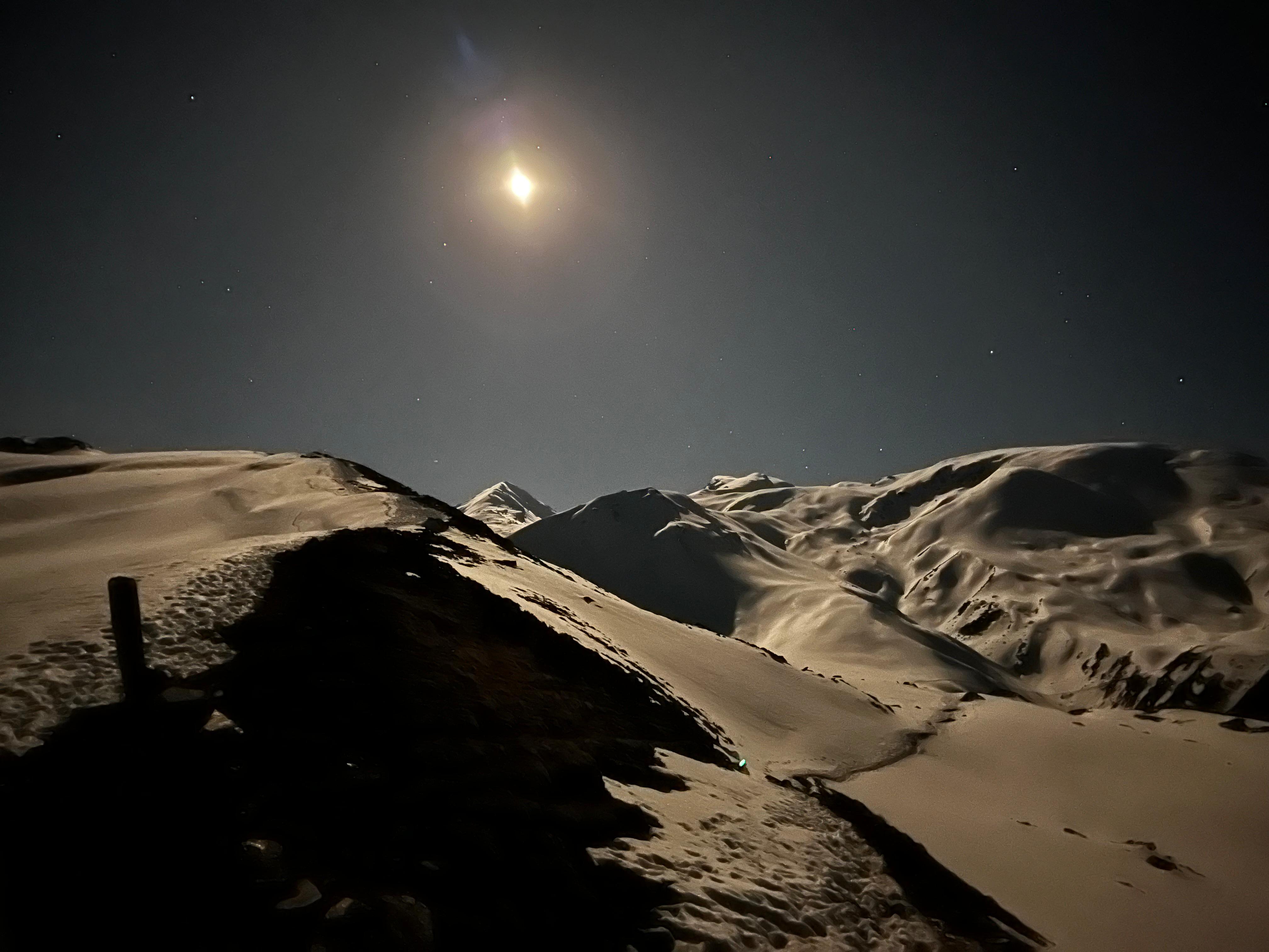
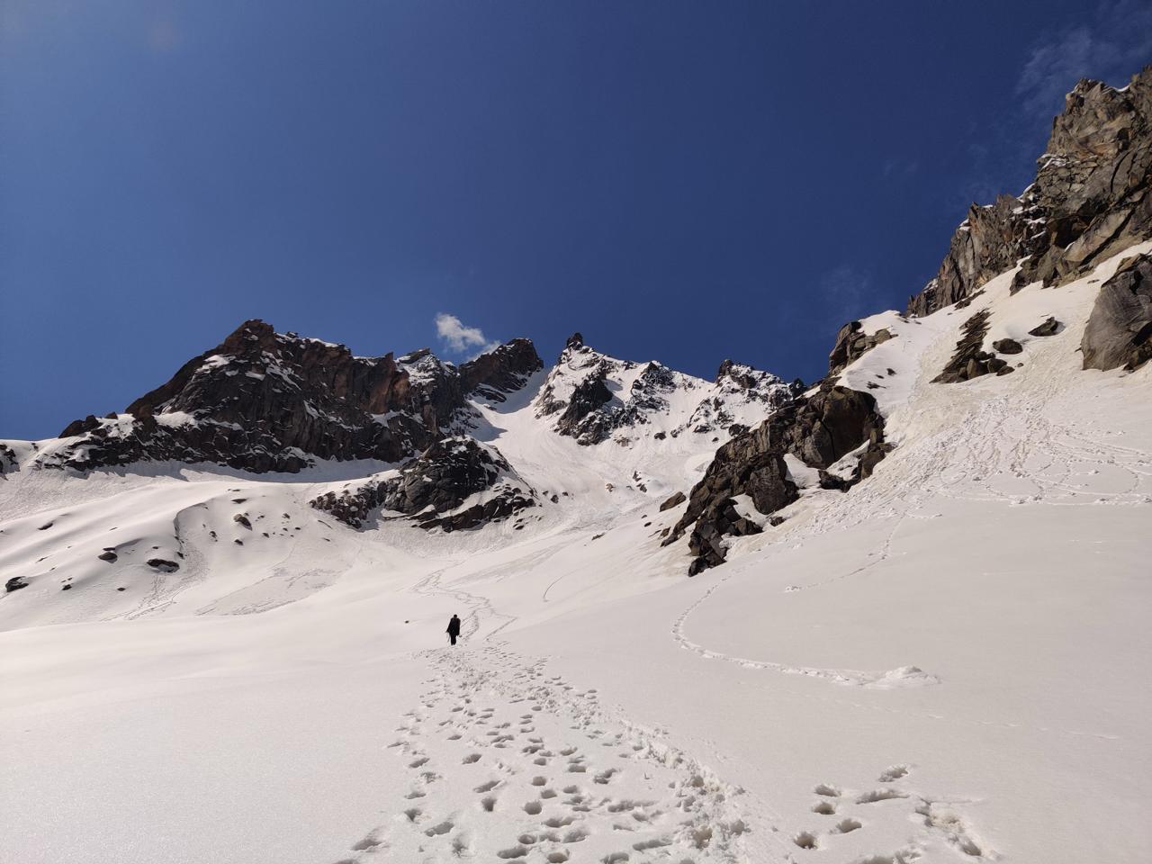
You leave Kalapari early, headlamps on, the air cold and dry. The first climb kicks in immediately: a steady, steep ascent that wakes up your legs and warms your breath. It is not technical, just persistent, the kind of climb where you fall into your own rhythm and let the slope take over.
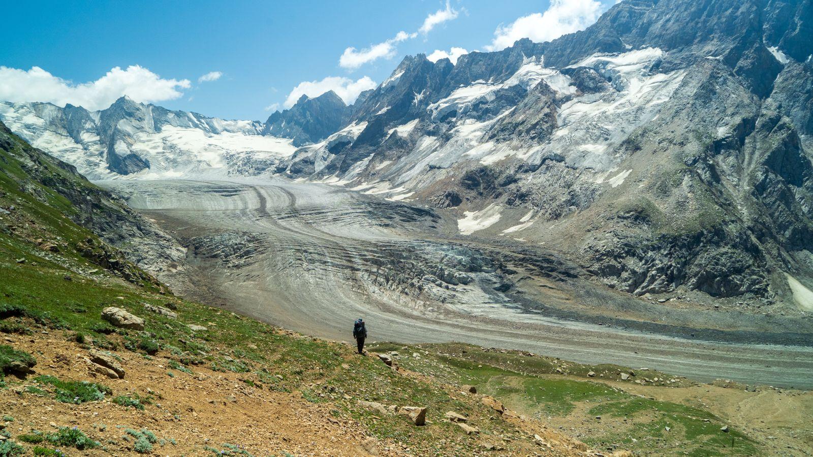
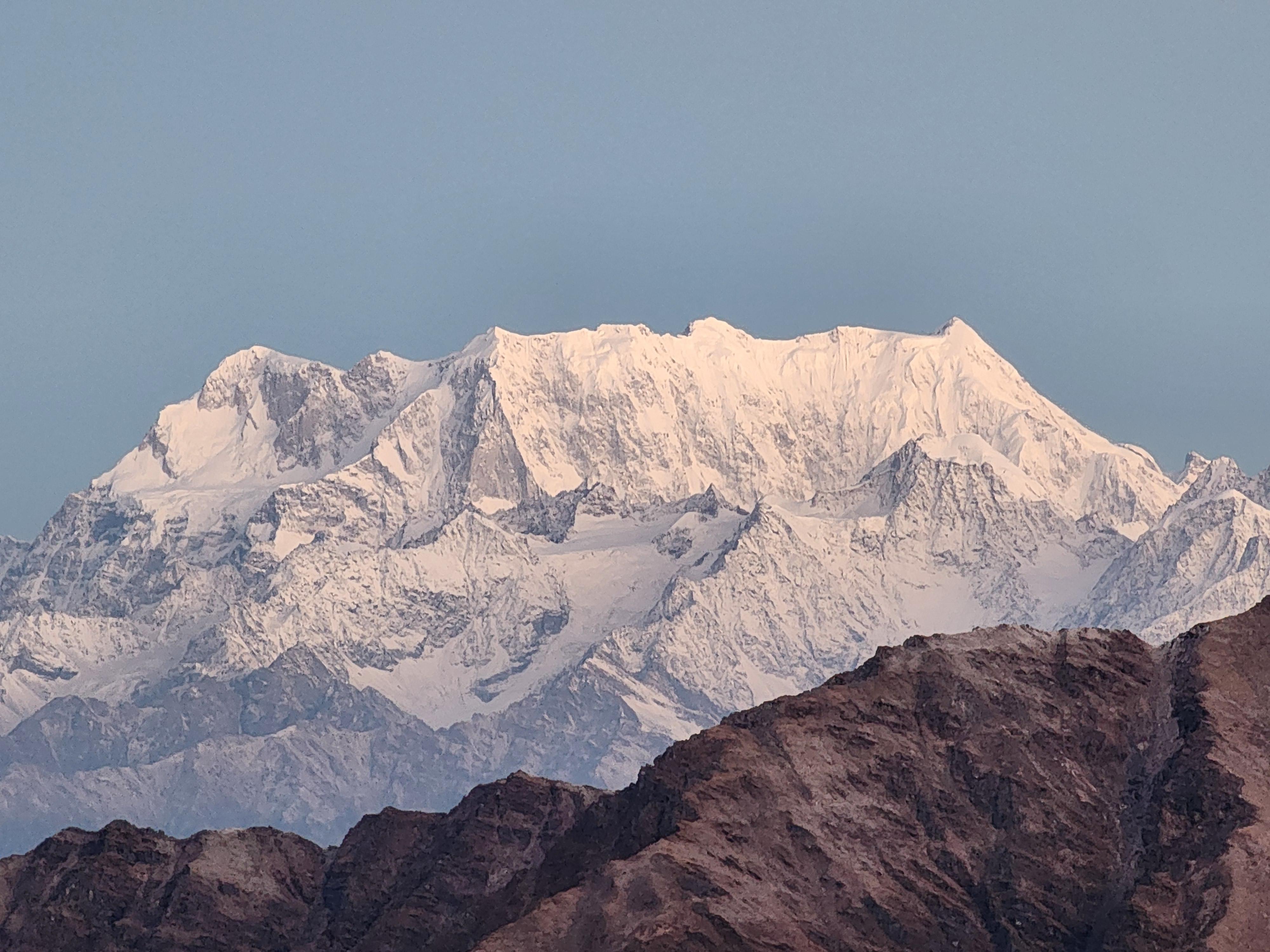
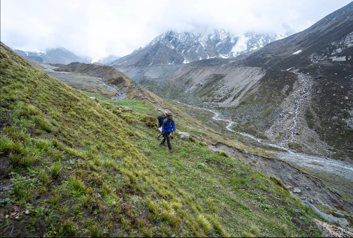
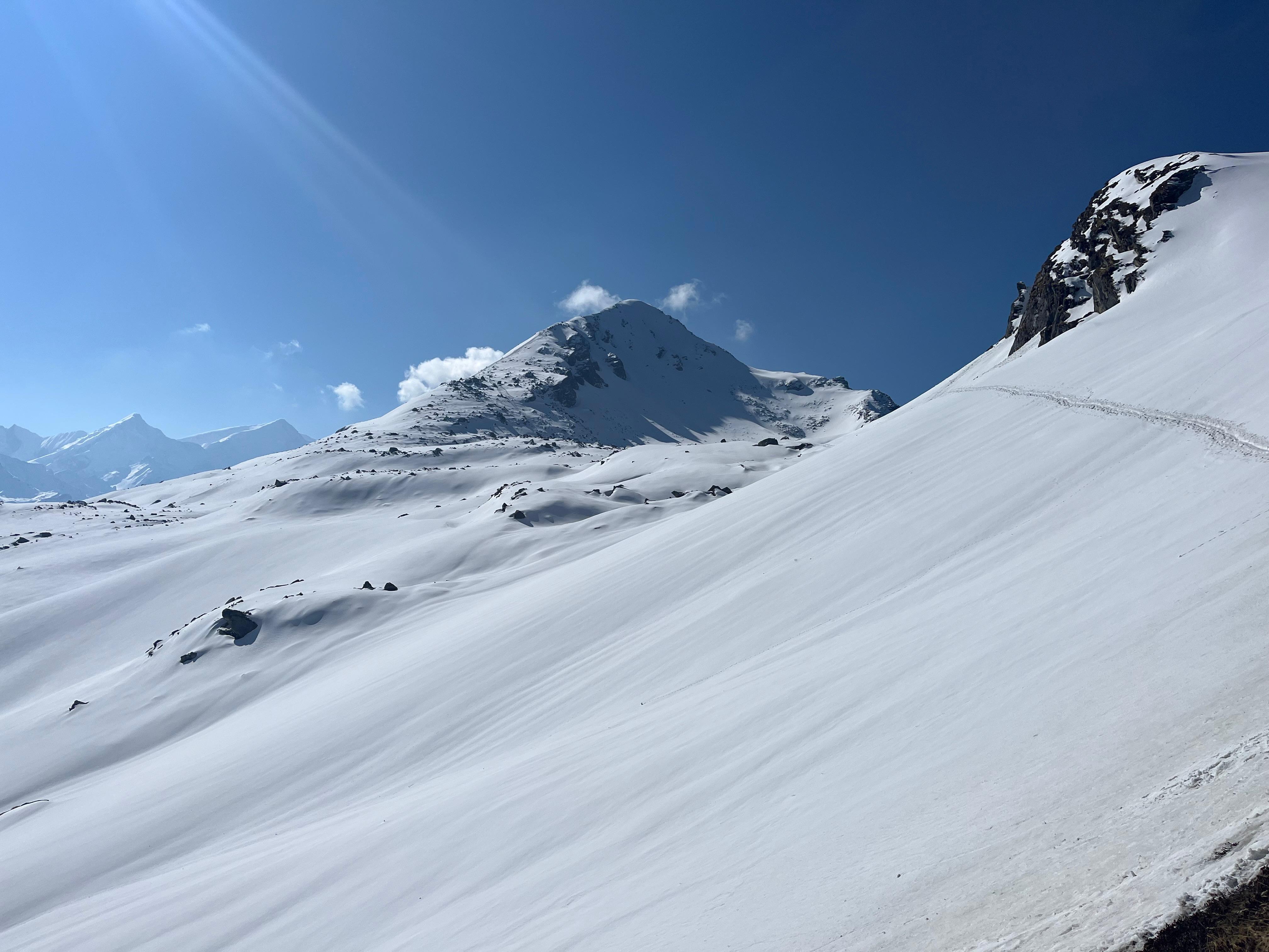
When the incline eases, the terrain opens into a vast glacier. The shift is sudden: hard ice under your feet, a crunch with every step, and long, silent stretches of flat walking. The glacier feels enormous, yet strangely calming; it's the kind of place where everyone naturally spreads out, each person walking in their own space.
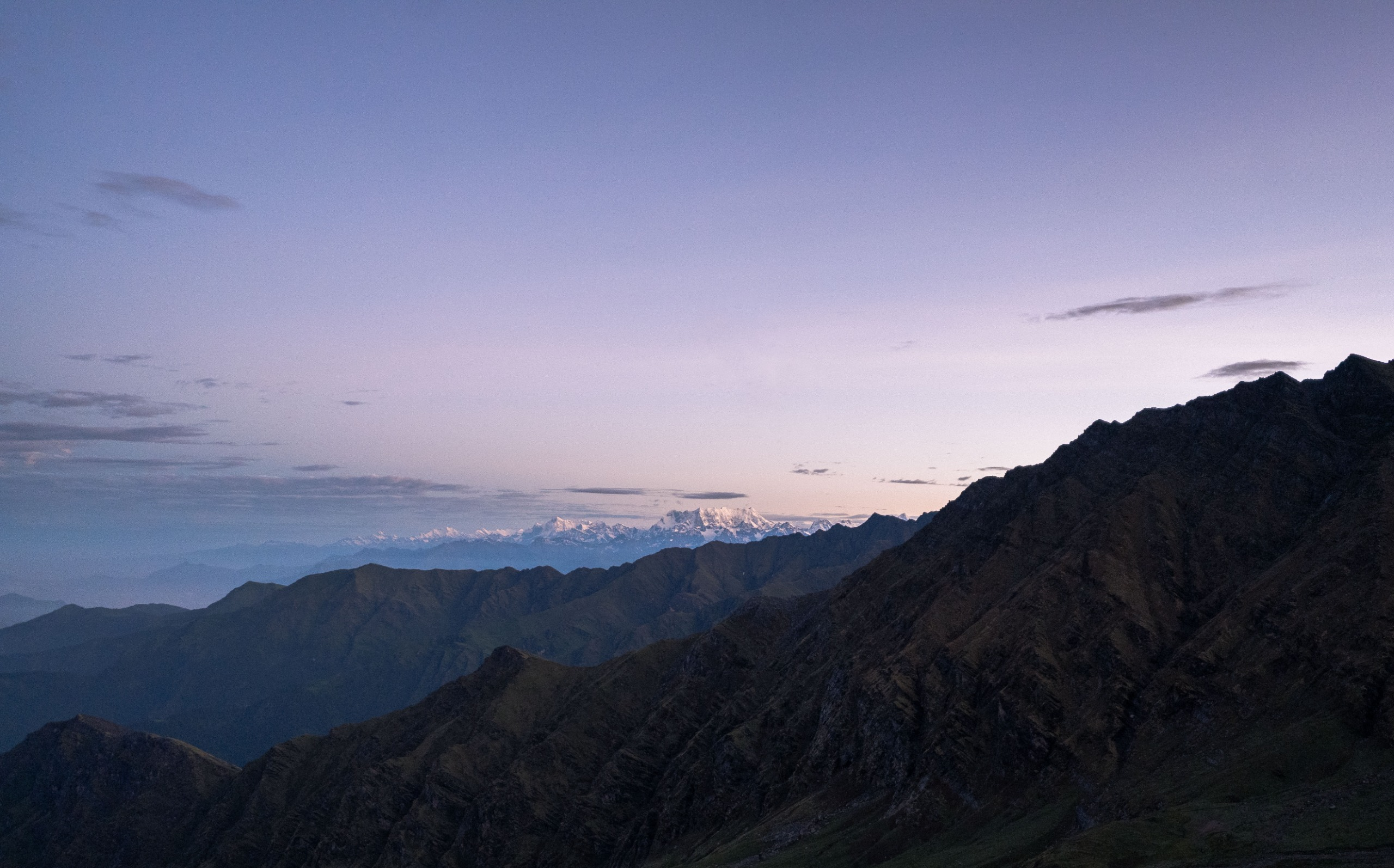
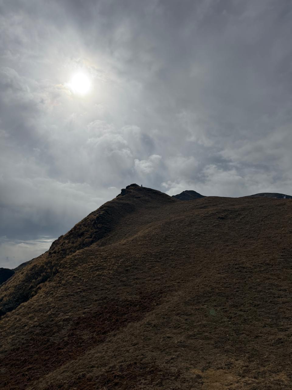
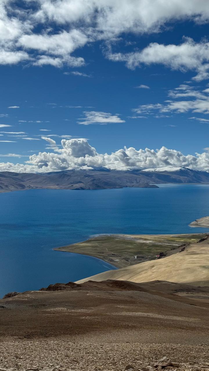
As you move closer to the pass, the gradient increases again. The final push to Lomvilad is short but steep. You reach the ridge gently, no dramatic drop-offs, no sudden exposure, just an open saddle that catches wind from both sides. The view here is vast.
Ladakh is behind you, raw, stony, and quiet.
Kashmir ahead, softer colours, more profound valleys, meadows tucked between folds.
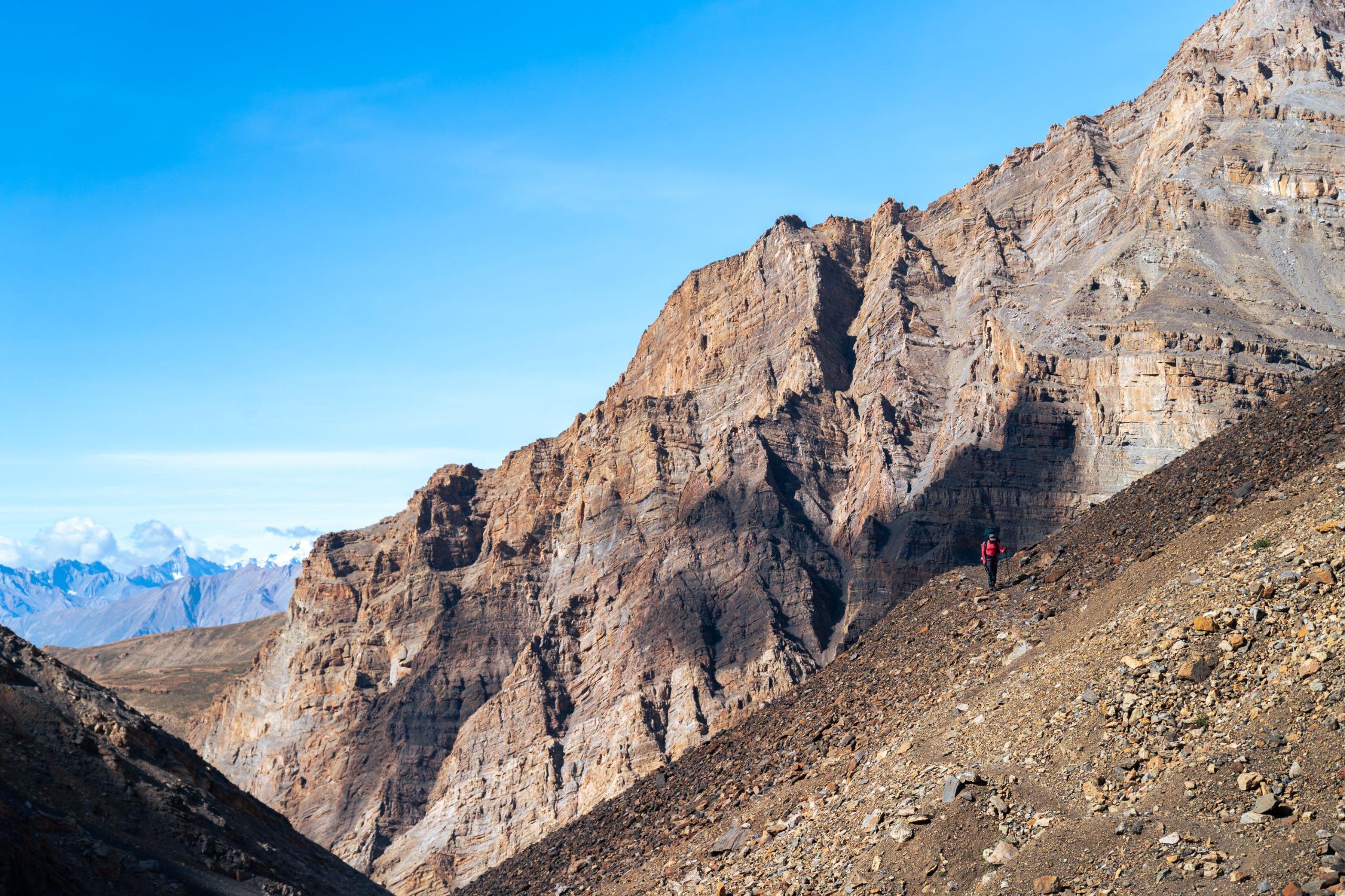
The descent begins almost immediately. The trail drops onto another glacier, this one more broken and scattered.
There are small crevasses, nothing alarming, but enough to require attention.
Your instructors lead the way, set the pace, and guide you through sections that feel slightly technical, narrow shelves, pockets of loose ice, and the long moraine that follows.
And then… that moment every person in Warwan remembers:
You spot Kaintal for the first time.
A green patch in the distance.
A tiny dot.
A promise.
It looks close.
It isn’t.
You walk.
And walk.
And walk.
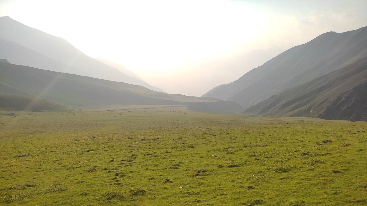
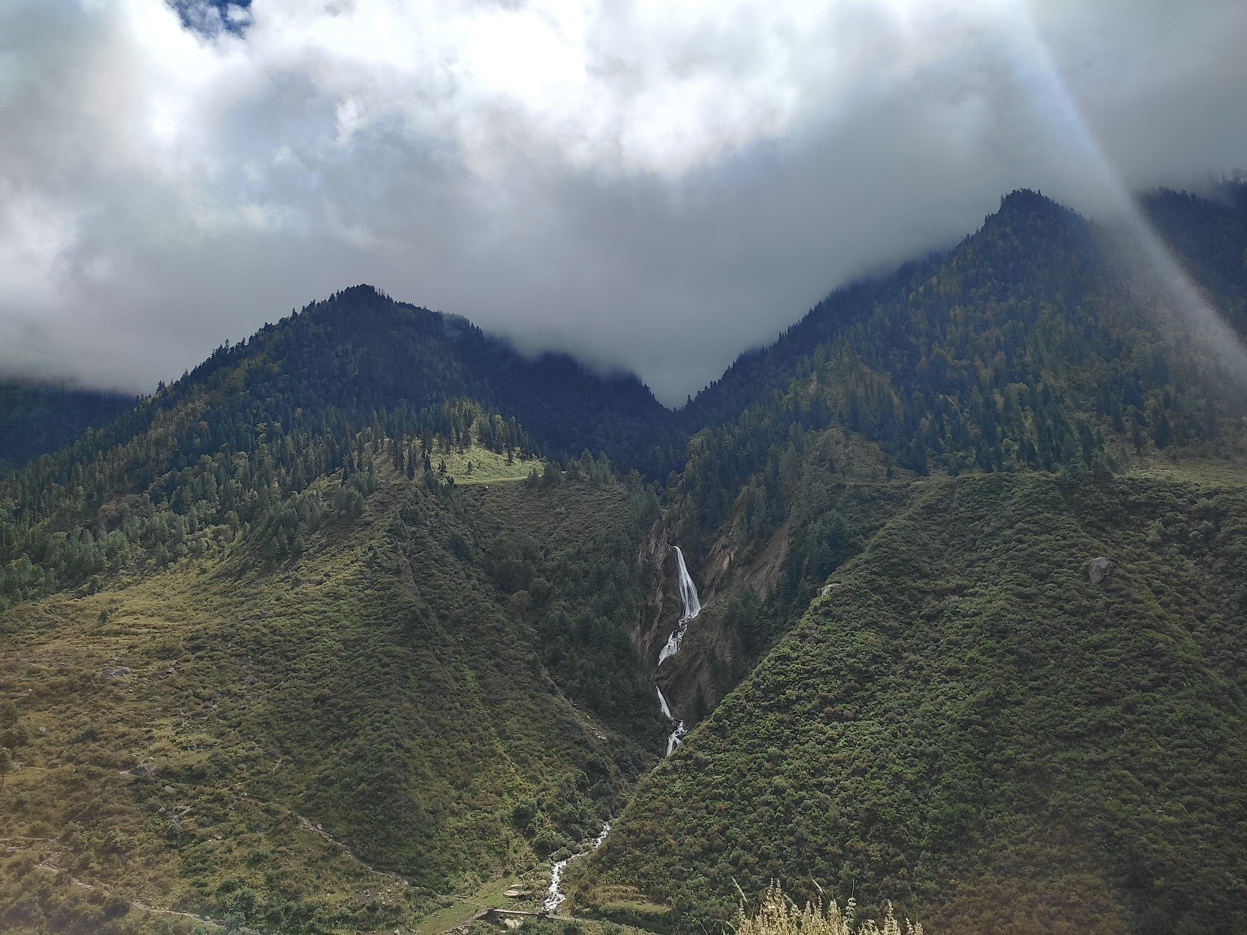
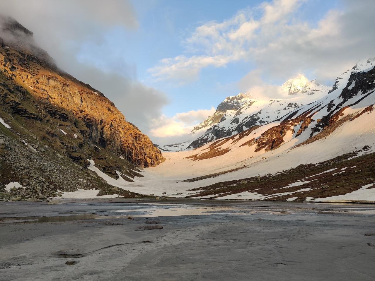
The campsite seems to stay exactly where it is, never closer, never farther, until suddenly, after another hour or two on the moraine, the trail drops into grass. Real grass. Flowers. Running streams. Kashmir is on the other side of the pass.
Reaching Kaintal feels like stepping into another world.
After a day of ice, wind, rock, and silence, the sight of green is a grounding experience.
You pitch your tents, loosen your shoulders, change into warm layers, and let the fatigue settle in slowly.
Tonight, sleep comes easily.
Day 5
Kaintal to Humpet
Trek Distance: ~17 km
Elevation: ~11,800 ft / ~3,600 m → 11,100 ft / 3,385 m
After yesterday’s long, glacial push over Lomvilad, today feels like the reward your body has been waiting for.
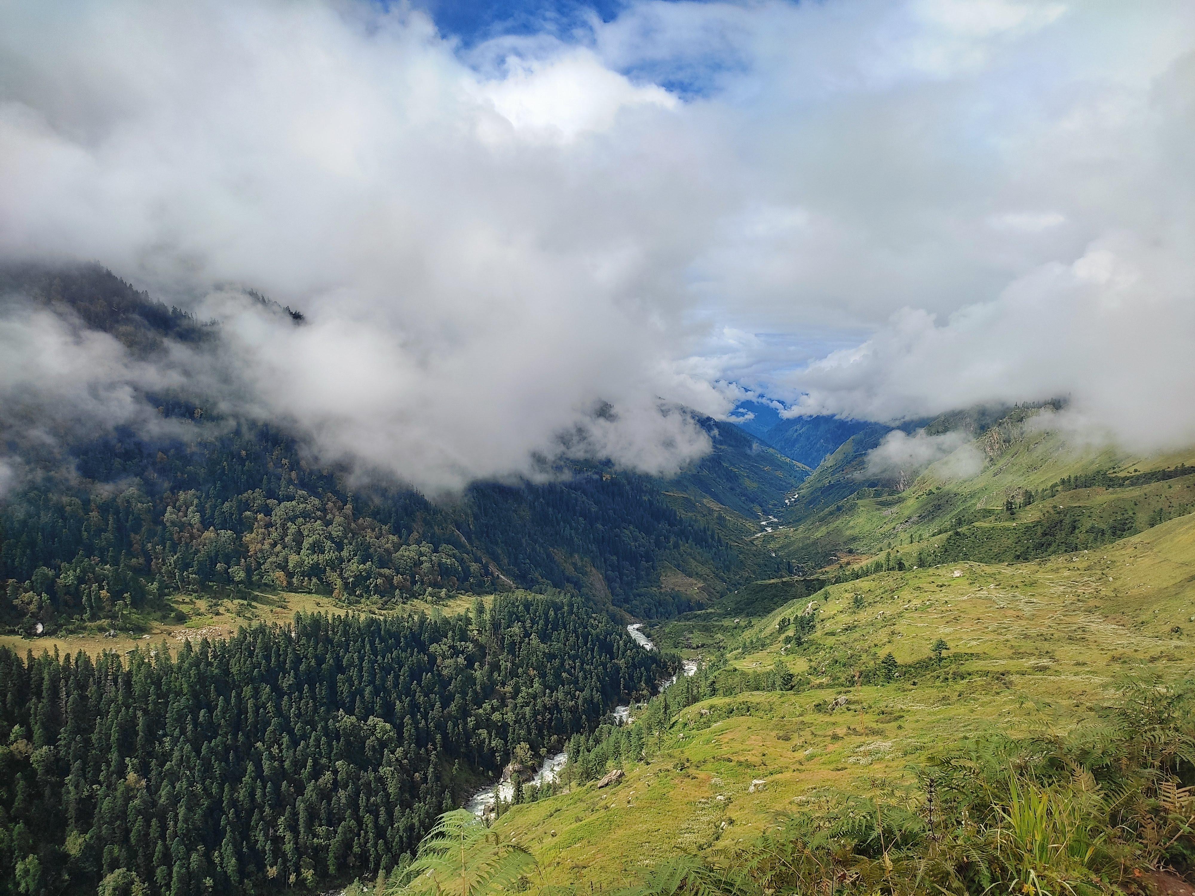
You leave Kaintal after a leisurely breakfast, stepping straight into the Kashmir you’ve always imagined: broad grass valleys, horses grazing freely, a river curling quietly beside you, and long stretches of trail where you don’t have to think too much about your footing.
The walk is not challenging, but it is long.
A gentle undulation across big, open meadows. Soft ground under your shoes. The sound of water is always nearby. Now and then, you pass a cluster of shepherd huts, smoke rising from one corner, children running barefoot in the grass, dogs watching you from a distance.
The day unfolds in layers:
A meadow opens, then closes into a narrow bend.
A river flattens out into a calm basin.
The mountains soften, the greens deepen, and the trail becomes almost meditative.
There are moments where the entire valley feels empty except for your team, just you, your pack, the wind moving through the grass, and the horse trails that cut clean lines across the plains.
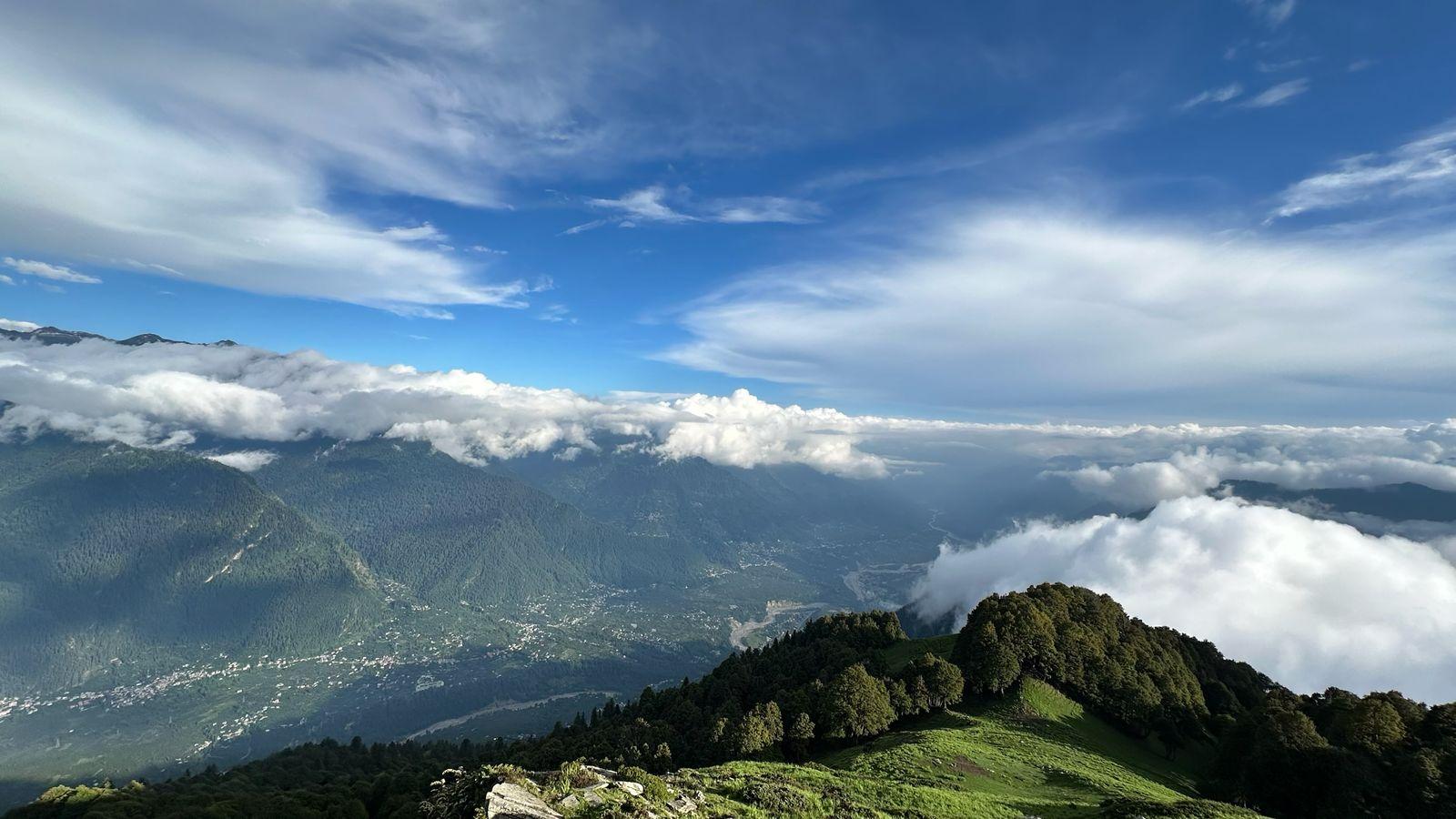
As you get closer to Humpet, the scenery sharpens.
Two valleys meet in a wide V-shaped opening.
The river spreads into multiple channels, each catching a different shade of evening light.
And right there, on the natural shelf above the river basin, sits your campsite, Humpet, often considered one of the most beautiful in the entire Warwan valley.
You reach in the evening, tired in a good way.
You drop your pack, splash your face in the cold water, and look up to realise you’re surrounded by slopes that glow gold as the sun sets.
Dinner tastes better here because of the view, or because today felt like walking inside a painting.
Tonight, the river is your soundtrack.
Day 6
Rest Day at Humpet
Elevation: ~11,100 ft / 3,385 m
Distance: None
Every Odyssey backpacking expedition has that one day where the trail pauses.
Where the rush drops.
Where nobody is thinking about the next campsite, the next ascent, the next kilometre.
Humpet is that day.
Not because the place “deserves” it, though it does, but because you need it.
Your body. Your mind. The group. The rhythm of the trek.
Humpet is one of those rare settings where everything slows down on its own.
Two valleys meeting like open arms, the river spreading into a calm basin, horses scattered across the grass like they belong to the landscape itself.
The morning starts slowly. Just the sound of the river and the sun slowly warming the tents.
You make breakfast together, no hurry.
There’s no agenda.
Some sit on the riverbank reading.
Some take a nap in the grass.
Some cook, experiment, or help prep lunch.
Someone will inevitably start gathering wood for a small fire to keep warm for the night.
This is the part of backpacking that no itinerary can capture: the unplanned conversations, the shared silences, the easy laughter, the feeling of being small yet grounded in a place that holds you completely.
You realise how different this is from a typical trek —
no rushing to “finish” the day,
no pressure to “see everything,”
No race to the next place.
Just being here is the point.
Day 7
Humpet to Sukhnai
Trek Distance: ~14–15 km
Elevation: 11,100 ft / 3,385 m → 9,320 ft / 2,840 m
The trail out of Humpet feels gentle right from the start.
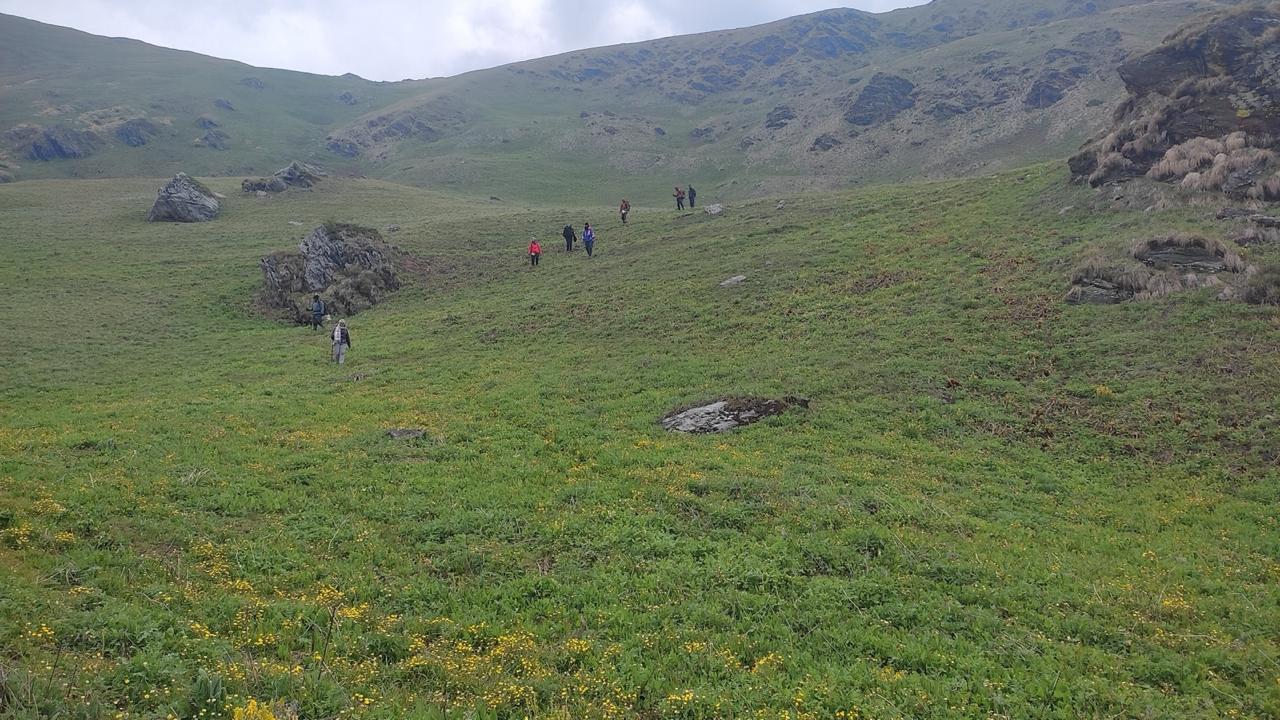
You pack slowly, step onto the meadow, and begin walking through some of the softest, greenest terrain of the entire valley. The slopes open wide, streams cut across the grass like silver threads, and horses graze lazily in the distance.
After the silence of the last few days, today feels a little more human.
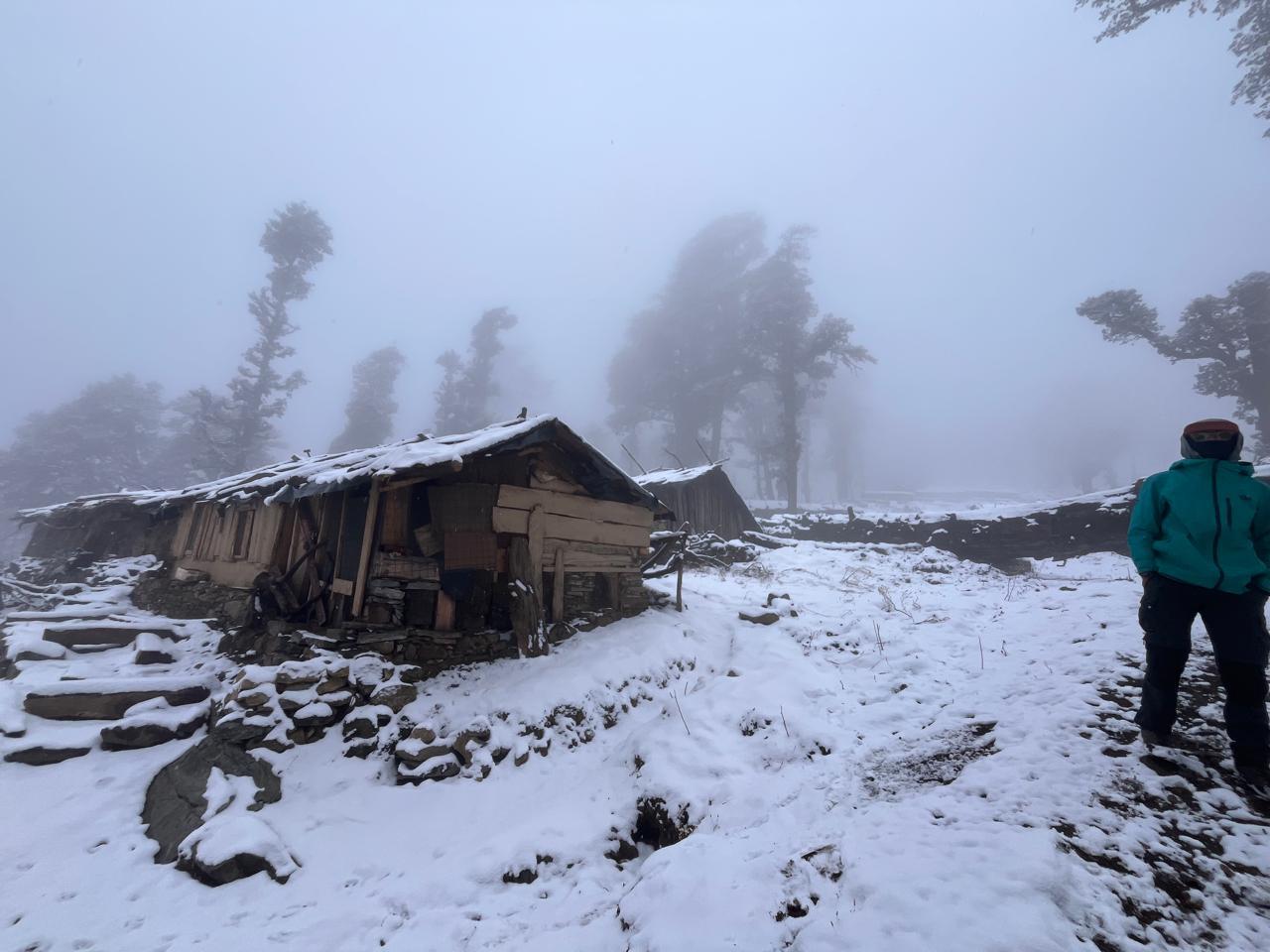
You start seeing people again, Bakarwal caravans moving with their flocks, Gujjar families setting up seasonal shelters, shepherds calling out to their livestock across the meadows.
By the time you begin the final descent into Sukhnai, the landscape feels different again, a broader, warmer stretch of Kashmir.
Sukhnai sits like a green bowl between hills, one of those villages that appear wholly and suddenly, as if the valley had been hiding it until the last moment.
Suppose you reach early, and the trail usually allows that. In that case, you can load up your backpacks, hop into the waiting vehicle, and drive part of the way to Mathigavran, breaking the journey towards civilisation just a little more gently
It’s the last night of the trek route.
Tomorrow you drive back to Srinagar.
Day 8
Drive back to Srinagar
Drive Distance: ~110–120 km
Elevation: 9,320 ft / 2,840 m → 5,200 ft / 1,585 m
You wake up in Sukhnai or Mathigavran, pack your bags one last time, and step into the vehicle for the drive back toward Srinagar. The road slowly winds its way out of the valley, following the river before connecting to the main routes leading toward Anantnag and ultimately to the city.
The scenery shifts quickly, meadows give way to villages, villages to forests, and forests to the familiar bustle of Kashmir’s towns.
By afternoon or early evening, you’re back in Srinagar.
Our Expectations From Participants
Warwan is a backpacking expedition, not a supported trek.
You carry your own pack, help with group tasks, and move as a small, self-contained team through one of the most remote valleys in India.
Here’s what we expect from you:
1. Come Prepared for Backpacking, Not Trekking
Backpacking means:
- Carrying 12–16 kg of your own gear
- Helping with cooking, camp chores, and water runs
- Setting up and packing down tents
- Navigating long days on uneven terrain
- Staying self-sufficient while moving together as a unit
If you’re coming from a traditional trek background (with porters, fixed camps, dining tents, and served meals), this requires a mindset shift.
Backpacking is slower, more intentional, more communal, and far more rewarding.
2. Be Comfortable With Remote Terrain
Warwan is not crowded, not commercial, and has long sections where you may not see anyone outside your team.
That calls for:
- Patience
- Calm judgment
- Respect for the environment
- Awareness of your energy, pace, and hydration
There are glacier crossings, braided river plains, moraine sections, and long descents. None is technical, but all demand focus.
3. Teamwork Over Everything
Backpacking only works when the group works.
We expect you to:
- Carry your share of the group load if required
- Help with food prep and clean-up
- Support slower teammates
- Check in on others during long days
- Maintain the outdoor etiquette of a small expedition.
Your attitude matters more than your pace.
4. Cultural Sensitivity
You’ll pass through Bakarwal and Gujjar settlements, communities with their own rhythm, traditions, and ways of living.
We expect:
- Respectful interaction
- Asking before taking photos
- No littering, and Leave No Trace.
- Understanding that you are a guest in someone’s home terrain
5. Mental Flexibility
The weather changes fast. River levels fluctuate.
Distances feel long. Camps can be cold. There may be no signal for days.
Come ready to adapt, not to expect comfort.
Minimum Fitness Requirements
Warwan is physically demanding because of:
- Long walking days
- Heavy backpacks
- High altitude
- Mixed terrain
- Back-to-back continuous movement
You must meet these baseline fitness requirements:
- Walk 12–15 km with a 12–15 kg backpack (not on flat city roads — include some hills or stair climbs)
- Climb 1,000–1,200 ft of ascent per hour. At a steady, conversational pace.
- Complete one long walk (20+ km) without knee or back issues.
- Hold basic strength benchmarks, such as:
- 30–40 squats
- 15–20 lunges/leg
- 1–2 minutes plank
- 10–15 push-ups
- Run for 30-45 minutes at a conversation pace.
- Climb 1,500–2,000 stairs (up + down) at a normal pace without feeling dead by the end of it.
- Have prior high-altitude experience (3,500–4,000 m and above)
This is mandatory. Warwan is not for first-time trekkers.
How to Train for Warwan (8-Week Plan)
A sample structure (adjust volume based on your level):
Weeks 1–2: Build Aerobic Base
- 45–60 mins brisk walk OR run, 4 days/week
- 60–90 mins stair climbing (up + down), 1–2 days/week
- Bodyweight strength: squats, lunges, planks, dead-bugs (3 sessions/week)
Weeks 3–5: Add Load & Elevation
- Walk 8–10 km with an 8–10 kg backpack, 2 days/week
- One long hike (12–15 km) every weekend
- Strength training with weights (deadlifts, step-ups, farmer’s carry)
- Breathing work and ankle, knee and hip mobility 10 minutes daily
Weeks 6–7: Trek Simulation Phase
- Walk 12–15 km with a 12–15 kg backpack, 2 days/week
- One long loaded hike (18–20 km) on mixed terrain
- Hill repeats or stair climbing with weight.
- Descend training (controlled, slow, strengthening knees)
Week 8: Taper Week
- Reduce intensity by 50%
- Focus on sleep, hydration, and mobility.
- Short, light-loaded walks
- No heavy strength work
Inclusion
Exclusion
How heavy will my backpack be?
Your personal gear
shared group gear
Food weight (reduces daily)
Is this suitable for first-time backpackers?
You require prior experience in high-altitude treks and solid physical fitness.
If you're new to backpacking but fit and experienced, please talk to us; we’ll assess your suitability during a call.
How technical is Lomvilad Pass?
What is the food like?
You’ll learn to: cook outdoors, manage fuel, Work with minimal equipment. We don’t compromise on nutrition; meals are simple, warm, high-calorie, and nourishing.
Will there be a phone network?
What makes Warwan different from other backpacking routes?
What about safety?
On this trek, we ensure:
1. Certified Odyssey instructors trained in wilderness safety
2. Detailed risk assessment before entering glacier/moraine zones
3. Constant monitoring for altitude symptoms
4. Pre-defined evacuation plans and exit routes
5. Communication devices for remote terrain (satellite/text devices)
6. Strict movement protocols during river crossings, glacier walks, and pass day
7. Group movement ethics (no one walks alone, controlled pace, structured breaks)
Backpacking doesn’t mean “less safe.” It means more aware, more prepared, and more responsible as a team.
Your instructors handle:
-Navigation
-Group management
-Terrain decisions
-Weather assessment
-Emergency protocols
Your responsibility:
-Fitness
-Pacing
-Hydration
-Teamwork
-Carrying your pack
-Following the plan
Safety is shared, not outsourced
SELECT DATE TO REGISTER
Thank You!
Your form has been submitted successfully. We'll get back to you soon.
On Request