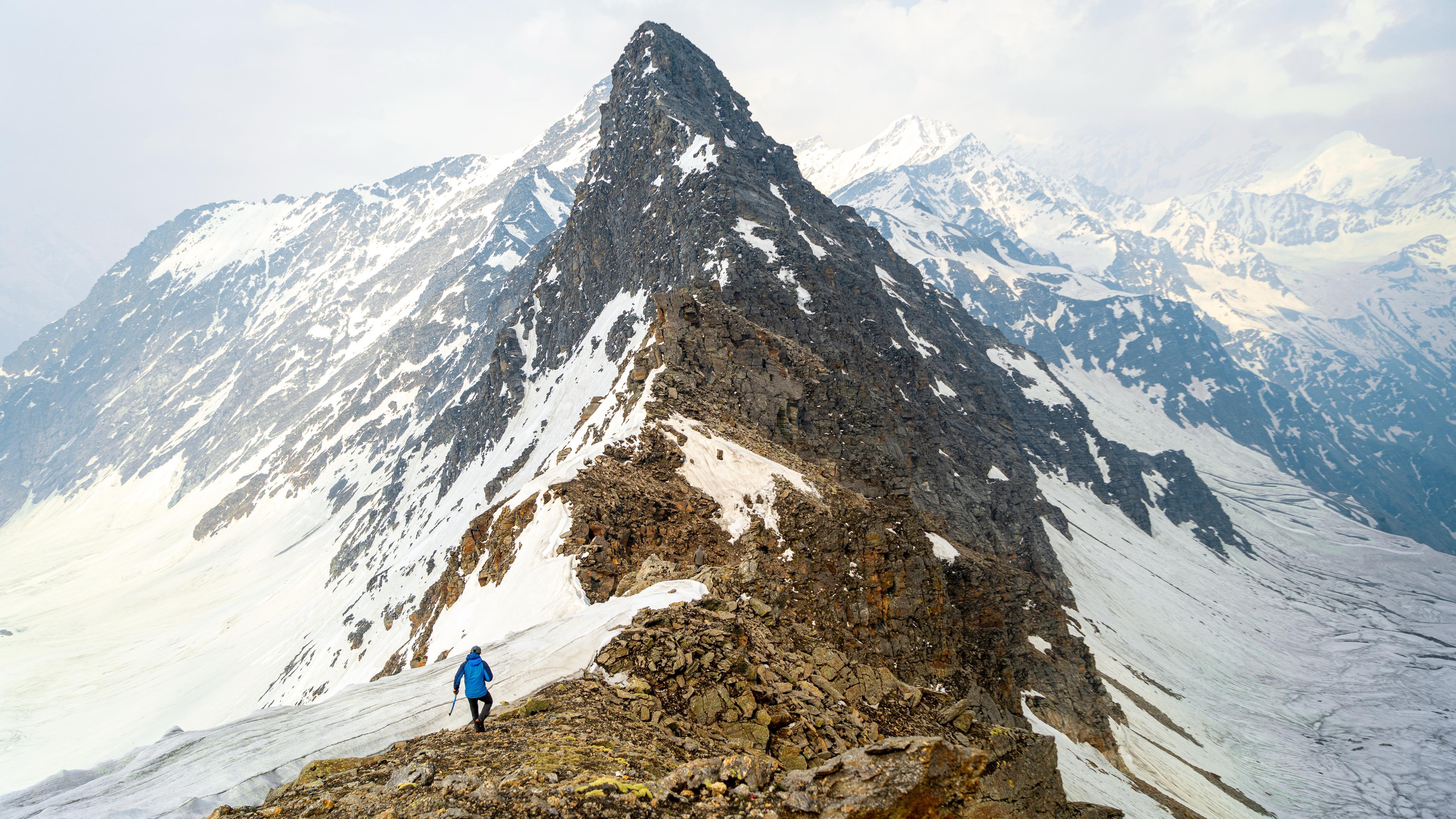


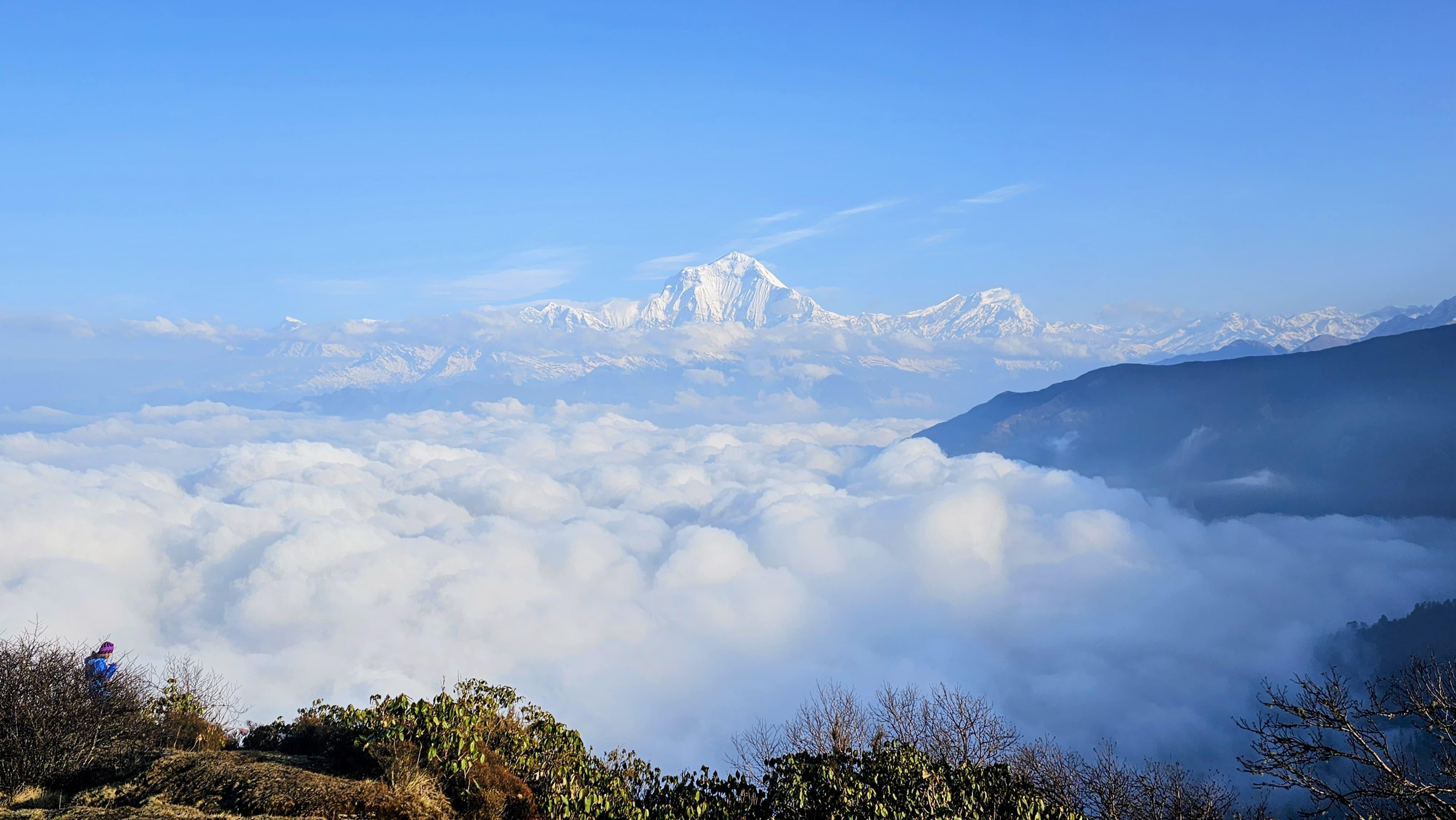
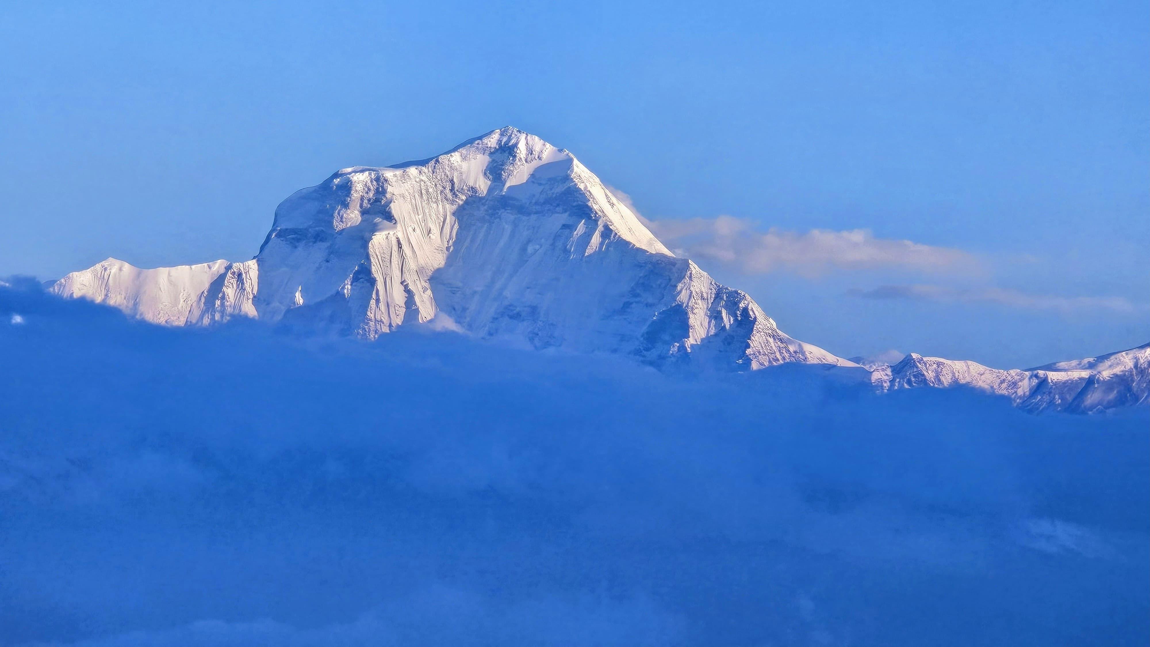
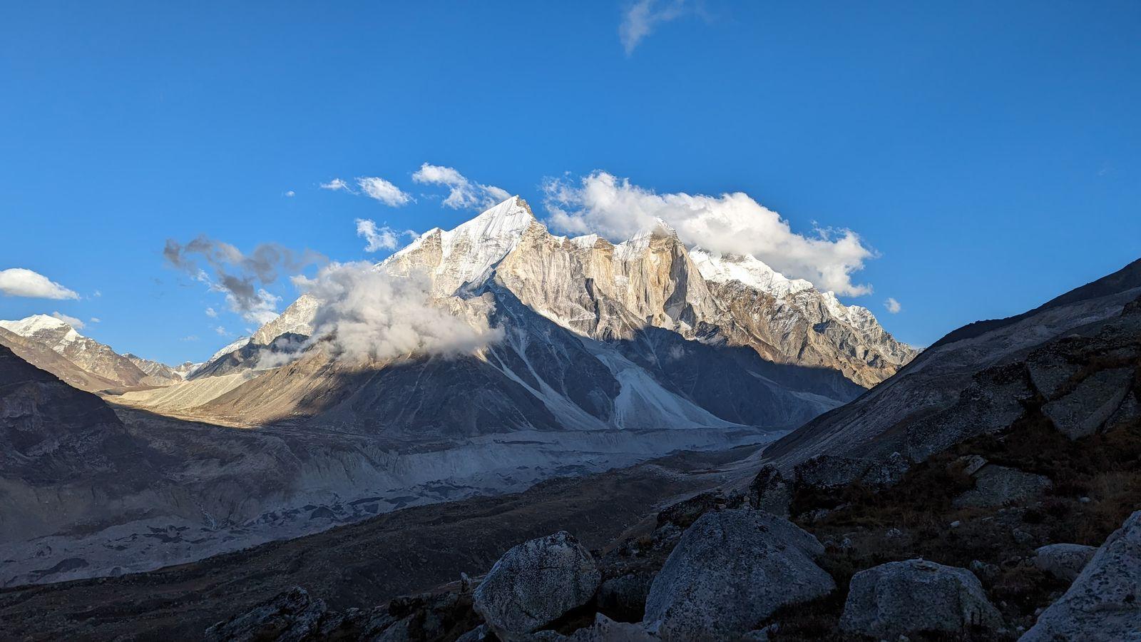
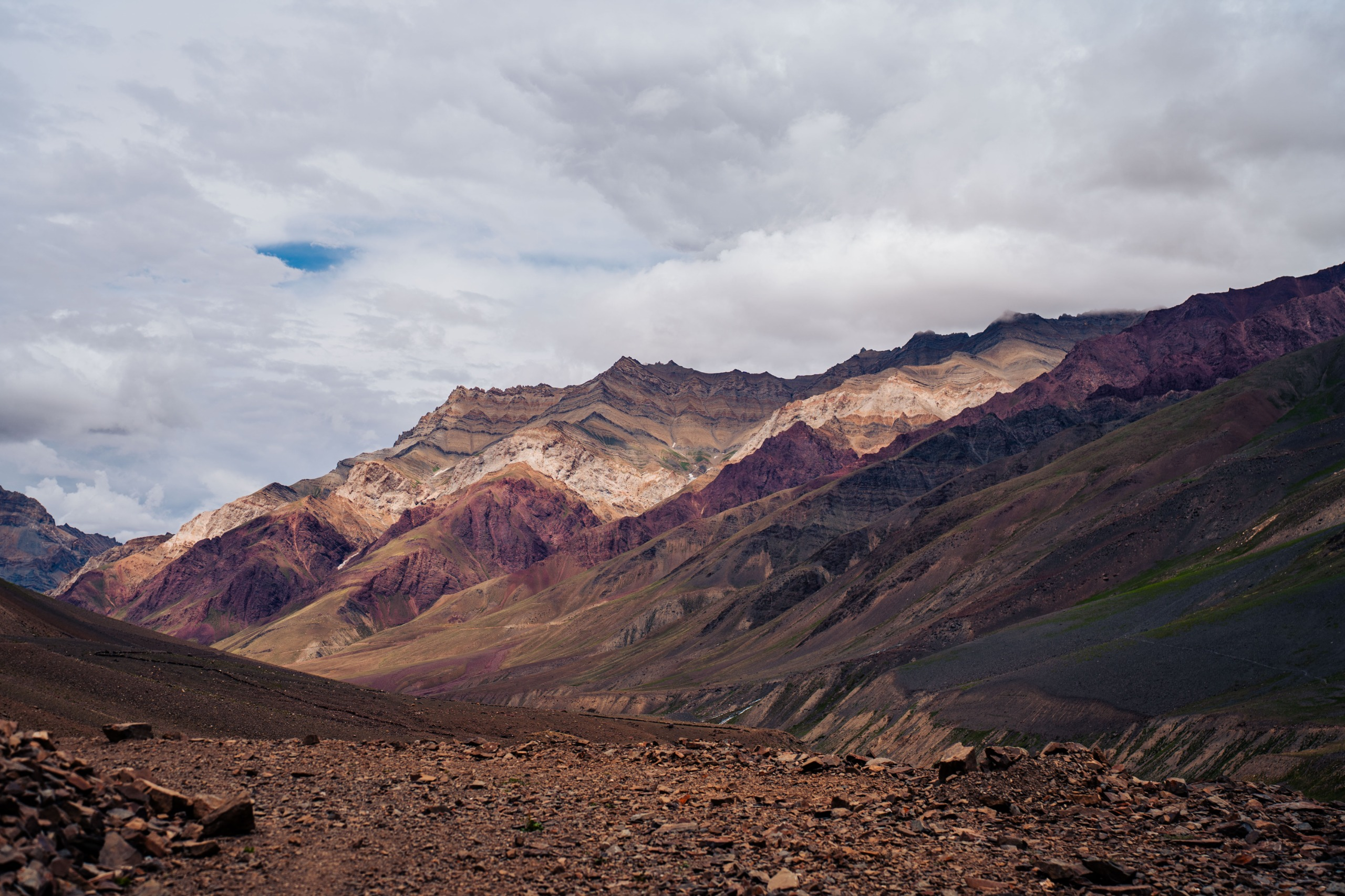
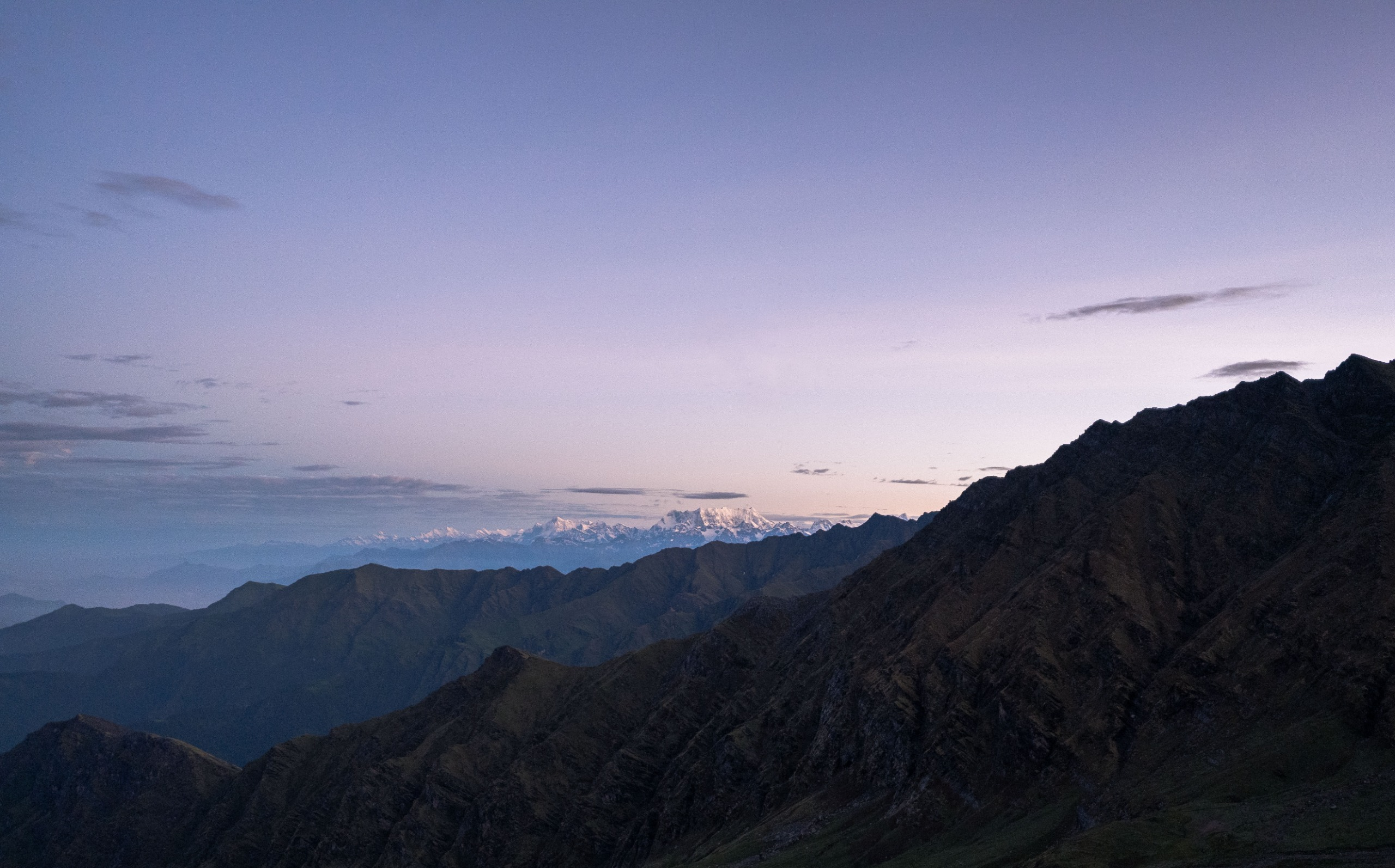
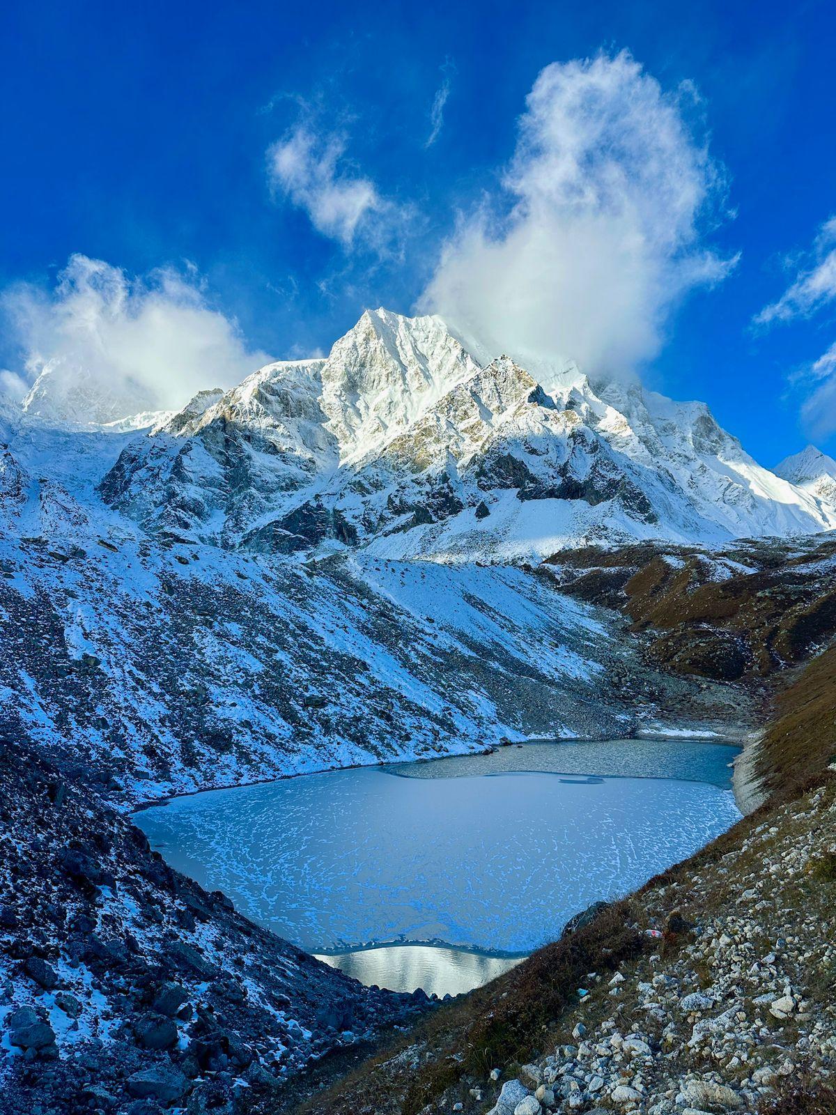
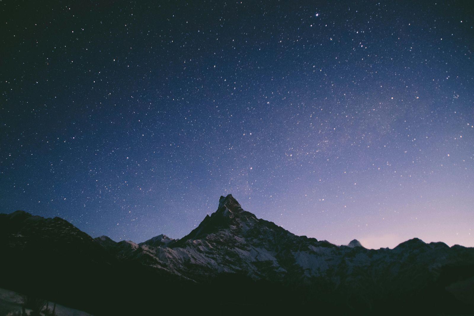
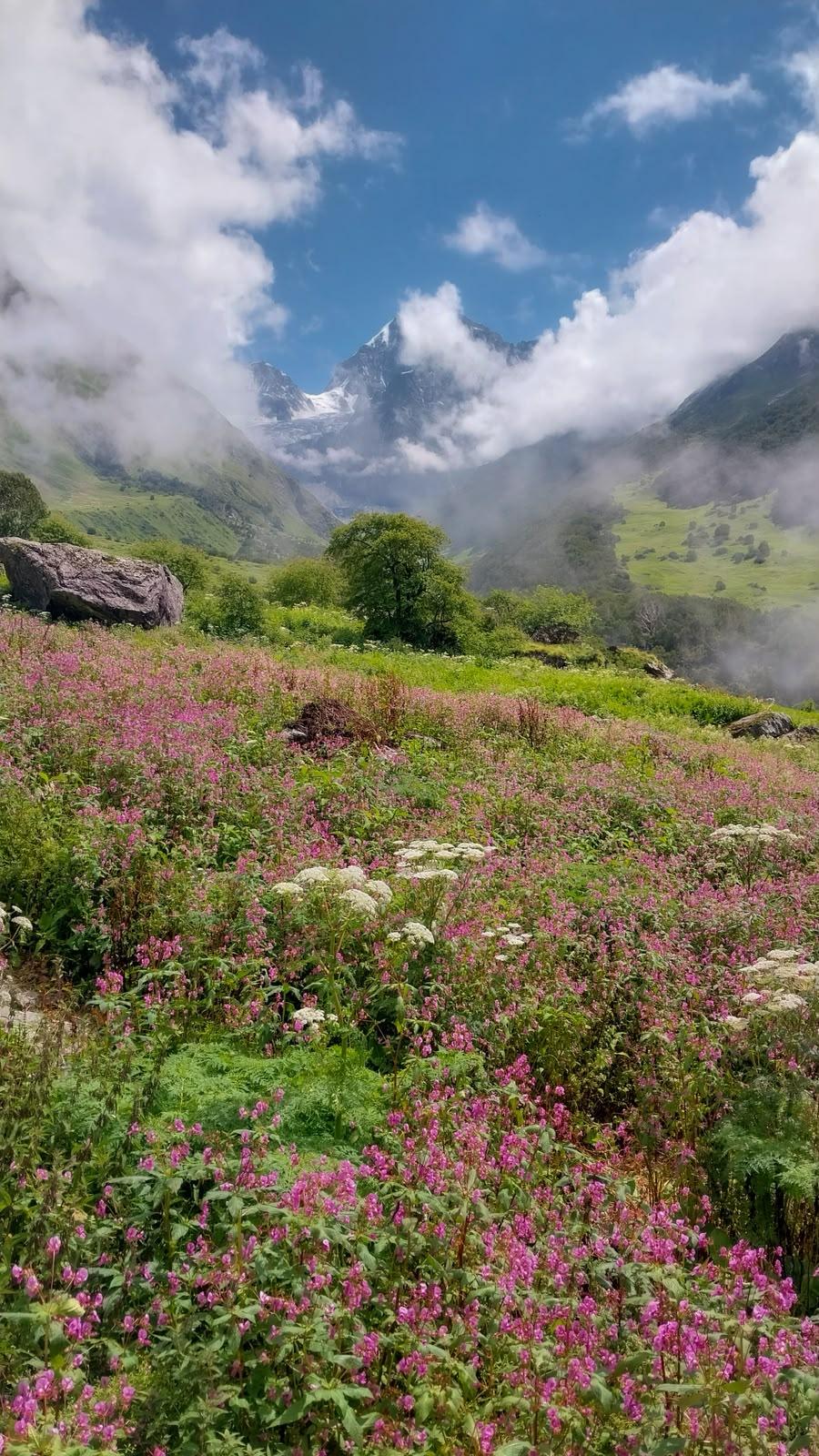
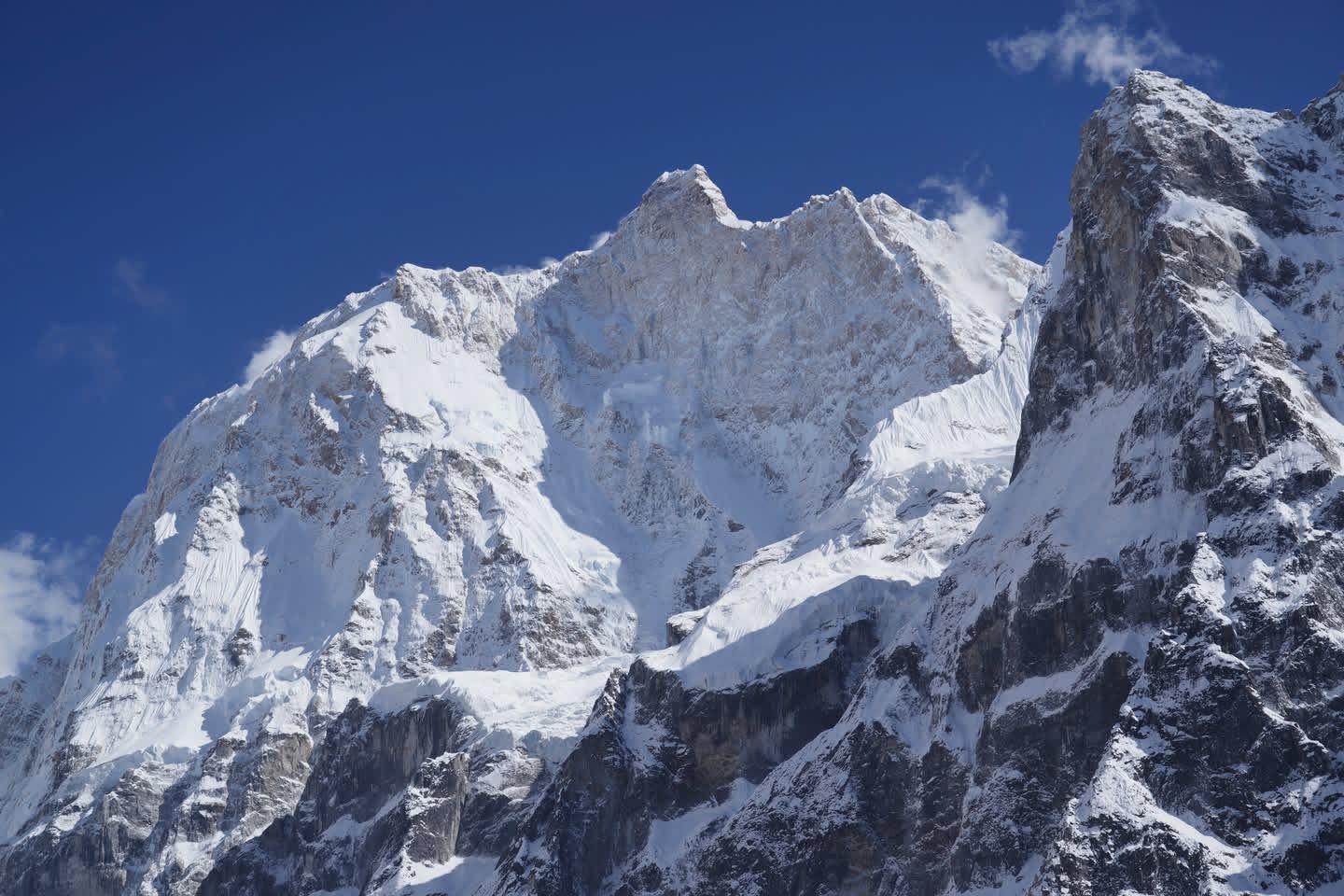
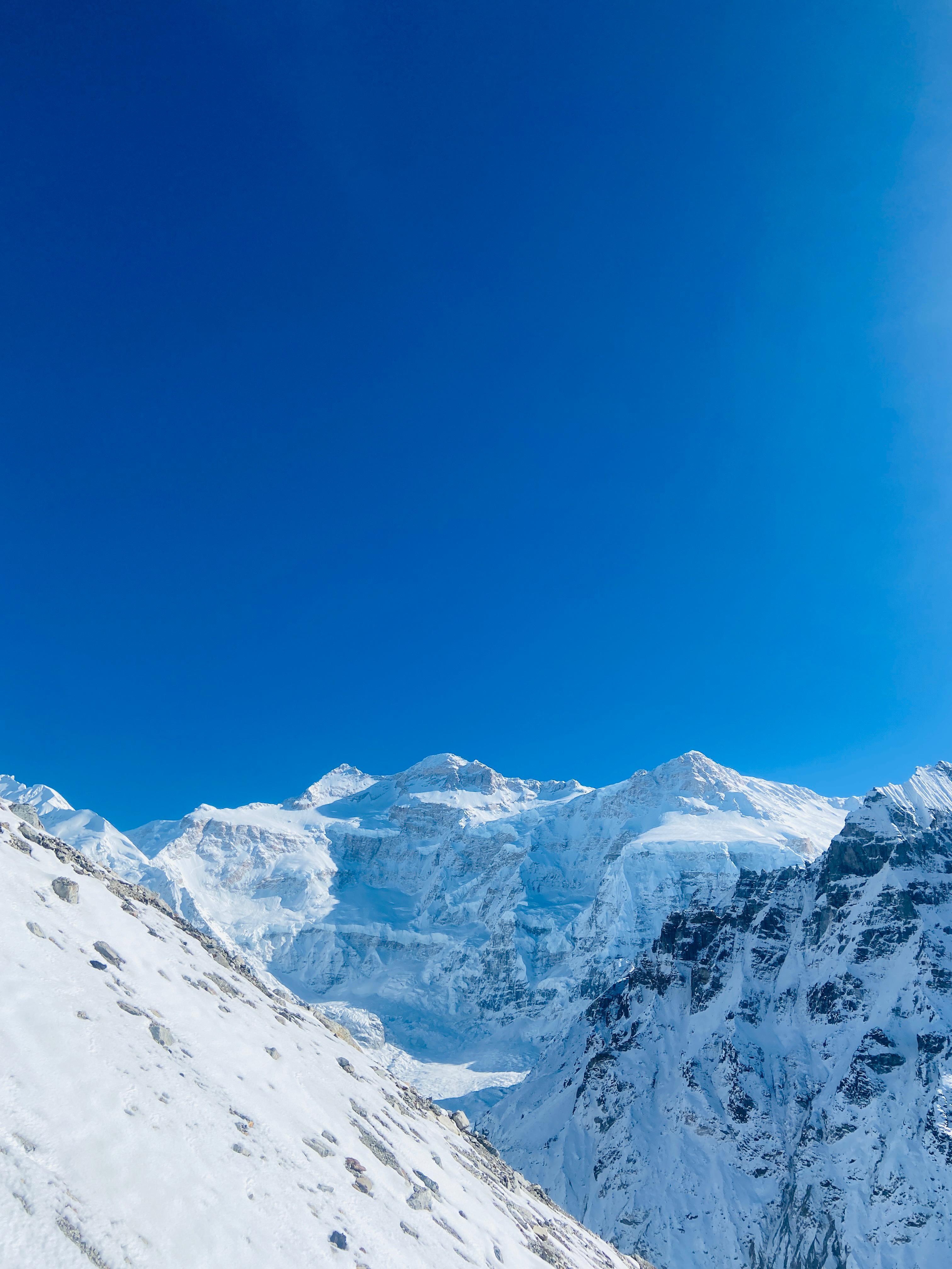
Bali Pass is the kind of route that resets how you measure an “ordinary” day. You begin in the gentle, green stitched meadows of the Har-Ki-Dun corridor and — over the course of a week — you trade groves of birch and blue-flowered meadows for the knife-edge silence of the col and long, plunging descent into the Yamunotri world. The pass itself sits around 4,950 m (≈16,200 ft) and is a high, exposed threshold: when you stand on the col the mountains open into a panorama that stitches together two different Himalayan moods — rounded, pastoral ridgelines on one side and raw, glaciated amphitheatres on the other.
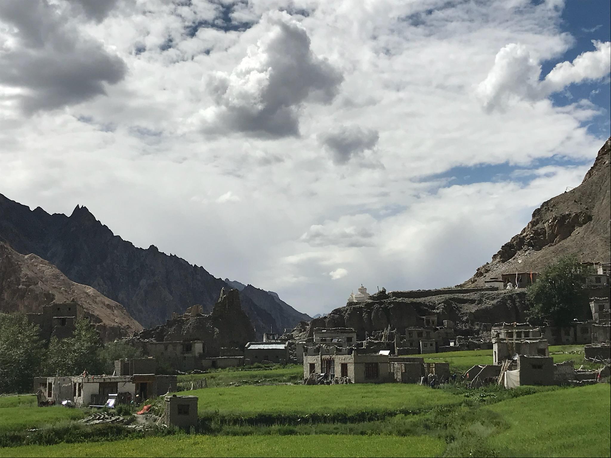
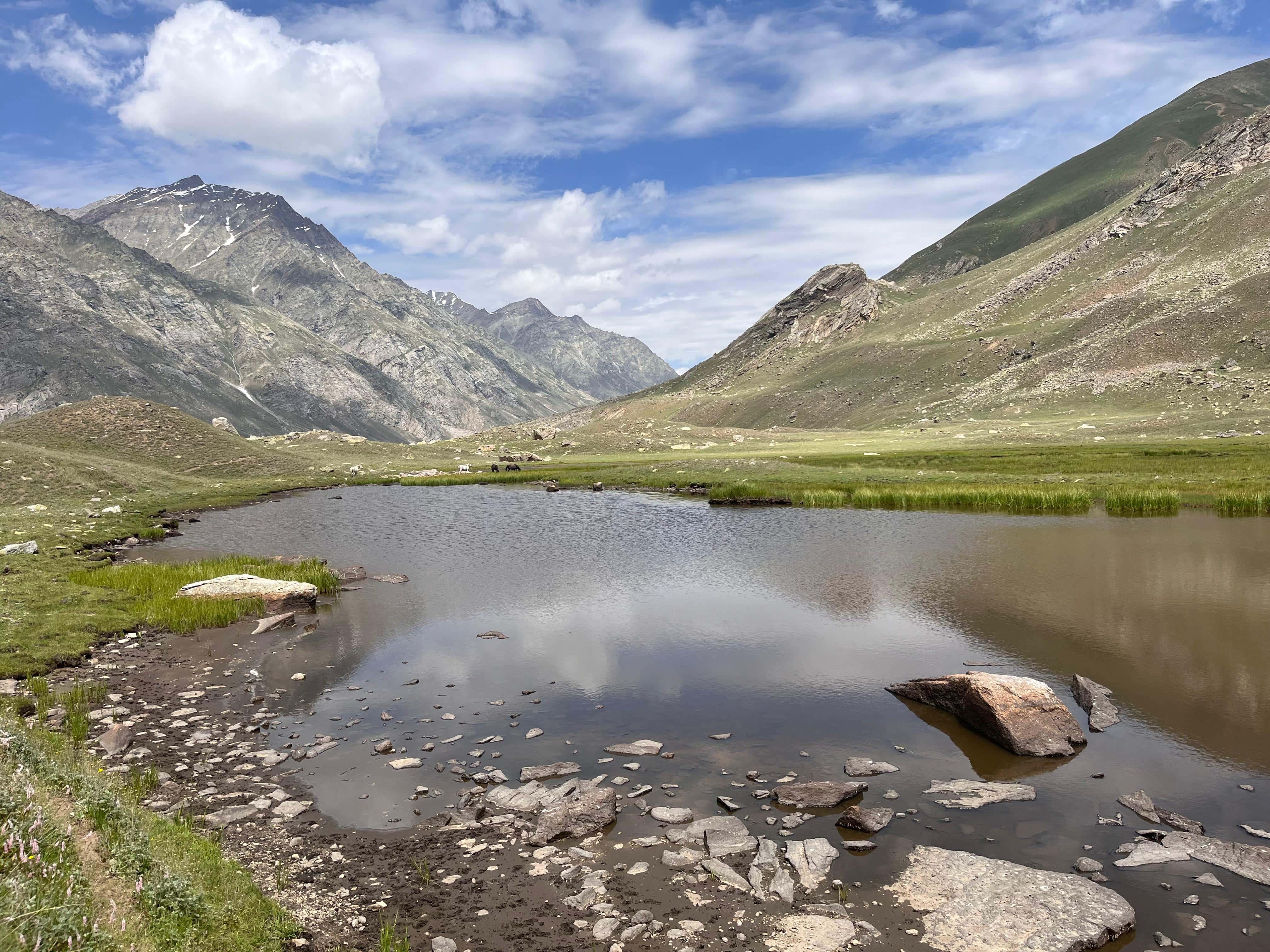
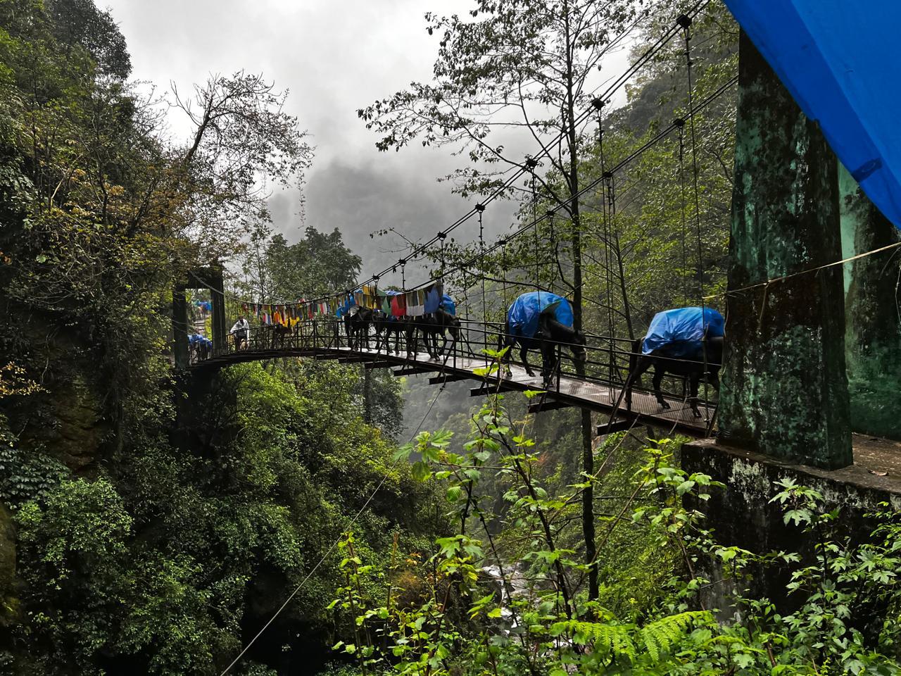
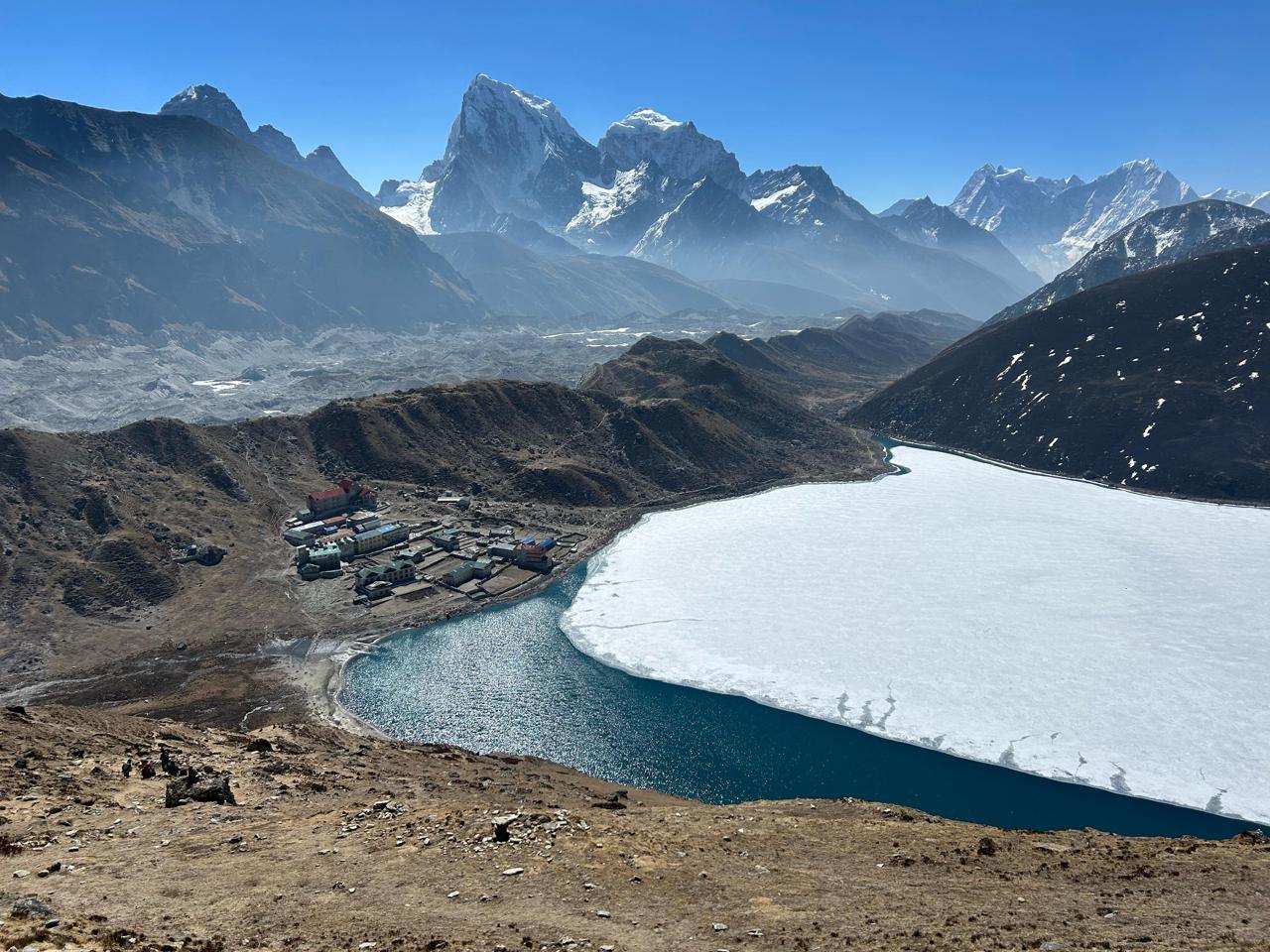
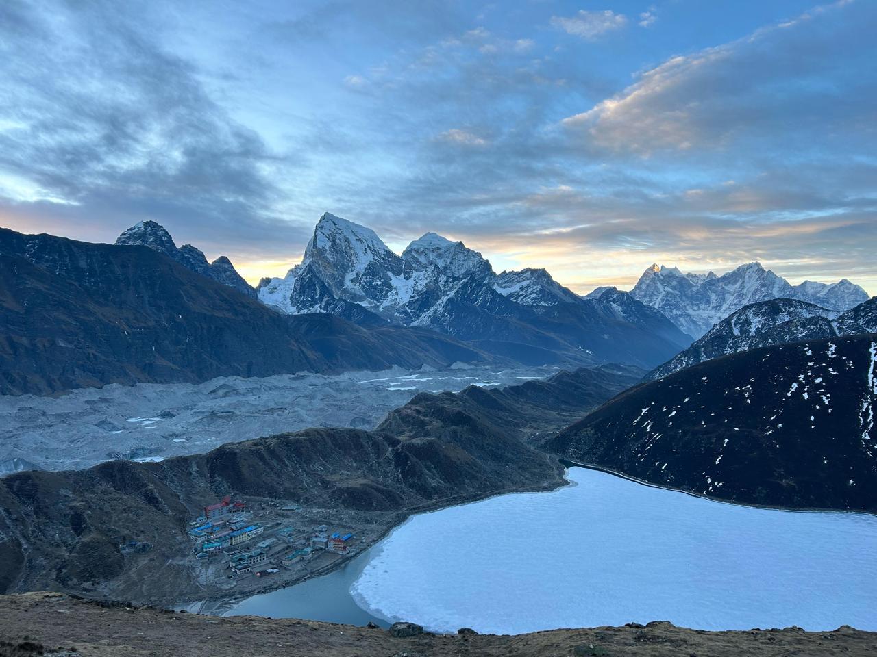
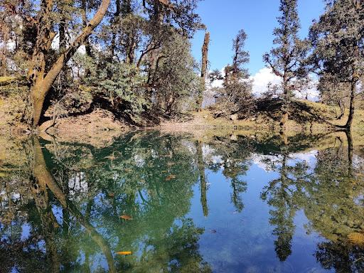
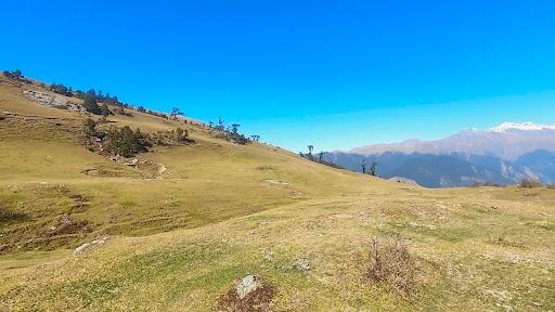
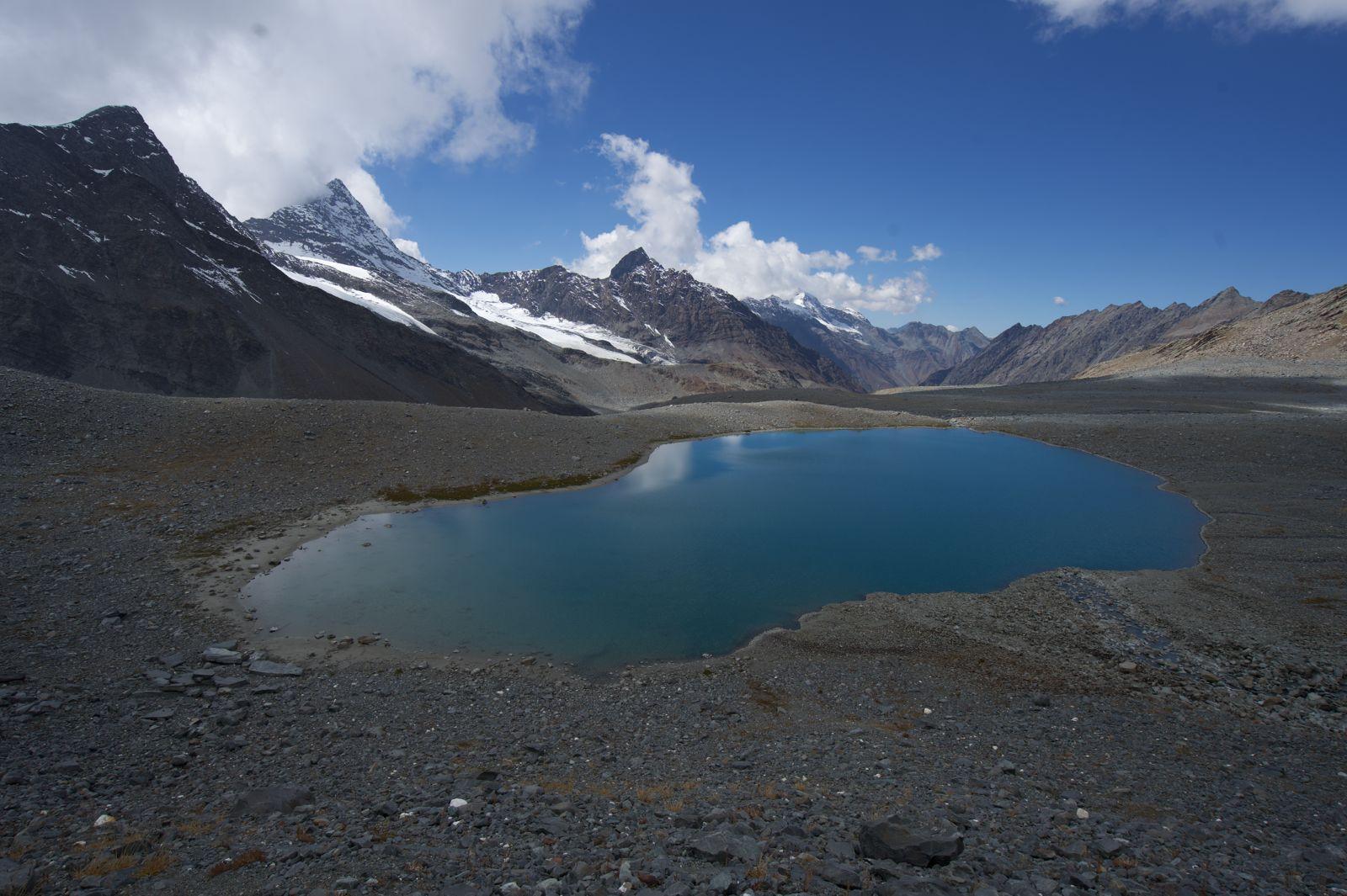
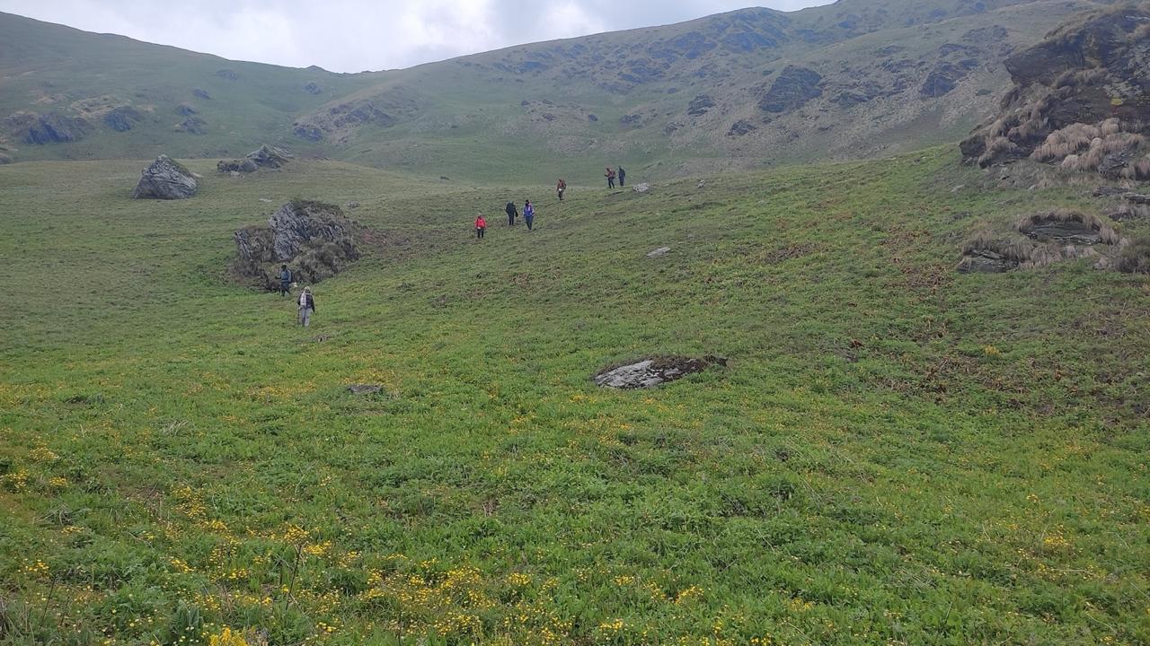
On this Odyssey route we begin at Kotgaon and drive high to Gangaad, then move in through Osla and climb into the Devsu Thach meadows — long carpets of tussock and rare highland flowers that make every camp feel like a painting. Ruinsara Tal is a highlight in itself: a mirror lake cradled at roughly 3,500–3,630 m, ringed by bhojpatra (birch) and alpine ridges, and a place where silence is interrupted only by the slap of a tent flap or a distant cascade. Camps at Ruinsara are exposed but breathtaking and give you a proper alpine night with stars so close they feel reachable.
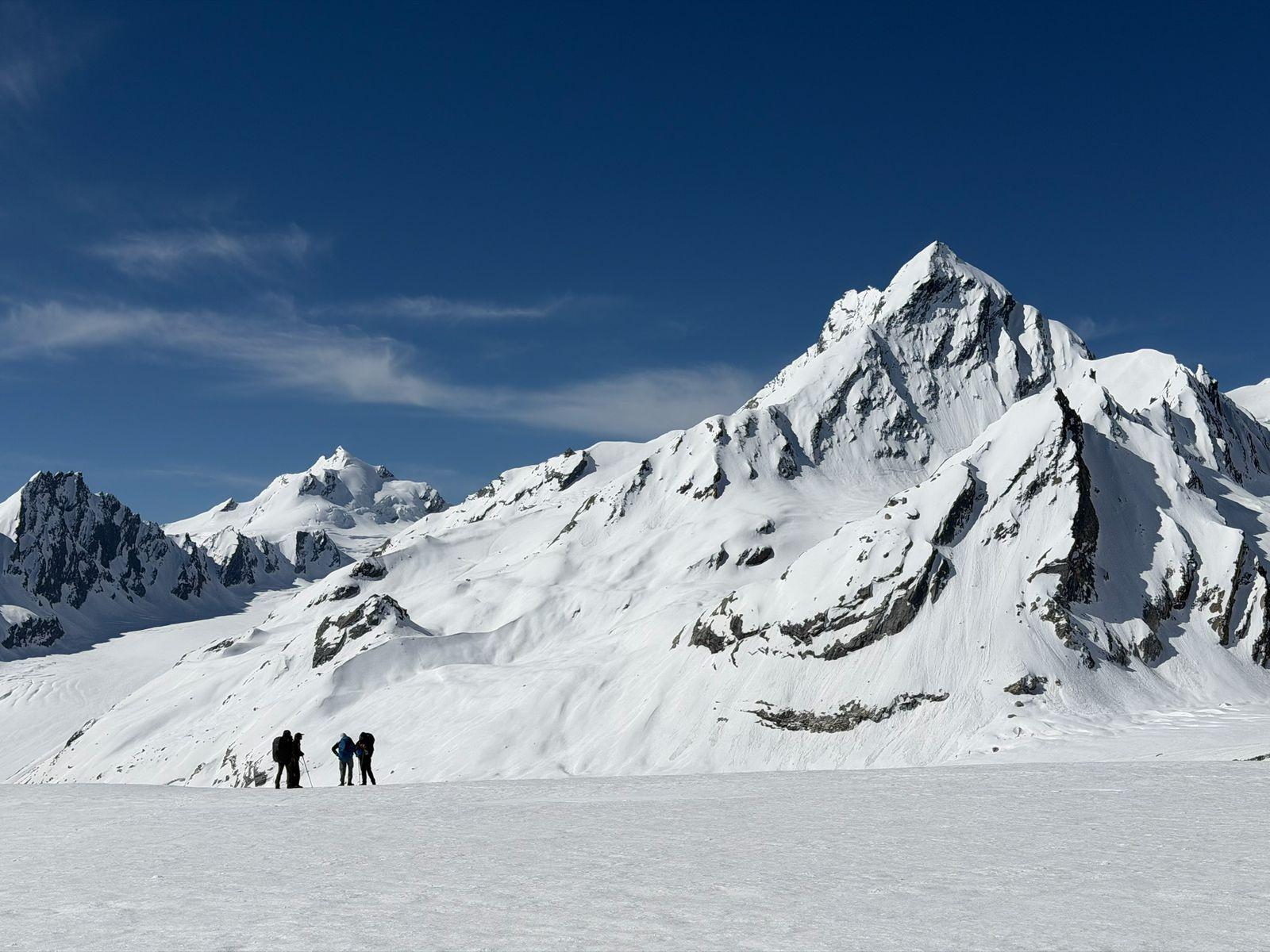
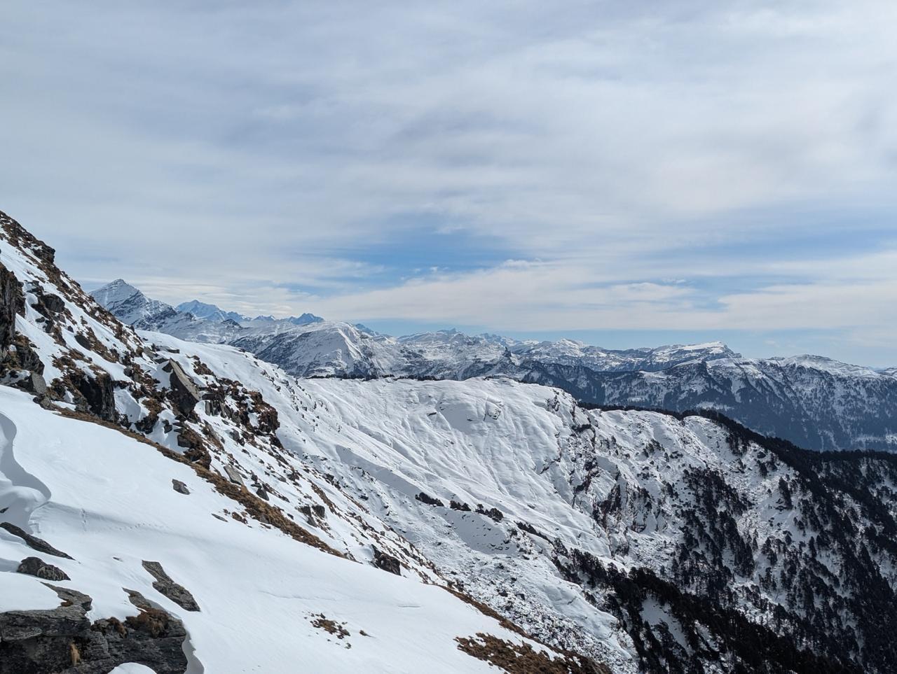
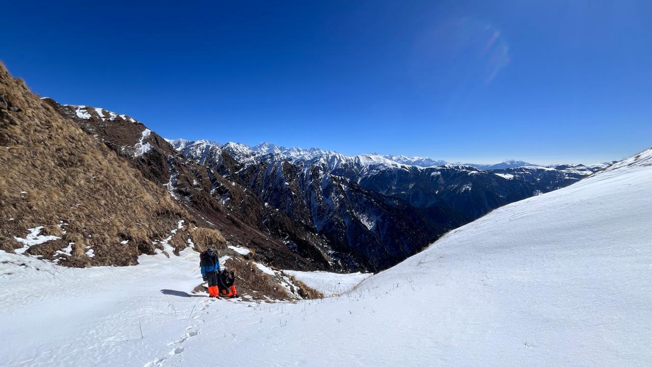
From Ruinsara the trail steepens: short, technical pitches, moraine-tied sections, and open scree approach the Odari saddle and the col camps. The Bali col day is the most demanding — long hours, altitude, and route finding when snow lingers. Many years the final push will require careful footwork across wind-scoured ridges or a short stretch of snow; in some seasons guides may use basic mountaineering tools (ropes, ice-axe techniques) where required. Once you gain the col, the descent is long but generous: stone bands, a few meadows, then a steep drop toward Lower Dhamni and the Yamunotri valley — a dramatic mood shift from the soft meadows of the Har-Ki-Dun.
This route is not about speed. It asks for patience, attention to altitude, and humility in the face of long days and raw mountain weather. But for the prepared, it gives back a sequence of frontier experiences — remote campsites, a revered high lake, the uncanny stillness of the col, then a river-cut, fragrant descent into the tea-smoke villages of the Yamuna headwaters. This is an Odyssey trek: a blend of technical attention, long alpine days, and dramatic scenery that stays with people long after the tents are packed.
Day 1
Drive from Dehradun to Kotgaon
Drive: ≈ 210–260 km | 8–10 hrs (depending on road/traffic).
Elevation profile: Dehradun (≈450 m) → Kotgaon (~1,900–2,200 m) (drive).
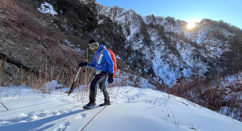
Description: Early departure from Dehradun. The drive climbs through Uttarkashi-ward hill roads, moving from river plains into pine and oak forests, then higher into small villages. Kotgaon is a small mountain hamlet used by local shepherds; final approach may include rough roads. Overnight at guesthouse / community lodge in Kotgaon. Team briefing, kit check, and pack distribution. Emphasize hydration and light walking to stretch legs.
Day 2
Drive from Kotgaon to Gangaad. Trek to Osla
Drive And Trek: Kotgaon → Gangaad drive ≈ 1–1.5 hr | Trek Gangaad → Osla ≈ 8–10 km | 4–5 hrs.
Elevation profile: Gangaad (~2,200–2,400 m) → Osla (~2,900–3,100 m).
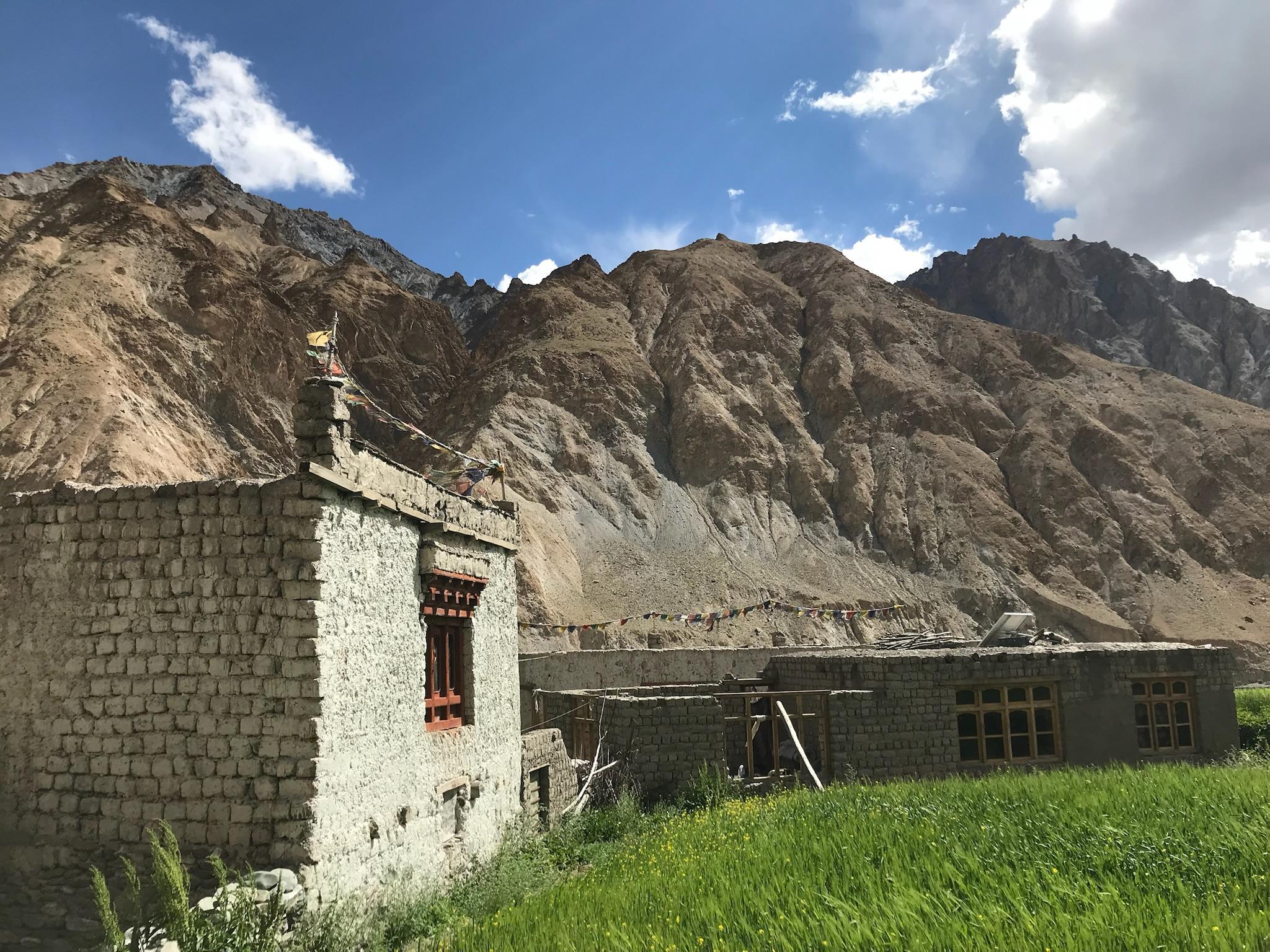
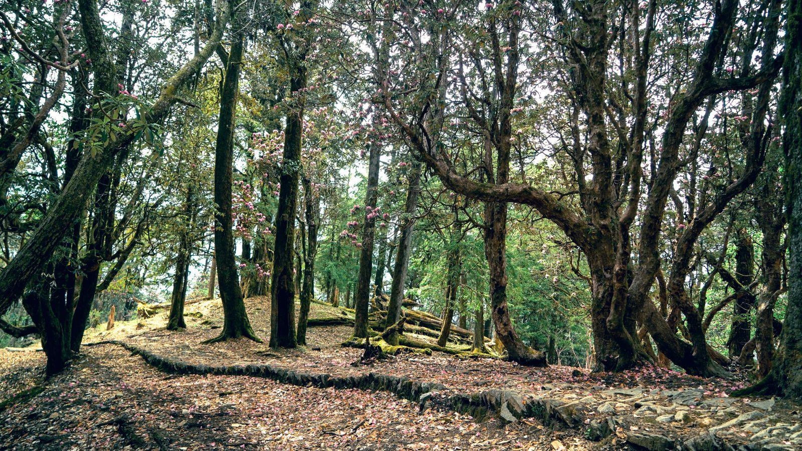
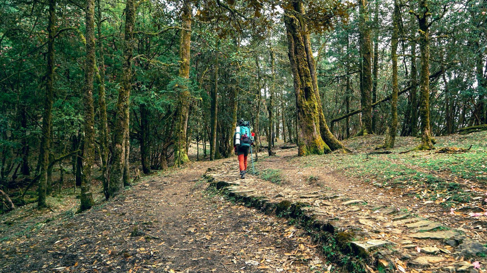
Description: Short drive to Gangaad to the trailhead. From here the trail climbs through mixed forests and small clearings into open slopes. The gradient is steady; the trail crosses seasonal streams and terraces with views back to the lower hills. Camp set up at Osla — a pleasant meadow or clearing chosen for wind protection. Focused on good hydration and early rest to aid acclimatisation.
Day 3
Osla to Devsu Thach
Trek: ≈ 10–12 km | 6–7 hrs.
Elevation profile: Osla (~3,000 m) → Devsu Thach (~3,400–3,600 m).
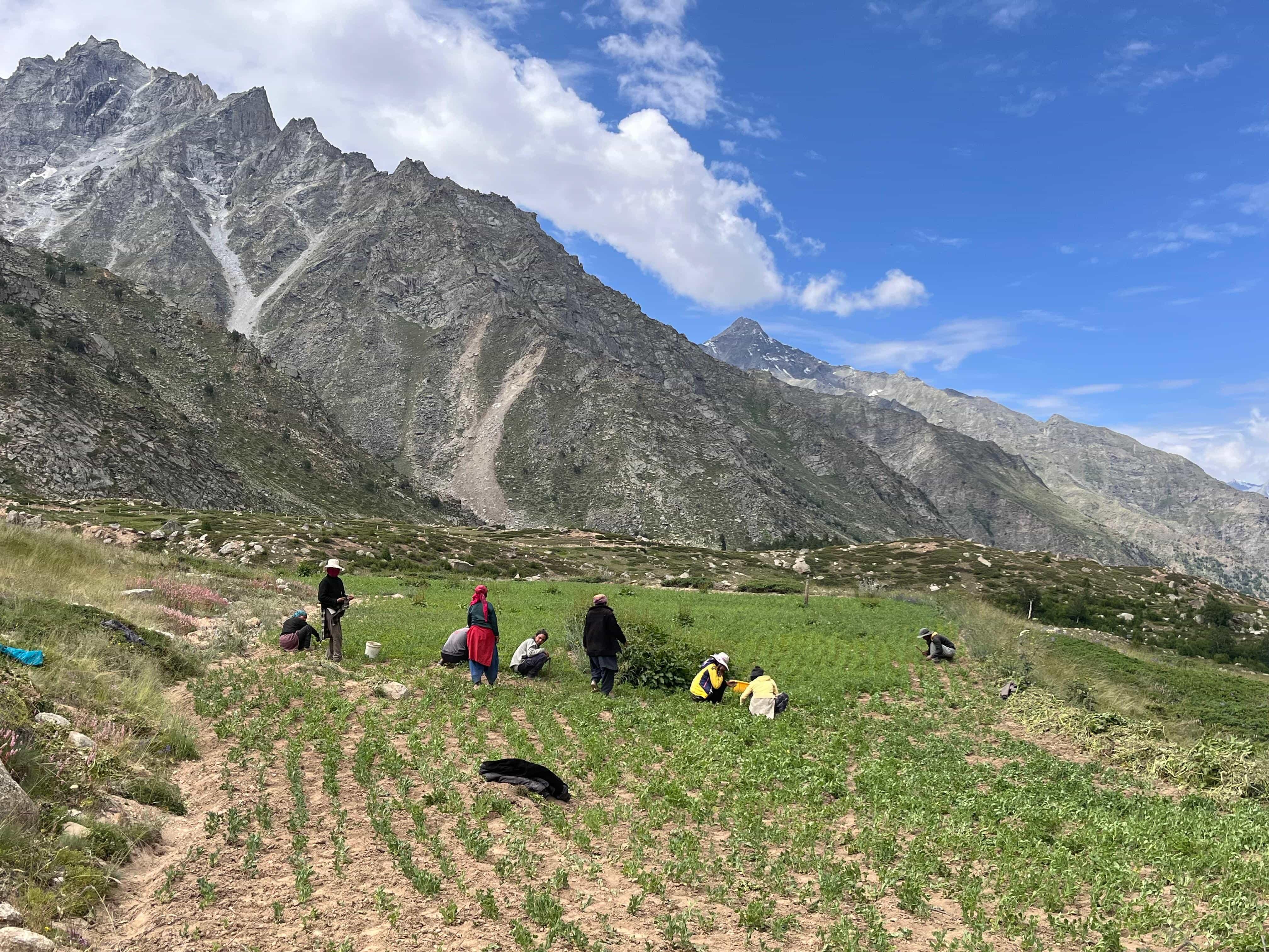
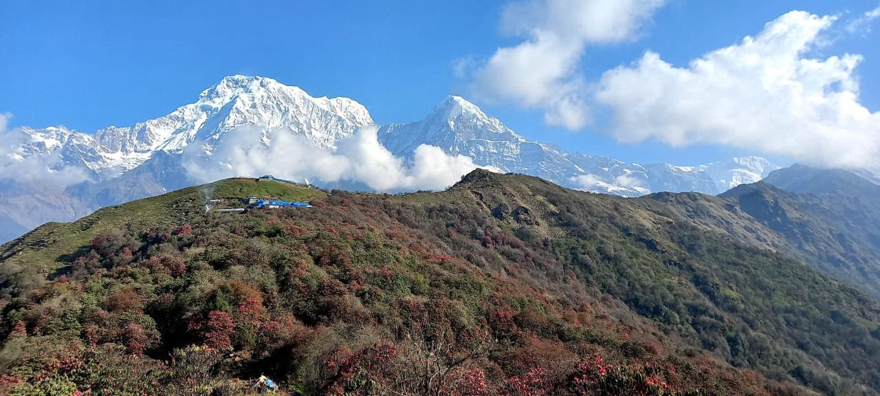
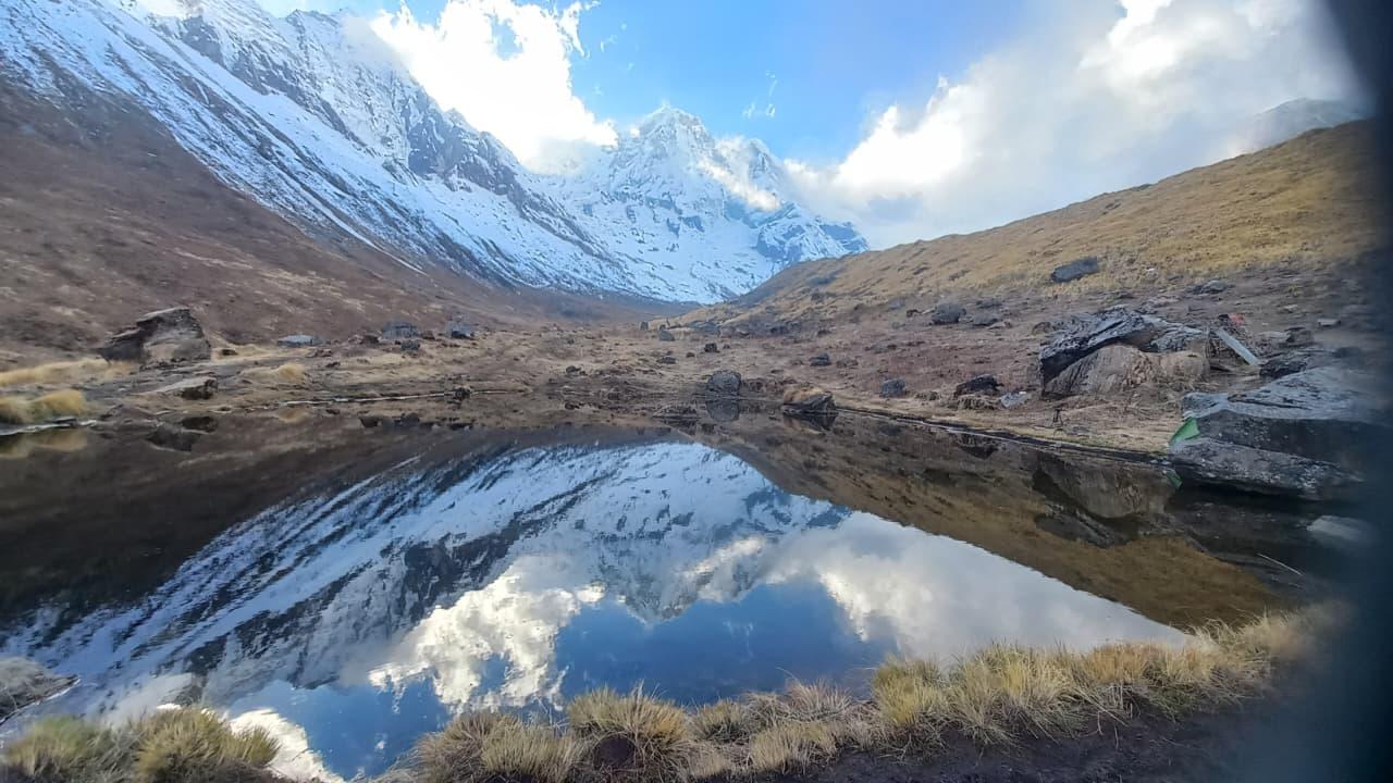
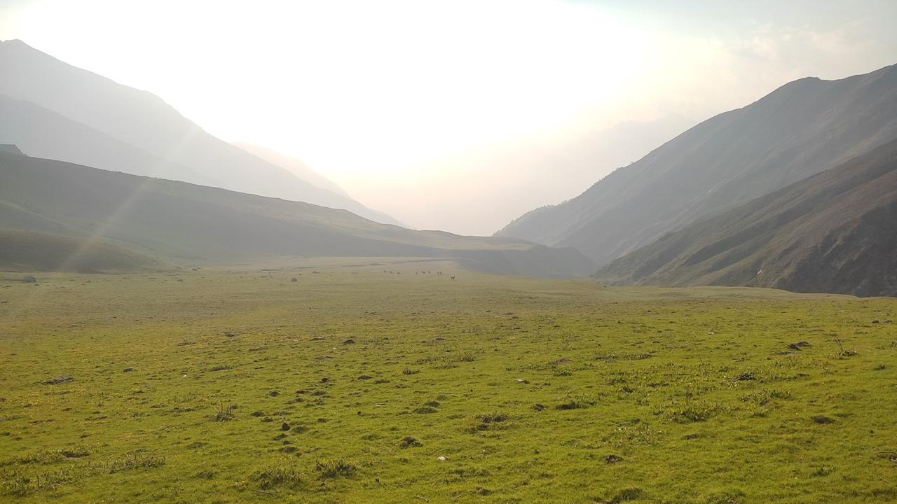
Description: A beautiful day through forests of bhojpatra (silver birch) and rhododendron, opening into vast meadows known locally as ‘thach’. Devsu Thach is high pastureland, a long green meadow with panoramic ridges — an ideal high camp with space and relative shelter. Terrain will include steady climbs, small stream crossings, and potentially marshy patches; horses/mules are used for group kit, but day packs are still significant.
Day 4
Devsu Thach to Ruinsara Tal
Trek: ≈ 8–10 km | 4–6 hrs.
Elevation profile: Devsu Thach (~3,400–3,600 m) → Ruinsara Tal (~3,500–3,630 m)
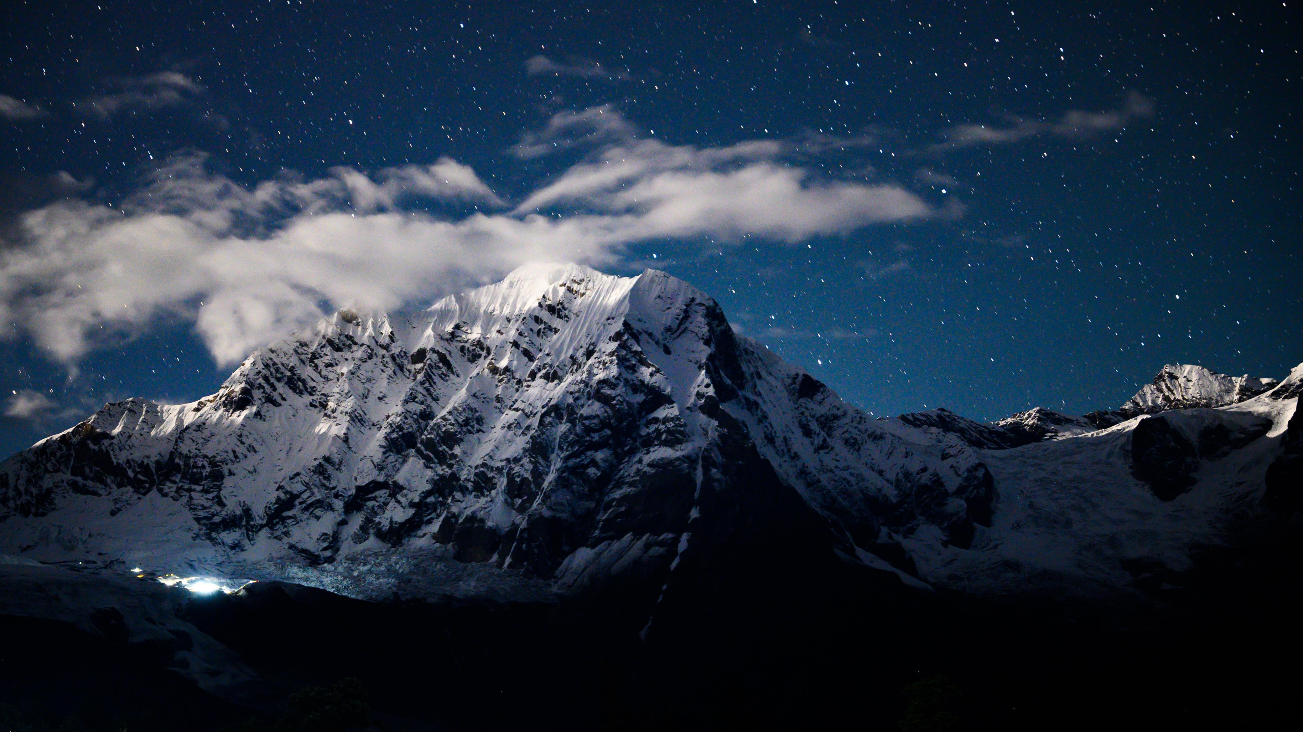
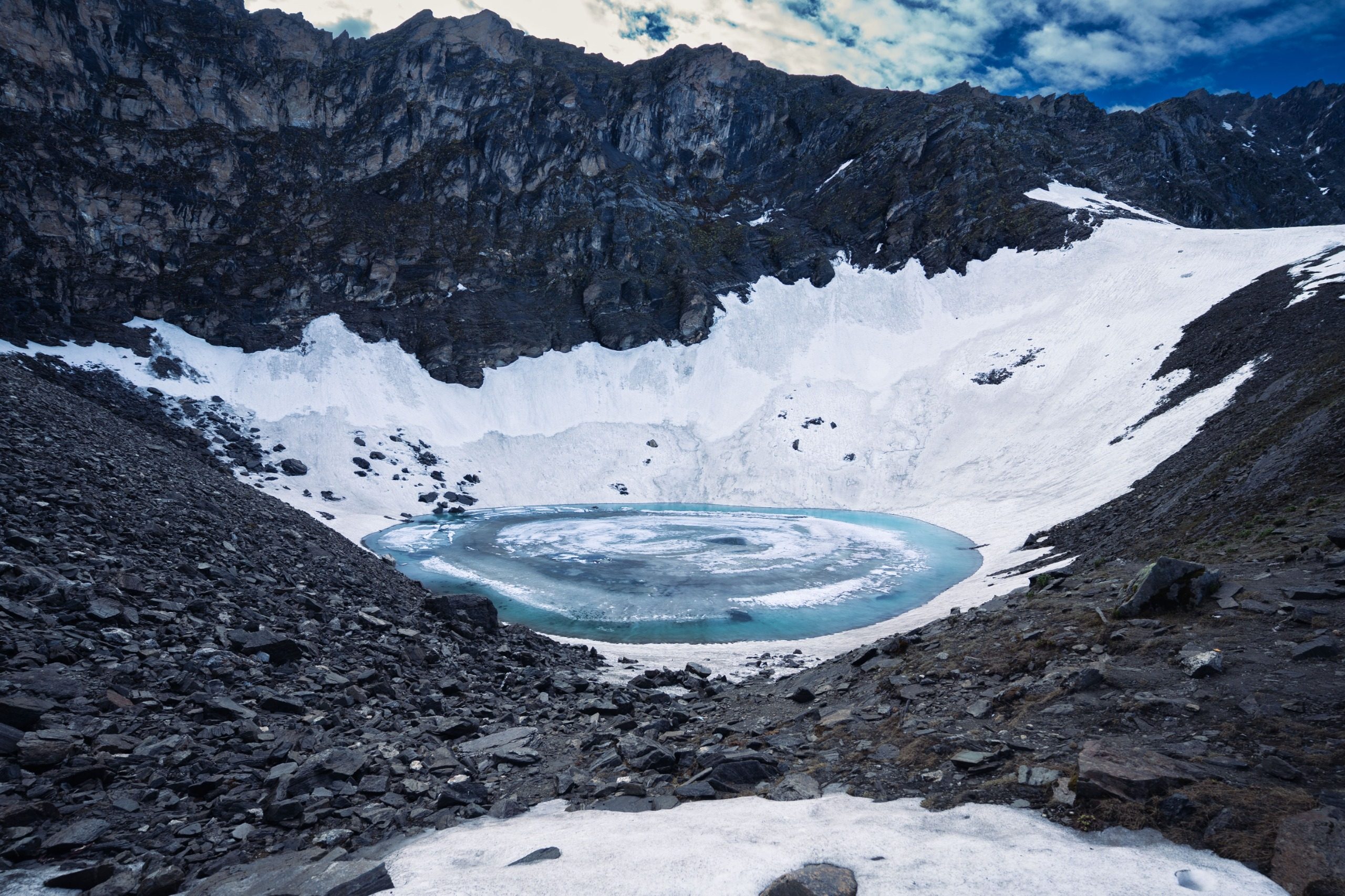
Description: The route drops briefly into a river corridor then climbs into the amphitheatre that cradles Ruinsara Tal. The final approach is remarkably scenic: the lake sits under steep ridges and is often fringed by bhojpatra trees and pastures. Camp beside the lake; allow time to explore the shoreline, photograph reflections, and observe local alpine flora. Night temperatures drop sharply here — prepare for cold.
Day 5
Ruinsara Tal to Odari
Trek: ≈ 6–8 km | 4–5 hrs.
Elevation profile: Ruinsara Tal (~3,500–3,630 m) → Odari (~3,700–4,000 m).
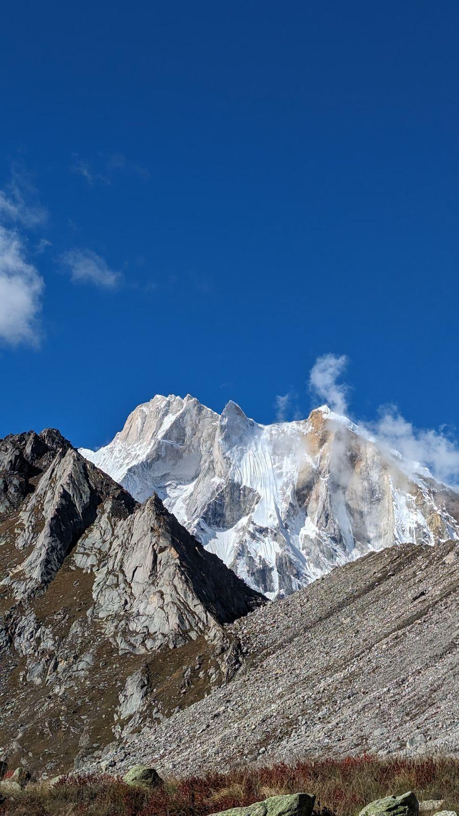
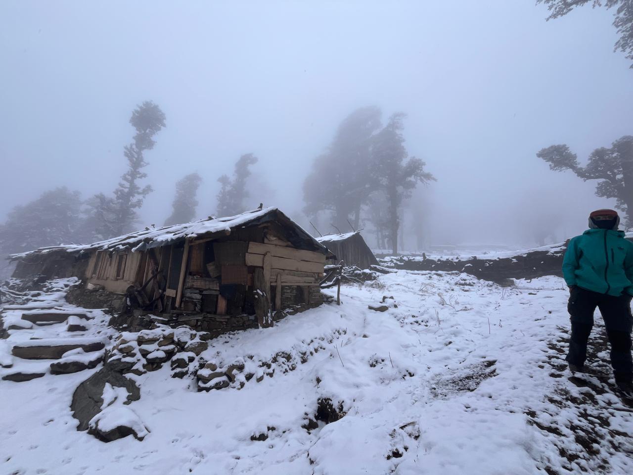
Description: A day of gradual gain with mixed terrain — from lake-shore walks to rocky ledges and alpine pastures. The trail becomes stonier approaching Odari; camps near Odari are exposed and require good tent anchoring. This day serves as an important acclimatisation push before the col approach. Keep pace controlled; monitor anyone showing signs of AMS.
Day 6
Odari to Bali Col Camp
Trek: ≈ 5–7 km | 6–8 hrs
Elevation profile: Odari (~3,900–4,000 m) → Bali Col Camp (~4,600 m).
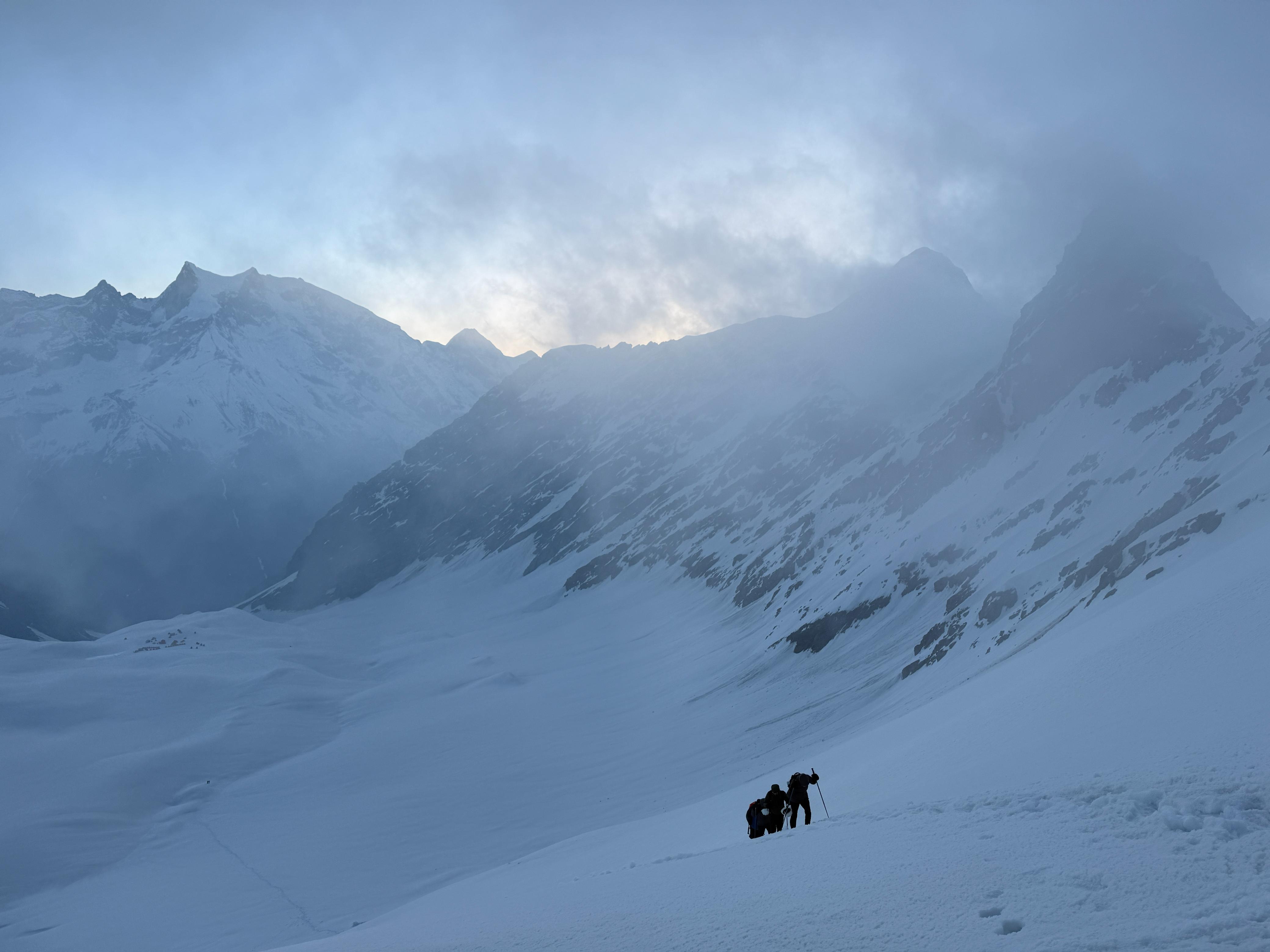
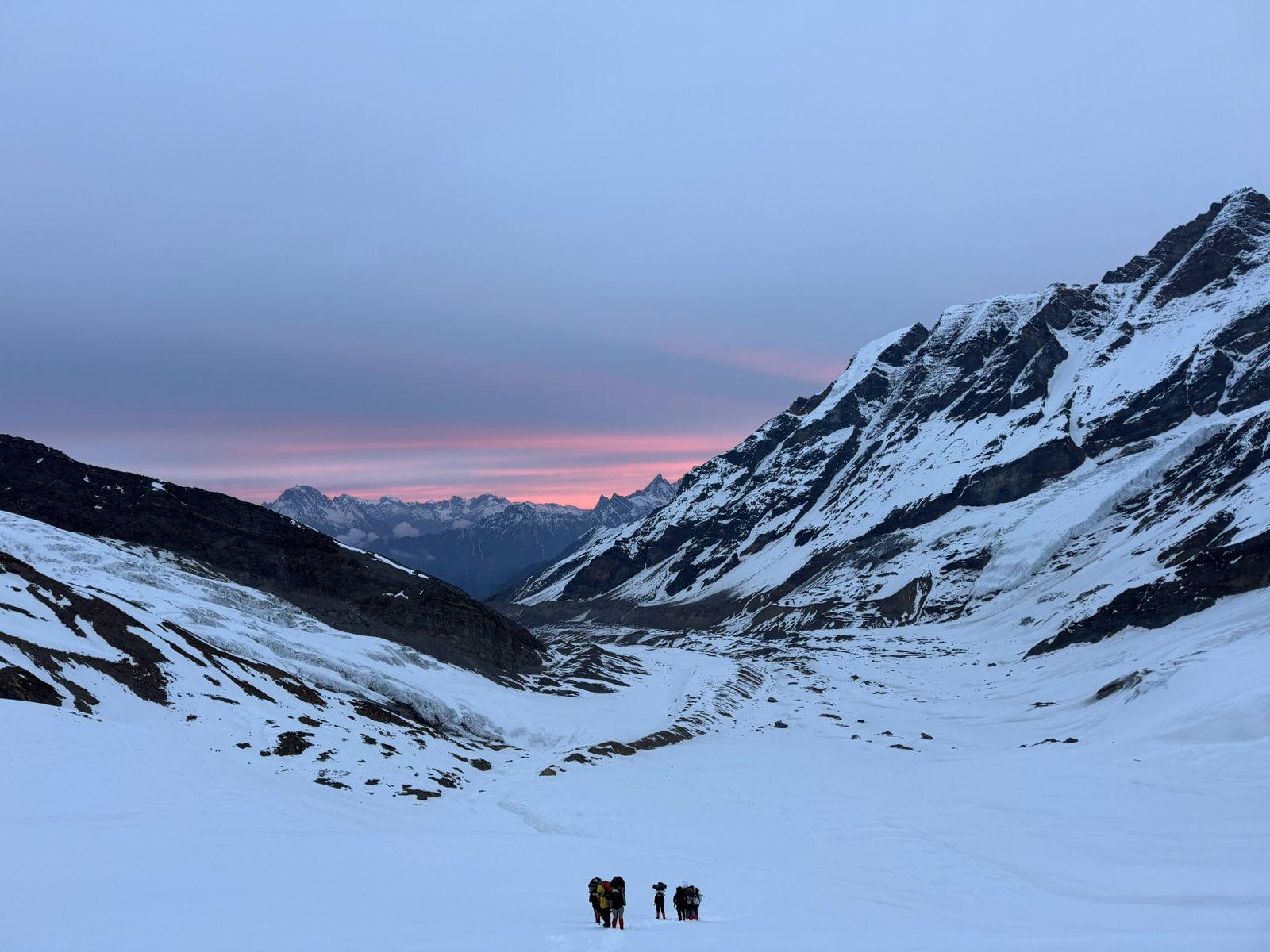
Description: A tough, slow day with rocky terrain and potential snow patches. The last section to col camp may be on moraine or broken rock. Expect winds and cold. The col camp is deliberately sited to stage the final pre-dawn assault on the pass — keep gear ready, sleeping windows optimized, and dinner early. Hydrate and rest.
Day 7
Bali Col Camp to Lower Damini via Bali Pass
Trek : ≈ 12–16 km | 8–12+ hrs depending on conditions.
Elevation profile: Bali Col Camp (~4,600 m) to Bali Pass (~4,950 m) to Lower Damini (~3,300–3,400 m).
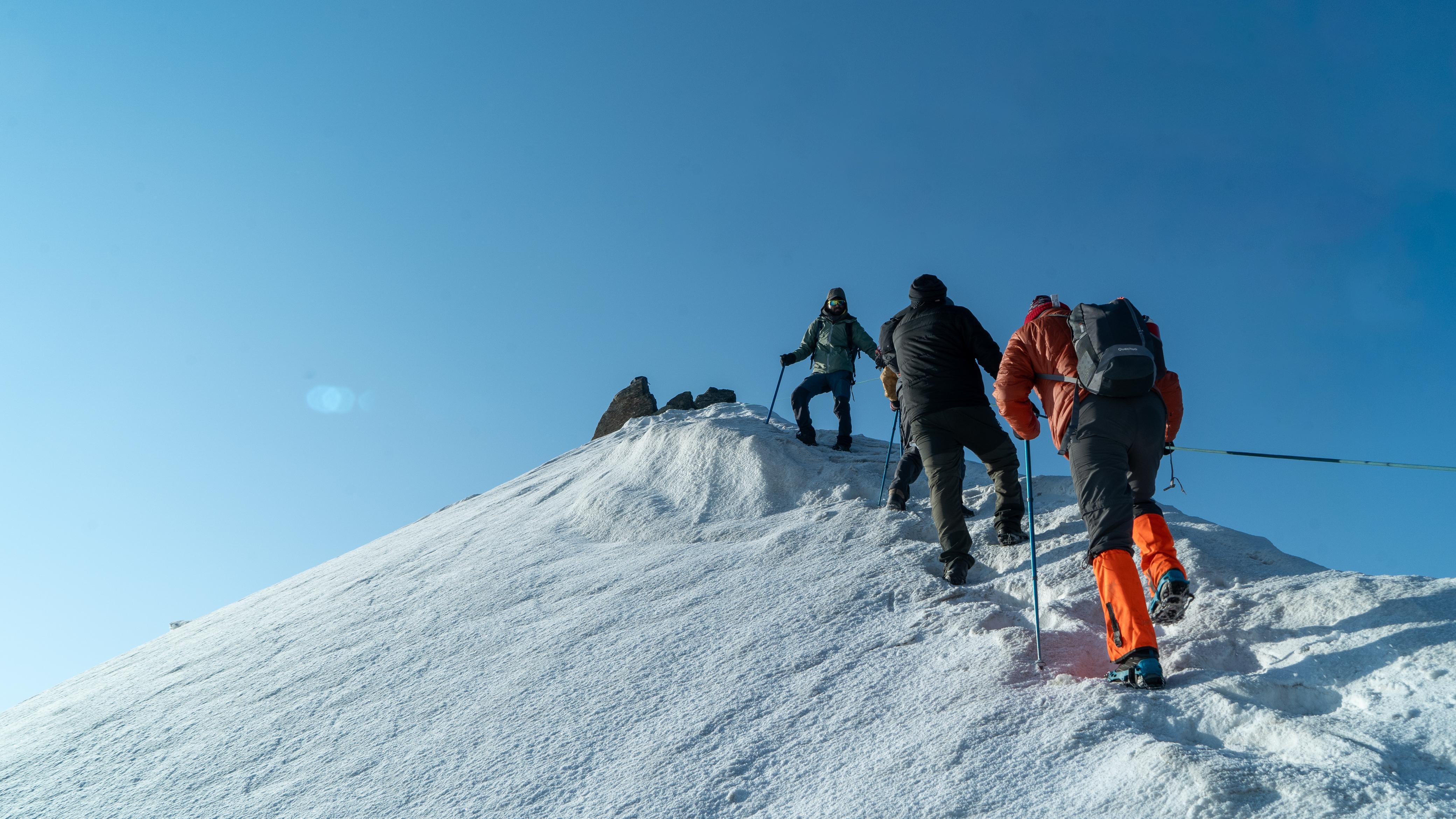
Description: The summit day. Start early (pre-dawn) to use firmer snow and avoid afternoon weather. Final push to the col is exposed, and when there’s snow it can be steep — expect route finding and careful footwork. At the top: panorama and a long descent. The drop to Lower Dhamni is big — loose scree, stone steps, and river crossings lower down. This is a long, rewarding day; finish at Lower Damini for a well-earned camp and celebration.
Day 8
Lower Damini to Janki Chatti/Yamunotri. Drive to Dehradun
Trek & Drive: Lower Dhamni to Janki Chatti ≈ 6–9 km | 3–5 hrs walk (downhill) ; Drive Janki Chatti to Dehradun ≈ 8–10 hrs / 200–220
Elevation profile: Lower Damini (~3,300 m) → Janki Chatti (~2,500–2,700 m) → Dehradun.
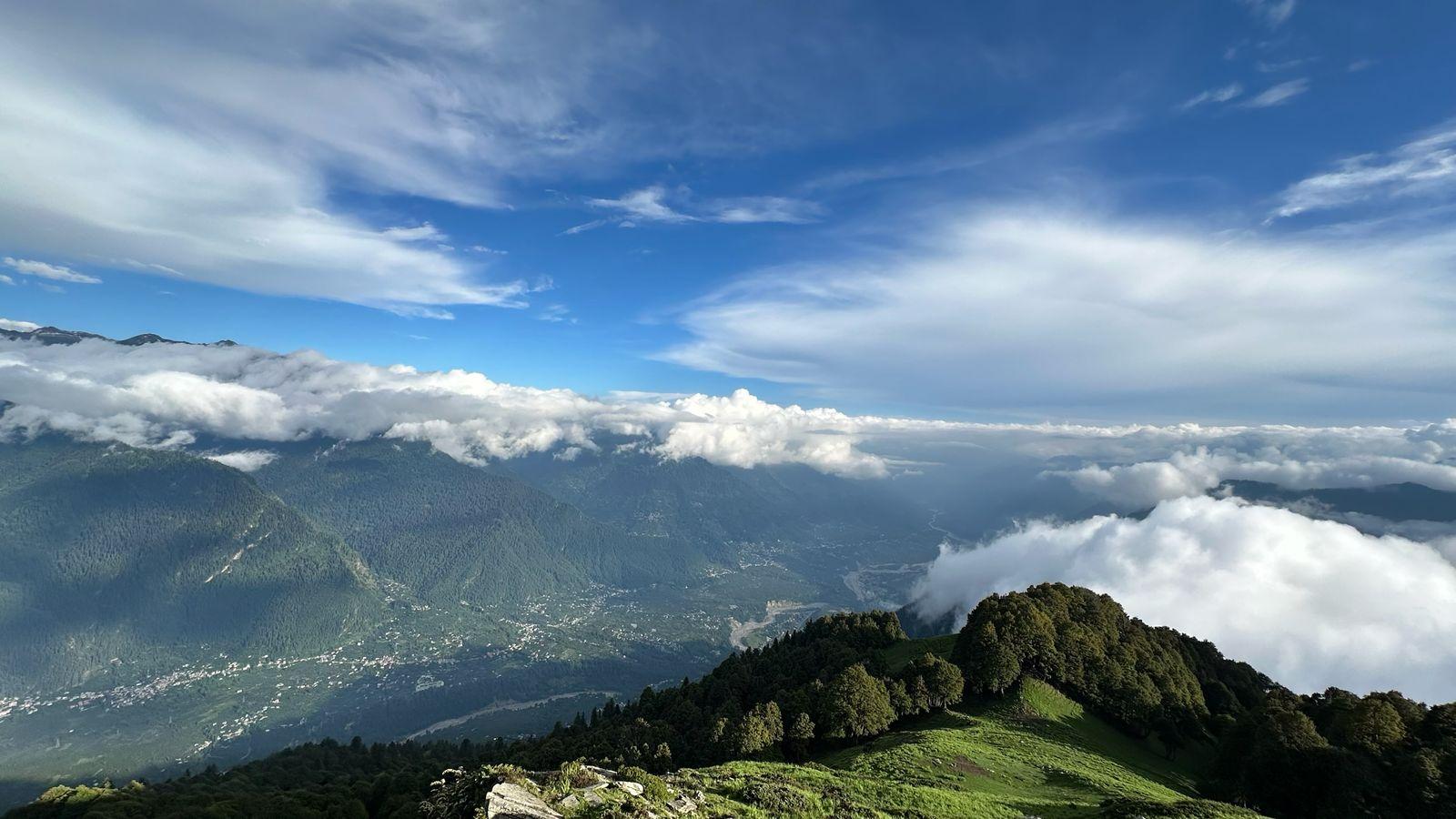
Description: A gentler, descending day following the Yamuna tributary down to the motorable road at Janki Chatti. From Janki Chatti the group boards vehicles for the long drive back to Dehradun.
Technical Experience
Prior multi-day trekking experience at altitudes above 3,000 m is strongly recommended. Participants should be comfortable with 6–10 hr mountain days carrying a daypack.
Experience with long downhill descents on loose scree and route-finding in alpine terrain is beneficial.
Medical/insurance: up-to-date travel insurance covering high-altitude trekking (to ~5,000 m) and emergency evacuation is mandatory.
Fitness Expectations
Training target: ability to walk 12–15 km with a 10–12 kg pack on varied uphill/downhill terrain for 4–6 hrs, and to do repeat long days up to 10–12 hours (on the pass day) at altitude.
Recommended training timeline: 8–12 weeks of progressive endurance (hikes with elevation gain), stair/step training, and at least 2 long day hikes (>6 hrs) with loaded packs prior to the trek.
Aerobic baseline: 30–45 min steady cardio 4× per week (running, cycling, fast hiking), plus core & leg strength sessions (squats, lunges).
Inclusion
Exclusion
Is Bali Pass suitable for beginners?
When is the best time to go?
SELECT DATE TO REGISTER


Thank You!
Your form has been submitted successfully. We'll get back to you soon.
₹ 24,899 + 5% GST